Categories
- Argentina
- Chile
- Antarctica
- Easter Island
- Falklands (Malvinas)
- Bolivia
- Peru
- Uruguay
- Paraguay
- Brazil
- Venezuela
- Colombia
- Ecuador
- Galapagos
- Panama
- Costa Rica
- Cuba
- Nicaragua
- Honduras
- El Salvador
- Guatemala
- Belize
- Mexico
- Latin American Xmas
Pages
- Map of South America
- Home Page
- First week in Latin America – October 2009
- Map of Central America
- Contact Us
- The Jesuit Missions in South America
- A week in Buenos Aires
- Street Art of Buenos Aires
Archives
- October 2011 (3)
- September 2011 (9)
- August 2011 (10)
- July 2011 (7)
- June 2011 (6)
- May 2011 (11)
- April 2011 (10)
- March 2011 (4)
- February 2011 (5)
- January 2011 (6)
- December 2010 (6)
- November 2010 (4)
- October 2010 (8)
- September 2010 (5)
- August 2010 (7)
- July 2010 (5)
- June 2010 (6)
- May 2010 (6)
- April 2010 (7)
- March 2010 (6)
- February 2010 (9)
- January 2010 (4)
- December 2009 (8)
- November 2009 (5)
- October 2009 (2)
The Lost City
04th December 2010
Our first stop in Colombia was the pleasant Santa Marta [2] on the Caribbean coast of Columbia and the oldest city in South America. A drawn out 24 hours from Mérida (Venezuela) featured a bus full of suspicious people openly bribing officials at all 12 check points between Maracaibo [1] and the frontera. Something must have been up as Colombian police grabbed them soon after crossing; thankfully we had already changed buses.
.
The next day we spent relaxing at the beach in the nearby fishing village of Taganga where we chose a fresh reef fish for lunch from one of the palm thatched restaurants along the beach. Perfectly cooked, it was delicious.
.
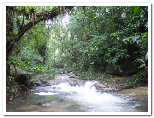
To begin the tough trek through the Colombian jungle to the Ciudad Perdida (Lost City) a four wheel drive took us to the pueblo of El Mamey on a barely passable, rutted, muddy track. The first creek crossing, with knee deep water, came up after 5 minutes walking. It was no use being precious, there were many more creek crossings and a lot of mud to come so we barged straight through, boots and all. The gradient increased seriously (Kokoda Track style) before a steep, muddy descent to our first nights camp which was a row of hammocks strung up under a shelter. It rained every day so the same set of wet clothes and boots went back on in the mornings and at night a carefully kept dry set.
.
It continued to rain day and night but what´s a rainforest without rain. The trail was difficult at times but the scenery superb. We encountered scattered huts of the Kogui tribe (descendants of those from the Lost City) and passed the indigenous residents going up and down the trail. They all wear the same white(ish) tunic made of a natural fibre from the jungle and both men and women have long hair. There are some 1400 living in the Tyrona National Park.
.
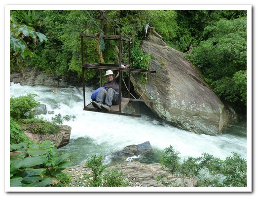
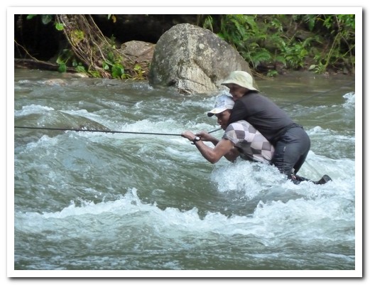
Two of the river crossings on day two were a little unnerving – one by sitting in a little open cage and being pulled across, 20 metres above the raging water, the other by wading through waist deep water, holding on to a rope strung across the river. With 3 strong men supporting us across, our feet were still swept from under us half way across and we had to be dragged the rest of the way. On day 3 it rained heavily for 12 hours and we nervously watched the river rising rapidly. The next morning we had to make 3 more crossings. The force of the water was just too powerful; poor John (one of our guides) carried us on his back while struggling with the rope.
.
More than 1200 mossy stone steps wind their way from the river up the jungle covered mountain to 1100 metres where the Tyrona Indians lived from 800 to 1600. After it was abandoned, the city was soon reclaimed by the jungle until in1972, was re discovered by grave robbers looking for gold. The dwellings are no longer there but elaborate terraces still stand where each dwelling was. Wide stone paths lead to the large ceremonial and central plazas.
.
We returned the same way; it had rained all night so the path was a river or a muddy quagmire. The 4 wheel drive road had deteriorated. Our vehicle stalled crossing a swollen creek and water poured in through the doors. The vehicle behind towed us out and we had to wait 2 hours for the water to subside finally reaching Santa Marta at 9pm.
.
The trek was fantastic and the Lost City worth all the effort but enough Indiana Jones stuff for us for a while.
.
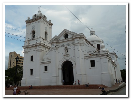
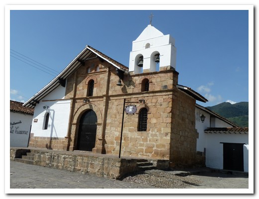
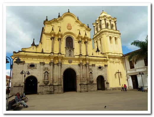
Santa Marta church
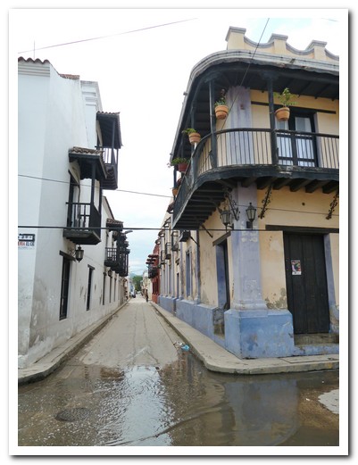
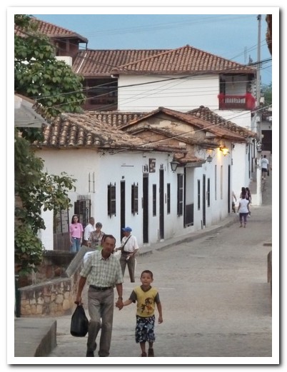
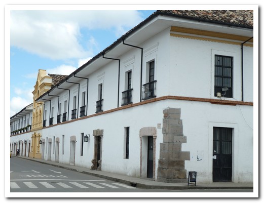
Colonial buildings in Santa Marta
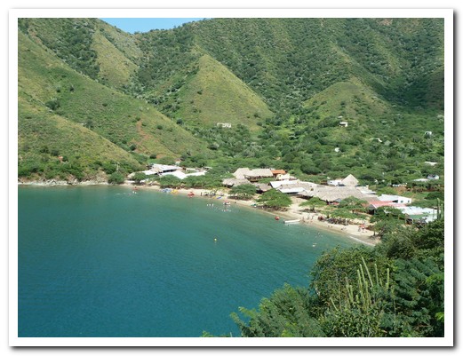
Nearby Taganga
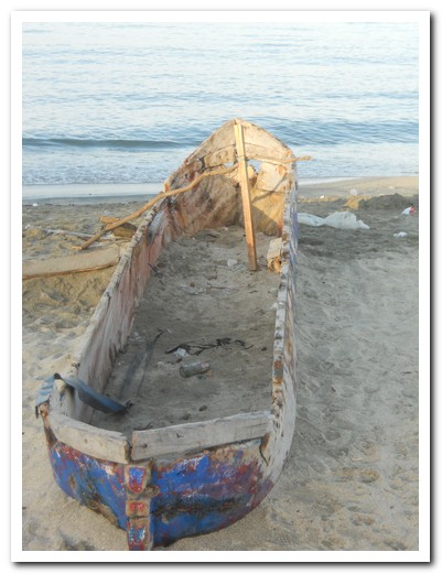
Canoe on the beach
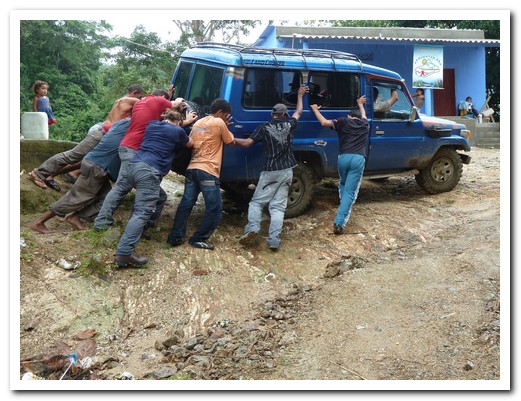
Colombian starter motor on the way to the Lost City trek
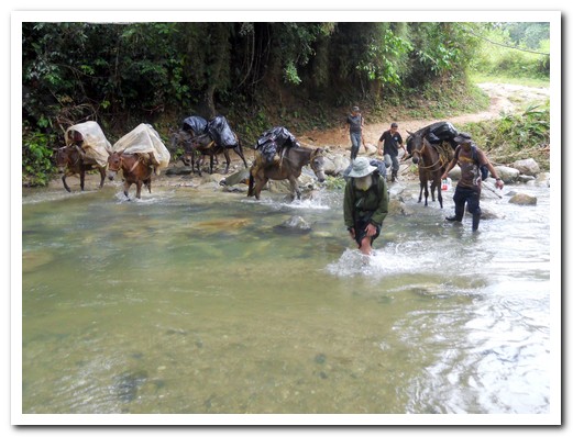
Look out - here come the mules
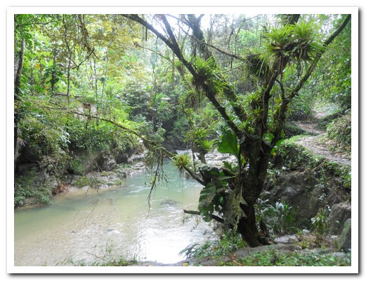
Jungle path
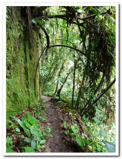
More jungle path
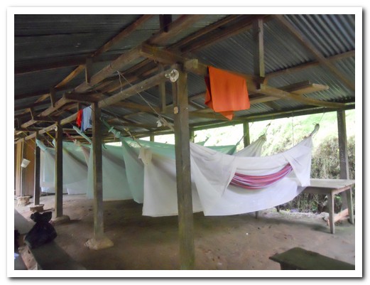
Camp 1

Indigenous huts
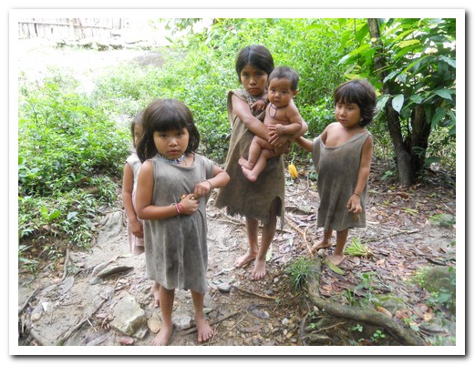
Some of the children
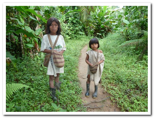
Children with typical carry bags
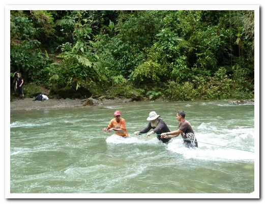
This is one way to cross a river
Another way to cross
And when all else fails ...
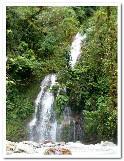
Waterfall
Path turned into a river after the rain
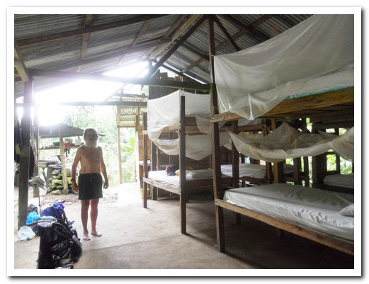
Camp 2
Freddie made delicious soup over a wood fire
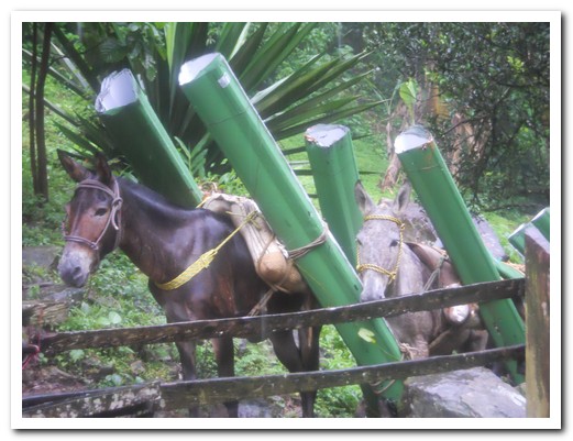
Mules carry tin roofing up the trail
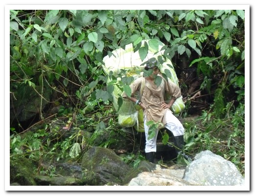
This is how the matresses get there
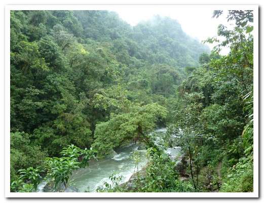
Swollen river
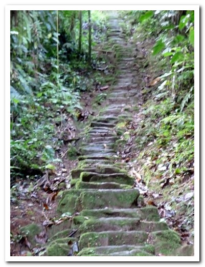
Mossy stone steps winding up to the Lost City
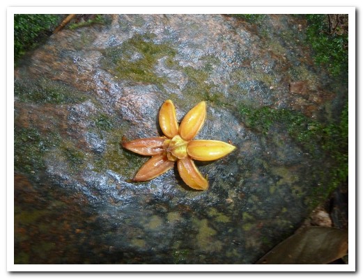
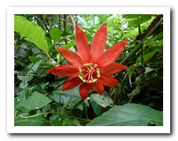
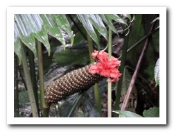
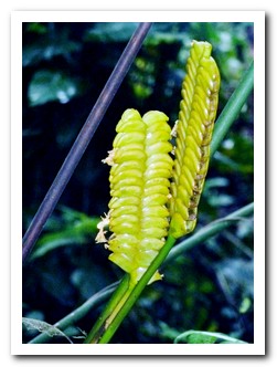
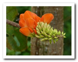
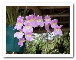
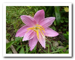
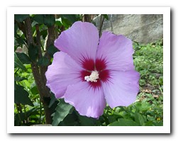
Flower on one of the steps
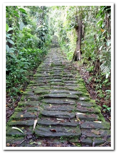
Long even steps lead to ...
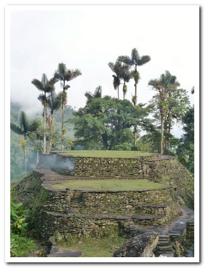
... The Lost City central plaza
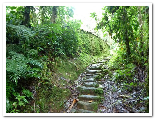
Mossy green walls
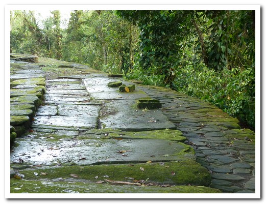
Large flat paving stones
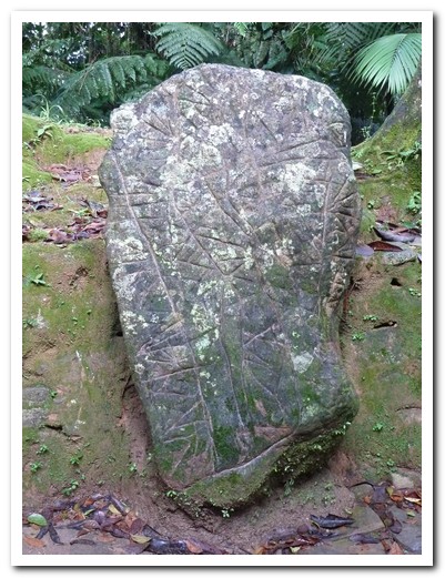
Map of the surrounding area carved into a rock
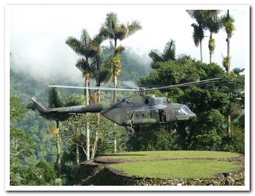
Helicopter resupplying Colombian army patrol lands on the Plaza
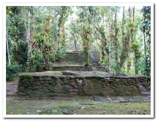
Round terraces where houses once stood
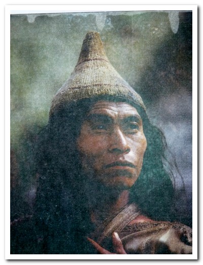
An old photo of one of the original Tyrona people
Colonial Villages
15th December 2010
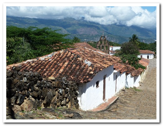
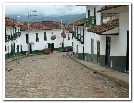
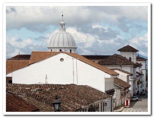
Leaving the coast behind we headed south to visit some of Colombia´s colonial hill towns.
.
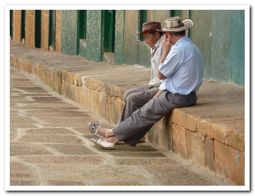
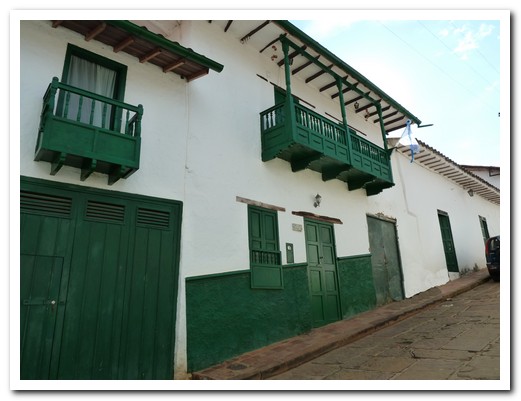
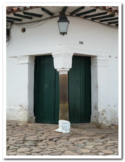
San Juan de Girón[3], founded in 1631, has a central plaza surrounded by blindingly white buildings trimmed with dark wooden doors, windows and balconies. In the evening a religious procession proceeded around the brightly lit plaza which was decorated for Christmas; many families were out enjoying themselves. We watched from the sidelines while sipping a beer from a nearby shop and snacking on grilled corn and meat from a street vendor.
.
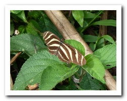
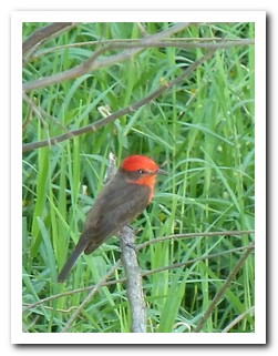
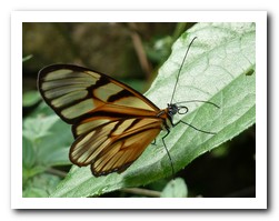
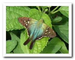
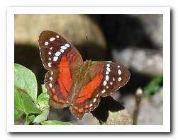
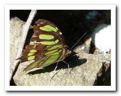
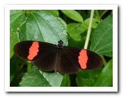
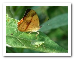
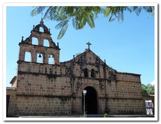
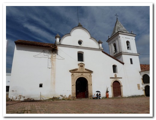
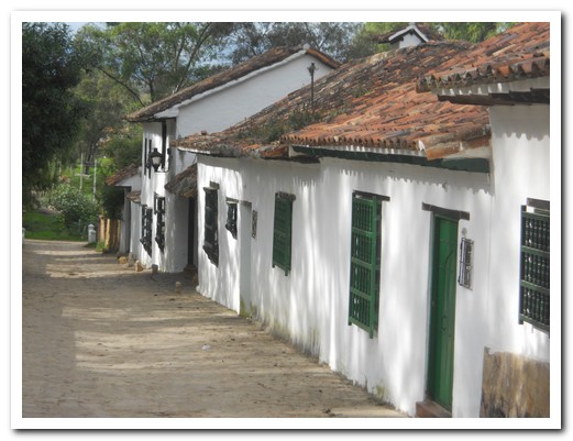
The much quieter Barichara (population 7500) [4] has kept its colonial charm. There are no modern buildings. The streets are paved with stone; the whitewashed walls have a splash of colour that matches the doors and windows. A pleasant way to visit the tiny, nearby village of Guane is by foot along the pre-Hispanic Camino Real, a footpath that once joined the indigenous villages. As we walked we enjoyed views of the surrounding mountains whilst listening to the birds and following the butterflies.
.
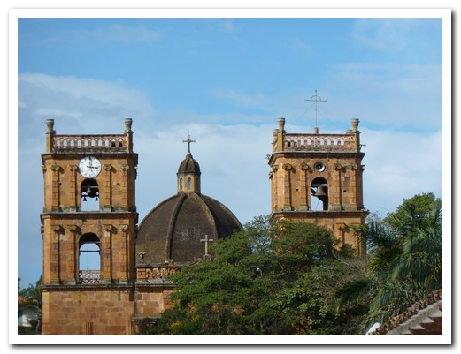
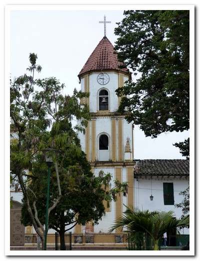
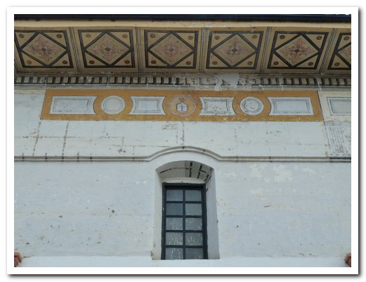
Tunja [5], lying in a lush green valley at 2800 meters, was an enjoyable stopover. There are some elegant mansions from the Spanish days, a large Plaza and 8 churches built in the Spanish Mudéjar (Islamic influenced) style around the historic centre.
.
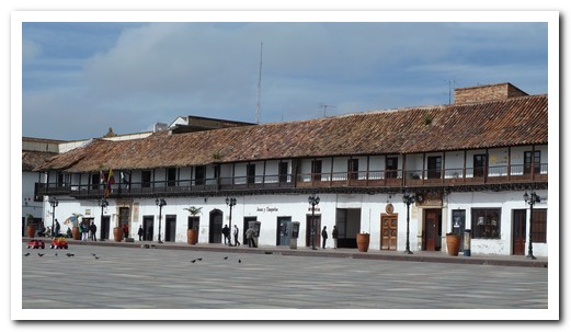
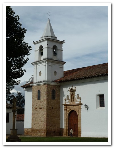
A short bus ride away and 700 meters lower is the postcard perfect colonial village of Villa de Leyva [6], founded in 1572. We hired bikes to ride to the fossil of a Kronosaurus (a giant prehistoric croc) and an ancient Muisca people ceremonial site of phallic stones and cylindrical stone monoliths which functioned as a solar observatory. In the surrounding hills is the Convento del Santo Ecce Homo (founded 1620).
.
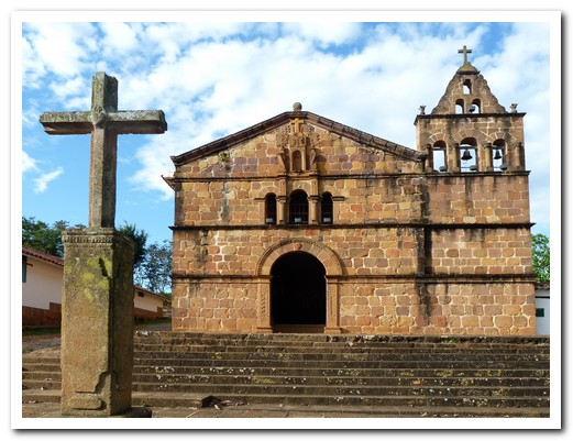
Old church at Girón
Dazzling white buidings ...

... of Girón
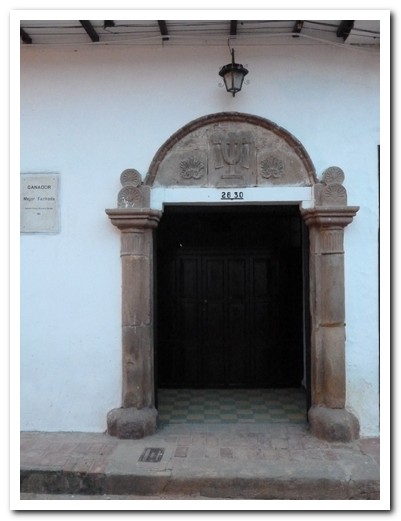
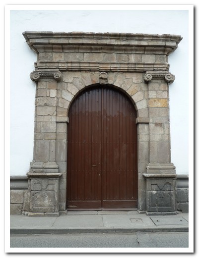
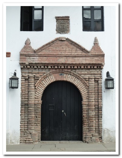
Doorway

Graduating from kindergarten
Breakfast tamales
Barichara Church
Typical hats and slippers of this region
Houses in Barichara
Barichara Cathedral
Barichara´s senior citizens march up the hill (followed by ambulance)
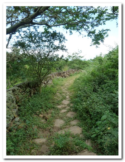
Camino Real
 |
 |
 |
 |
 |
 |
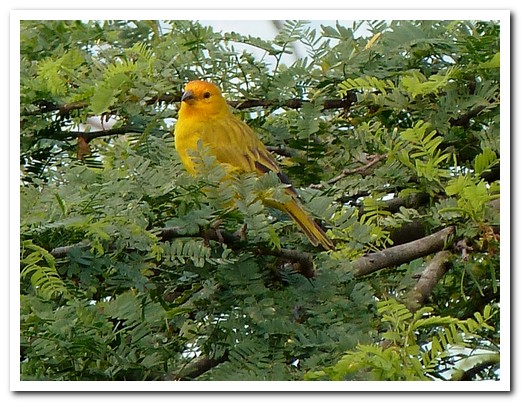
Bird singing on Camino Real
The village of Guane
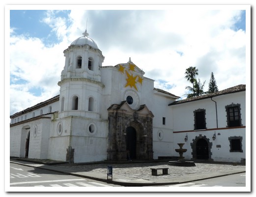
Guane Church
One of Tunja´s churches in the Mudéjar style

Doorway
Plaza Bolivar - Tunja
Plaza Bolivar and the Cathedral by night
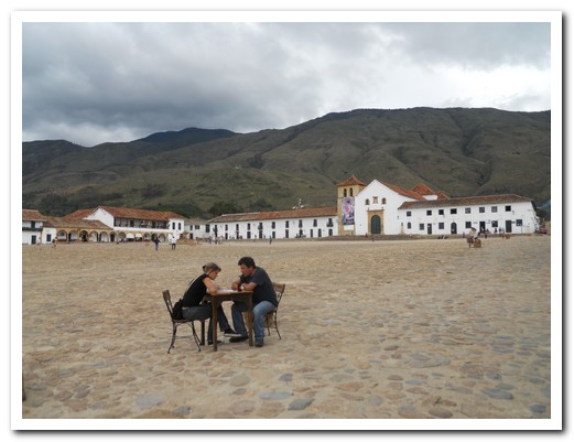
Plaza (largest in South America) at Villa de Leyva
Carmelite monastery at Villa de Leyva
Shady street

Typical mens dress
Corner of a Villa de Leyva buiding (note paving and no footpaths)
Lunch of meat grilled on an open fire
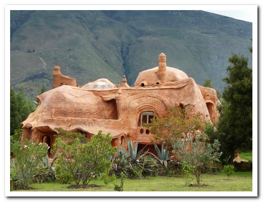
Nearby is a house made from clay, Gaudi style
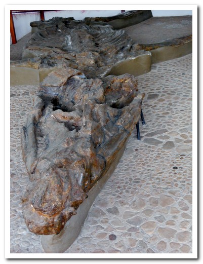
Fossil of a 7 meter Kronosaurus
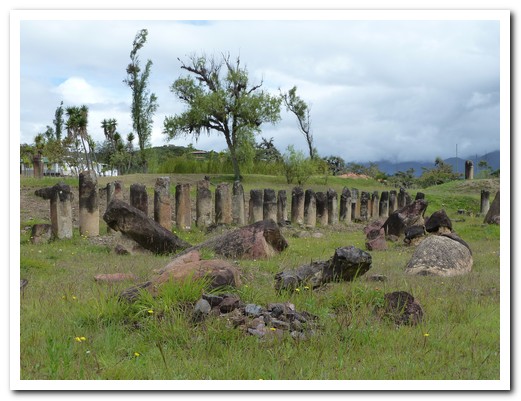
Stone monoliths arranged to follow the sun´s path
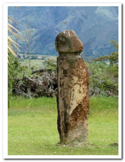
Many huge phallic monoliths are still standing
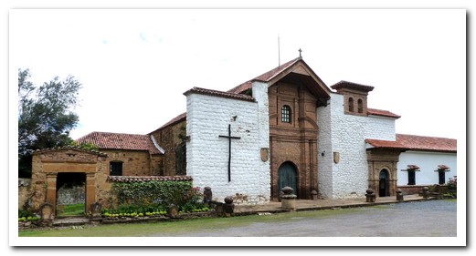
The 1620 Dominican Convento del Santo Ecce Homo
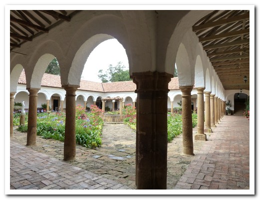
Inside the Convento
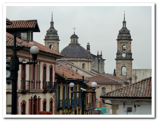
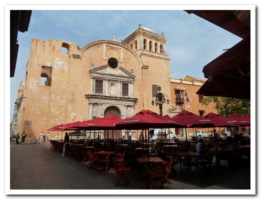
Bogotá
20th December 2010
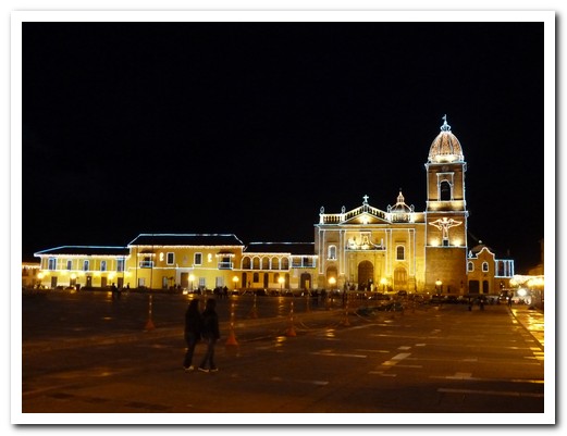
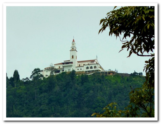
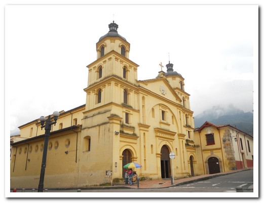
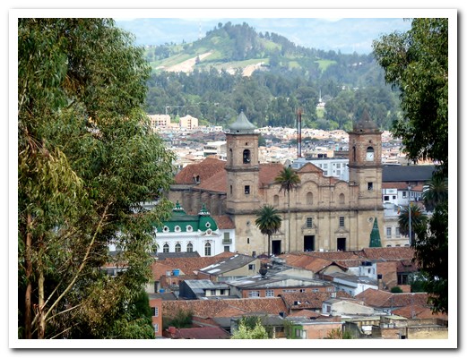
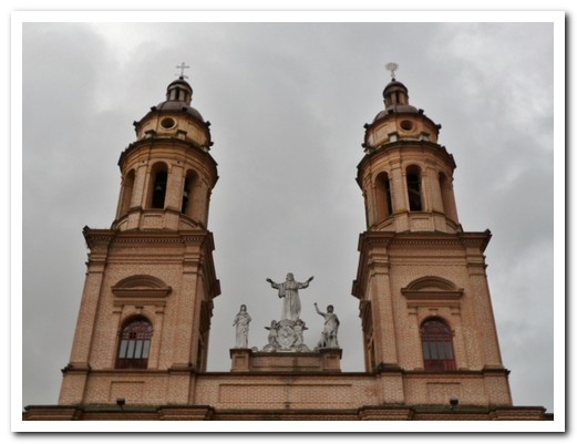
Tired, shabby, traffic snarled Bogotá [7] was a shock after the quiet little colonial villages. Colombia´s capital, founded in 1538 by Spanish explorers, is located on a plateau in the Andes at 2600 meters. It was cold and wet, but the people warm and friendly. From the church atop Cerro Montserrat are wonderful views of the city and surrounding countryside (on a good day).
.
By staying at Casa Platypus in La Candelaria, we were close to the sights of the old centre. We started our walk at the Plaza del Toros, the Mudéjar style red brick bull ring, and continued via many interesting historical churches to the post colonial government buildings. The gold museum, the finest in the world, which displays magnificent gold and pottery artefacts from pre-Hispanic Colombia kept us occupied for a rainy afternoon.
.
On Sunday, we took the steam train to Zipaquirá [8] to visit the Salt Cathedral, the world’s largest underground cathedral which can hold 8400 people, built in a salt mine 180 metres below ground level. The train was slow but musicians playing flutes of the Andes, traditional Colombian music and jazz livened up the trip. When we returned to the Bogotá railway station in the evening, there were no taxis. A kind Colombian family we met on the train, fearing for our safety, offered to drive us back to our hostel. We took up their offer and were very grateful to them.
.
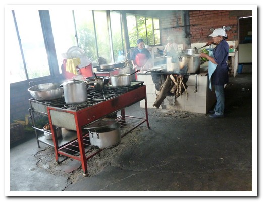
We couldn´t leave Bogotá without trying the local speciality – Lechona, a whole pig carcass stuffed with its own meat, rice and dried peas.
.
Church on top of Cerro Montserrat overlooks Bogotá
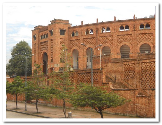
Mudéjar style bullring
One of Bogotá´s 200 churches
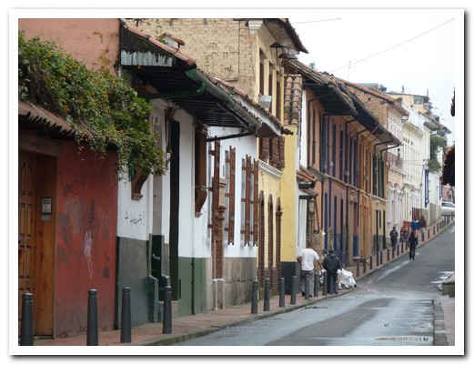
Street in La Candelaria
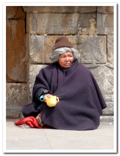
Lady begging
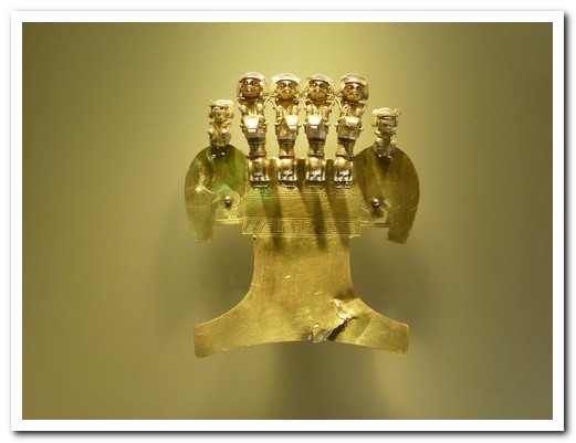
Gold funerary ornamnets ...
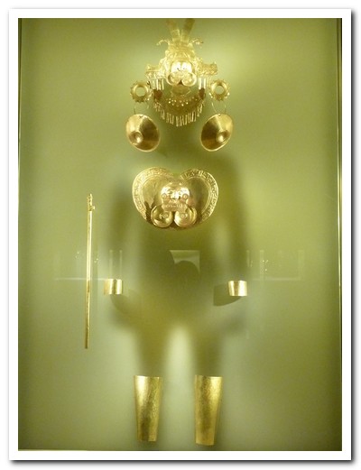
... in Bogotá´s gold museum
Yellow church
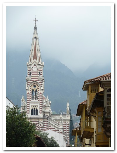
Striped Gothic church
The Cathedral
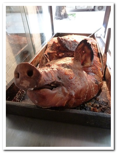
Lechona
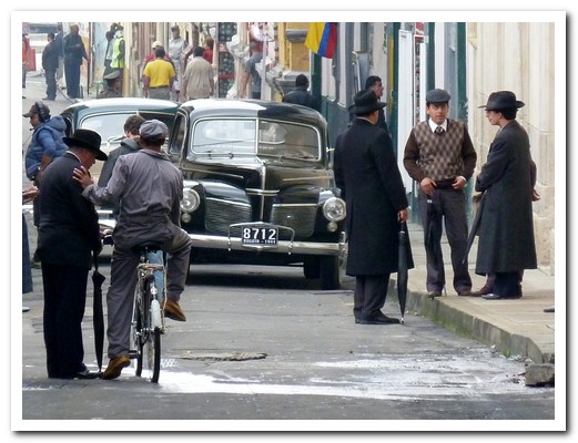
Filming a telenovela (TV soap opera) on a Bogotá street
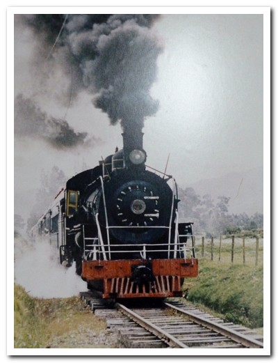
Steam train to Zipaquirá
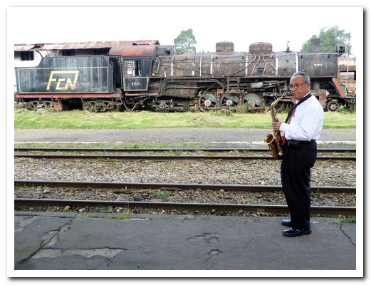
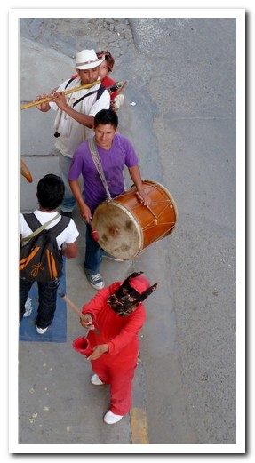
Musicians played
Zipaquirá
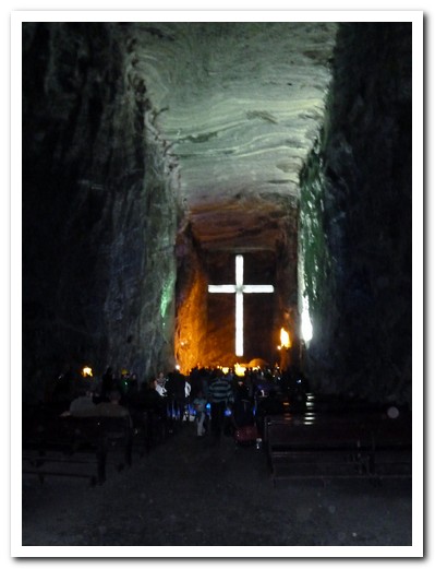
Mass in the Cathedral inside an old salt mine
San Agustín
25th December 2010
We arrived in San Agustín [9] at 8 am after an all night bus from Bogotá and within minutes Jorge from World Heritage Travel Office had organised 3 days of sightseeing of one of the important archaeological sites in Colombia.
.
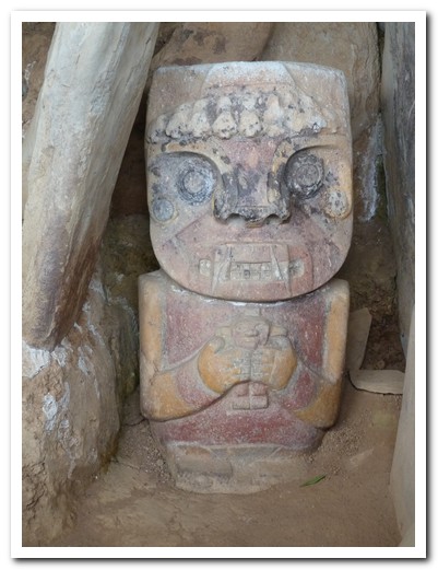
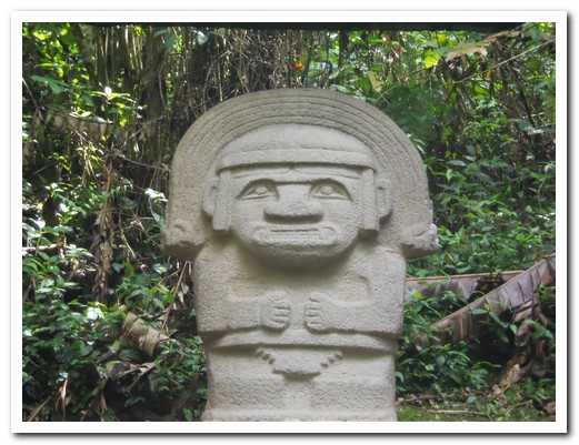
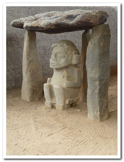
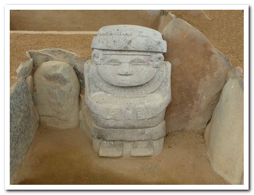
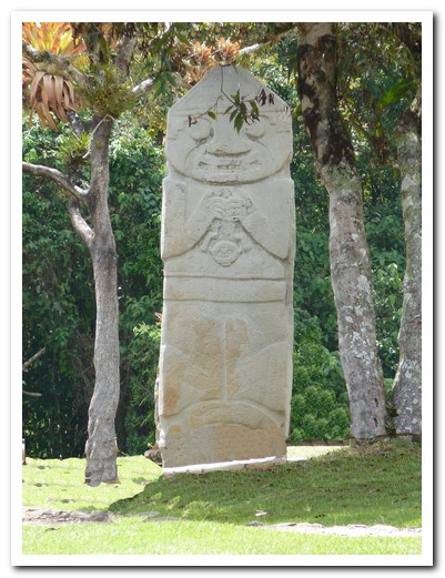
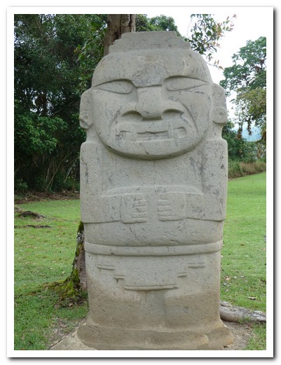
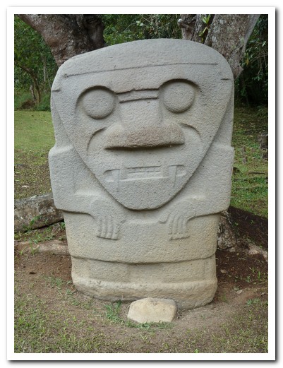
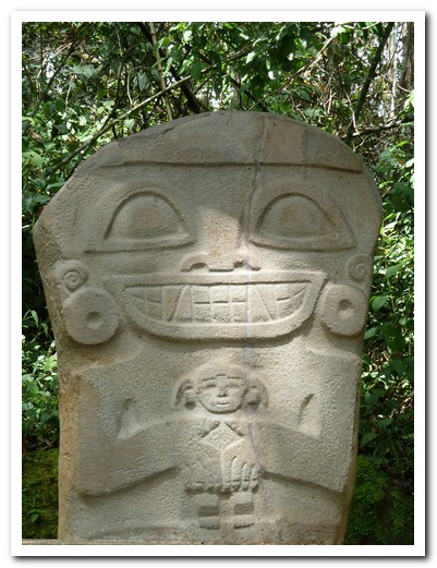
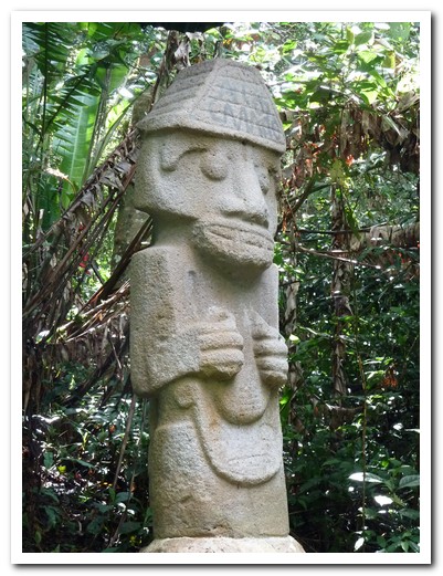
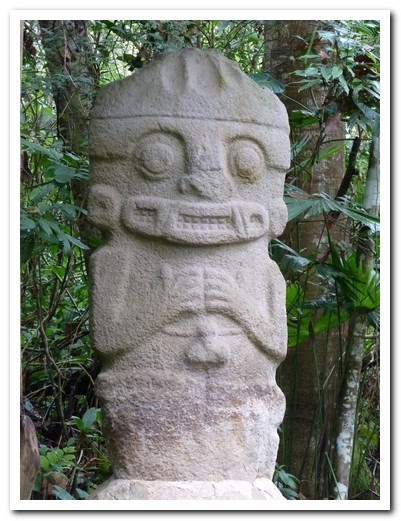
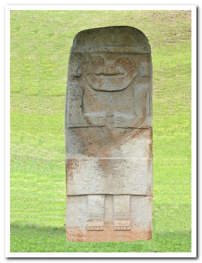
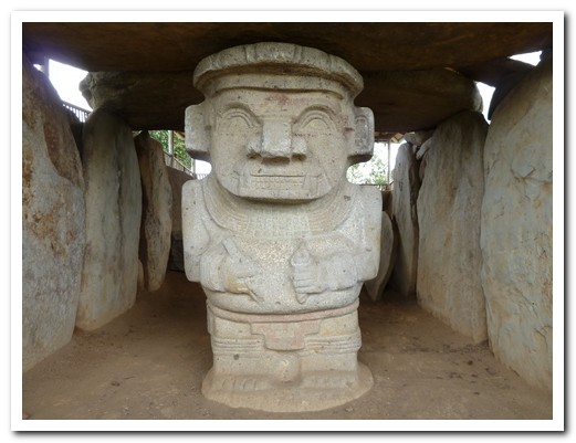
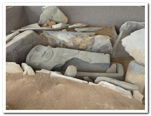
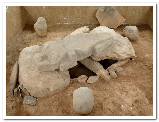
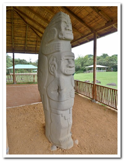
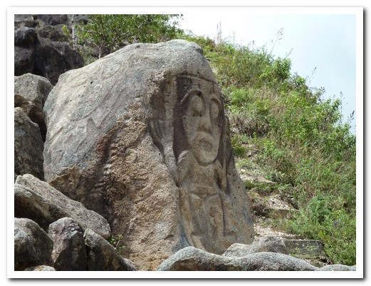
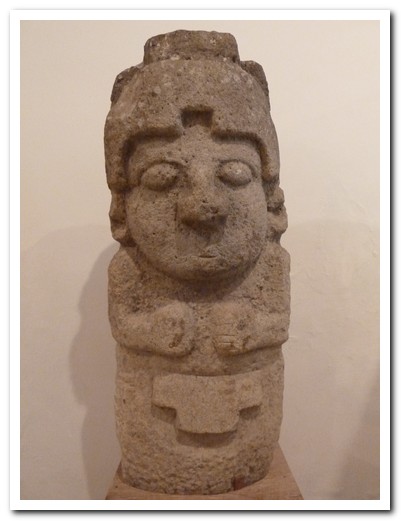
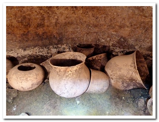
The mysterious Agustiniana culture, which thrived between the 6th and 14th centuries around San Agustín, had already disappeared before the Spanish arrival. Inside flat topped burial mounds they left behind tombs with magnificent carved stone sculptures in the shapes of animals, warriors and human faces some mythical, some realistic. There are about 400 statues and tombs scattered in groups in the area. The statues range from less than a 1 meter to 7 meters high, and some were originally brightly painted in red, yellow and black. At the entrance to several tombs there is a carved figure of the deceased flanked by 2 guards. After some time the bones were removed and placed in urns for a secondary, deeper burial. Only tribal chiefs, shamans and priests were buried in this way.
.
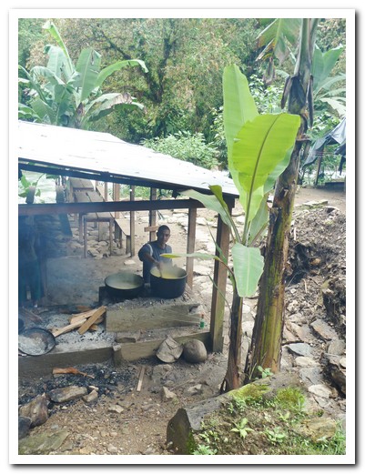
On a jeep trip to some of the more remote sites, we passed small farms of sugar cane, bananas and coffee. It was most interesting watching the cane being crushed by hand and the juice being boiled to make blocks of solid raw sugar called panela which is used throughout Colombia as a sweetener.
.
The main sites we covered on foot over 2 days, walking through lovely green countryside passing villages, houses and farms. The people of San Agustín and the surrounding areas have to be some of the friendliest we have met in our travels.
.
San Agustín´s oldest street
The local church
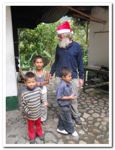
Santa with some village kids
Huge man made burial mound
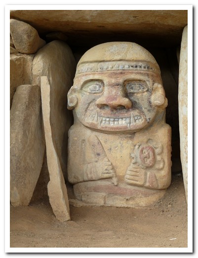
Statue depicting a boy sacrifice
Girl sacrifice (drug induced wide eyes on statue)

Tomb entrance (originally deep under ground)
Lone statue in the jungle
Primary burial tomb
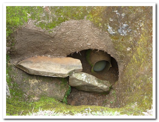
Secondary burial in ceramic pot
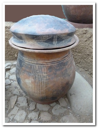
Funeral urn
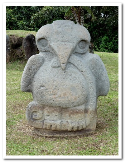
Eagle with snake
Pregnant woman
5 meter high statue
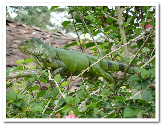
Iguana
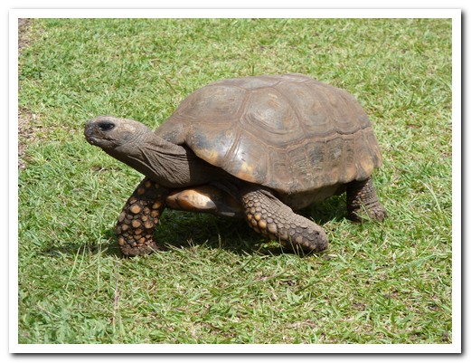
Tortoise
 |
 |
 |
 |
 |
 |
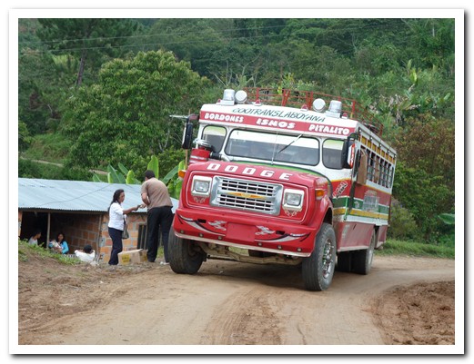
Brightly coloured ¨chiva¨ transports people and goods in the country areas
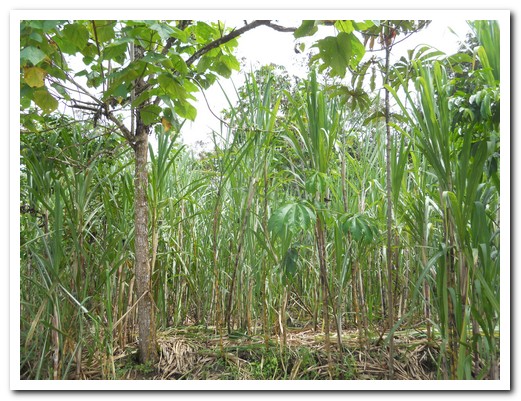
Sugar cane
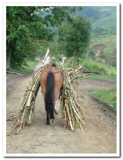
Mules carry the cut cane ...
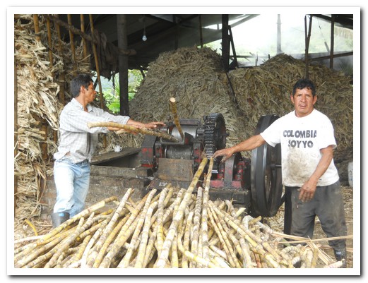
... to the factory for crushing
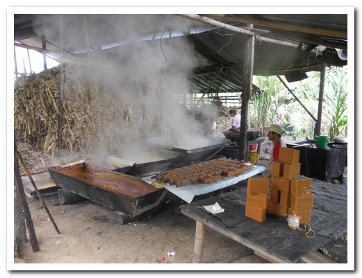
The boiling process to produce blocks of panela
The tallest statue at about 7 meters
Sarcophagus
Unfinished statue
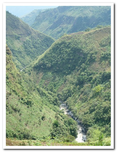
Rio Magdalena divids the east and central Andes of Colombia
Xmas in Popayán
26th December 2010
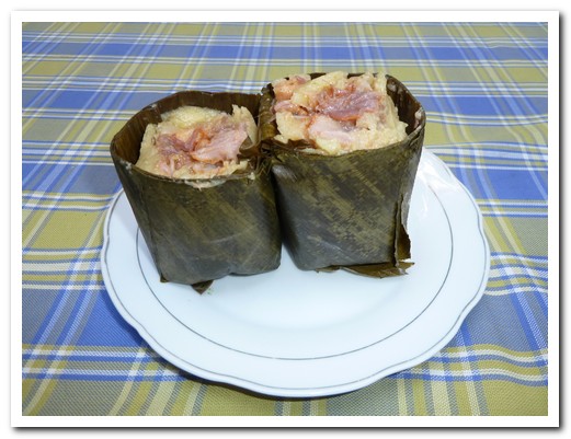
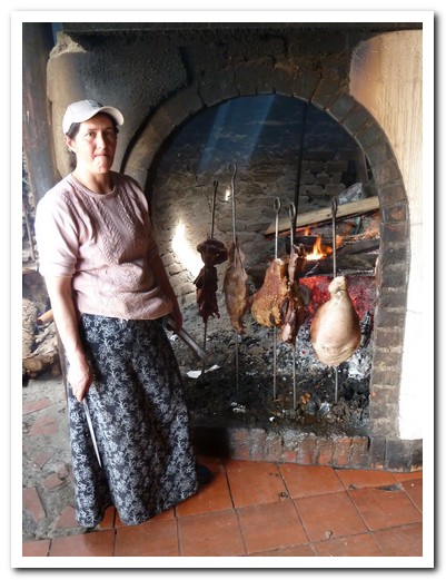
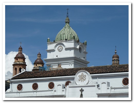
Popayán [10] is another beautiful, old colonial town and a pleasant place to spend a few days. The tamales here are the best we´ve had. Chicken and meat, combined with slices of potato, chick peas, peanuts and a corn mixture, is wrapped together in banana leaves and steamed to make a delicious and filling meal.
.
We arrived in Popayán on Christmas Eve after a slow, bumpy bus ride through the mountains from San Agustín, 6 hours to do 120 kilometres. The road was rough but the scenery magnificent. Our hostel, Hostel Trail had organised Christmas drinks and food that evening and a lovely traditional lunch for all the hostel guests on Christmas day at a nearby restaurant.
.
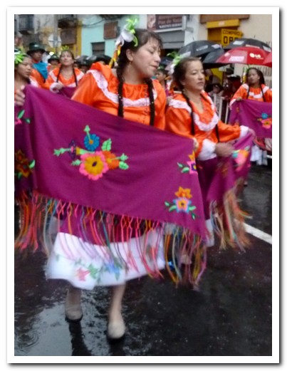
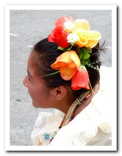
On Tuesdays, the nearby village of Silvia [11] comes alive. The local Guambiano Indians, in colourful traditional dress, come to buy and sell fruit, vegetables and meat at the weekly market.
.
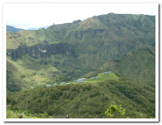
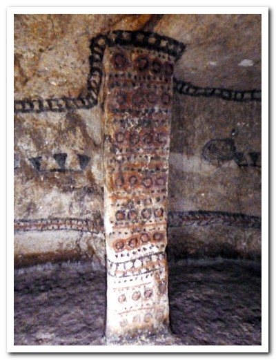
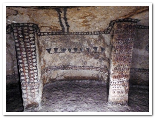
Tierradentro [12] (meaning under the ground), four and a half hours away by local bus is another important archaeological site. Our 5 am bus soon filled with families and farmers taking produce and fresh milk to market as it climbed above 3000 meters passing forests, fields and farms.
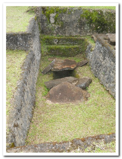
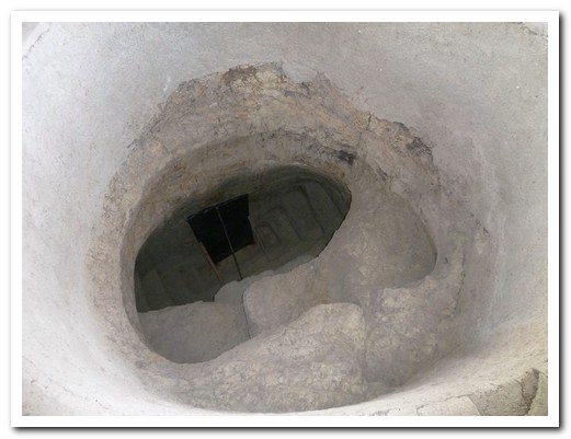
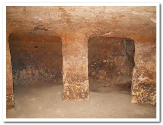
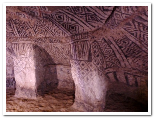
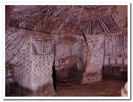
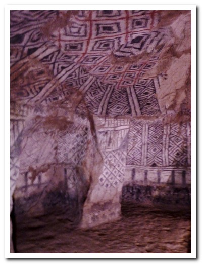
About 100 tombs have been discovered in the hillsides as well as a few stone statues. Each tomb is accessed by a well about 2 meters in diameter with spiral or zigzag stairs leading down to the tomb which can be as much as 5 meters deep. They range from 2 to 7 metres across with huge carved pillars. Domed ceilings and the walls are painted with geometric designs in red and black, some remarkably well preserved. This burial method is different to that used in San Agustín and unique in the Americas. We followed the path uphill and along the valley, passing the sites, to arrive at San Andrés de Pisimbalá where we found cold beer, delicious food and a good bed at La Portada.
.
Xmas dinner in Popayán
The yellow Iglesia San Francisco
The old part of Popayán
Iglesia Santo Domingo
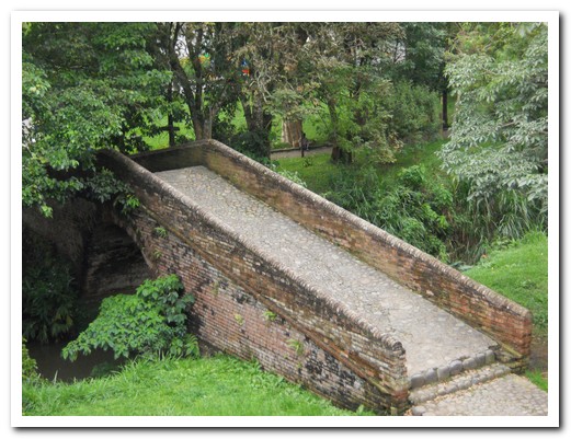
1713 bridge
Dome of the Cathedral
Painted eave of another church
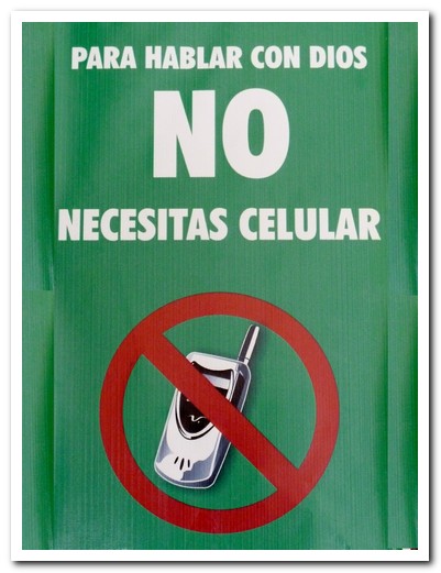
In the Cathedral - ¨To talk to God you don´t need a mobile phone¨
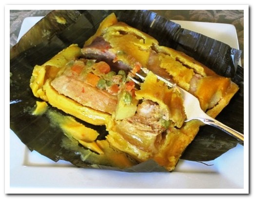
Tamale
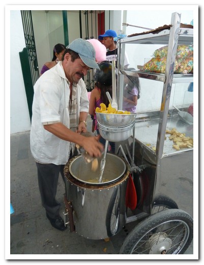
Street vendor making banana chips - yum!
Devil dancing in the street
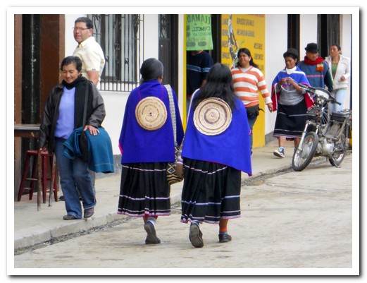
Local women heading to the market in Silvia
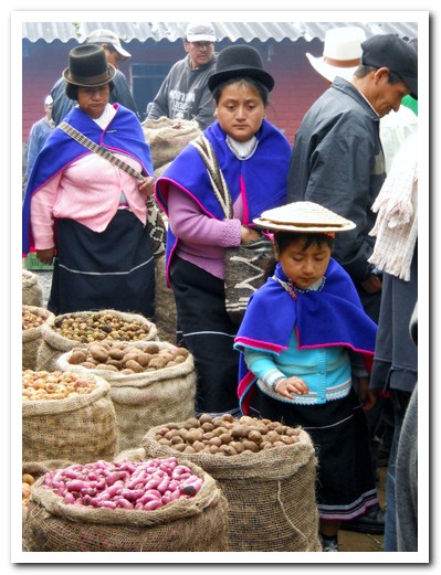
Eyeing off the potatoes in Silvia´s market
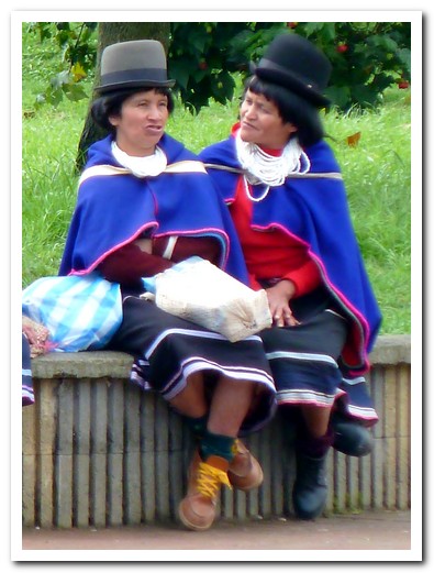
2 ladies chatting
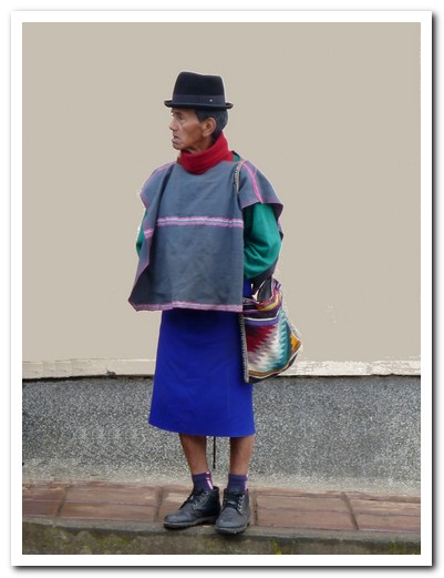
Local man in traditional dress
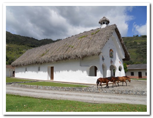
Thatched roof church at San Andrés
Underground tombs found on a ridge high in the mountains (protected by iron roofs)
Typical entrance to a tomb, this one original
Simple, unpainted tomb
One of the painted tombs
Statue, about 1 meter high
These pots contain cremated human remains
A more elaborate tomb
Beautifully decorated ceiling
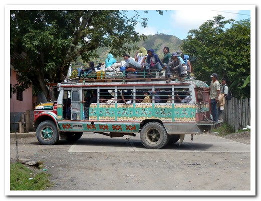
Always room for one more on a chiva!
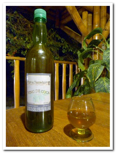
We enjoyed the locally made Coca wine so much we bought a bottle
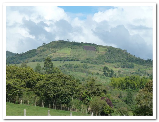
Mountain scenery
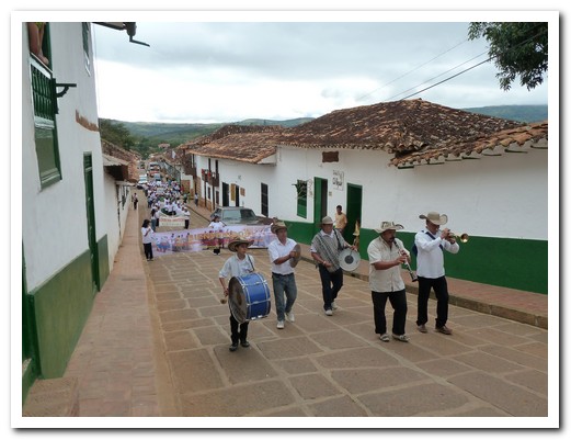
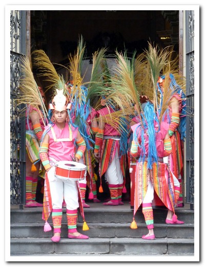
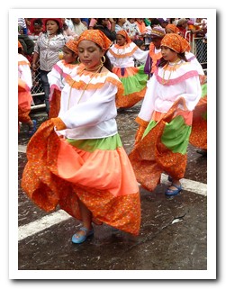
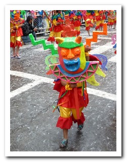
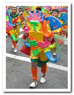
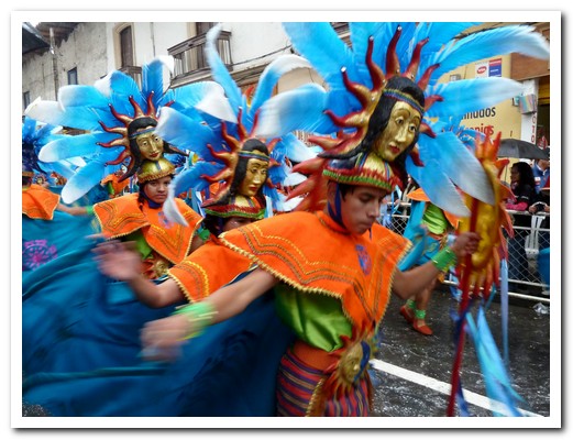
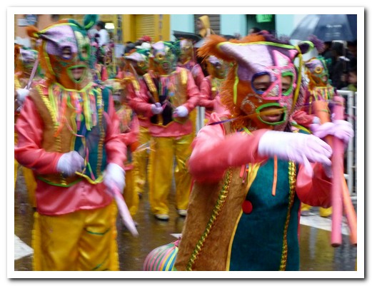
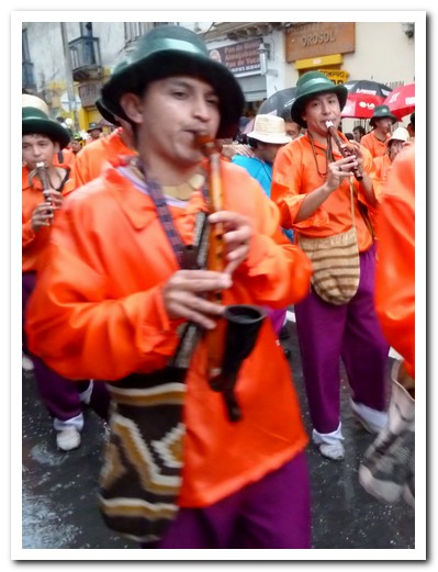
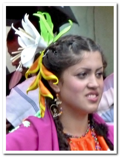
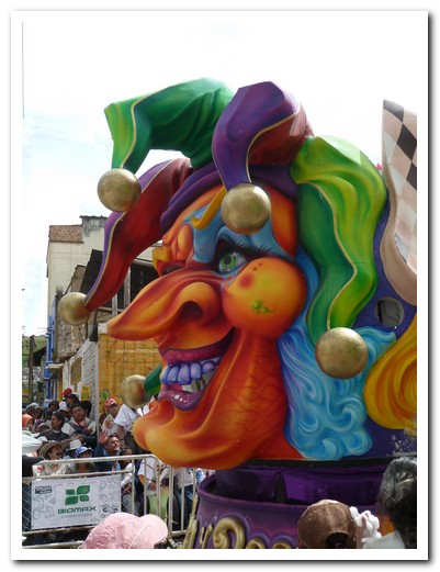
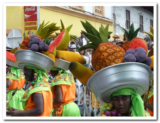
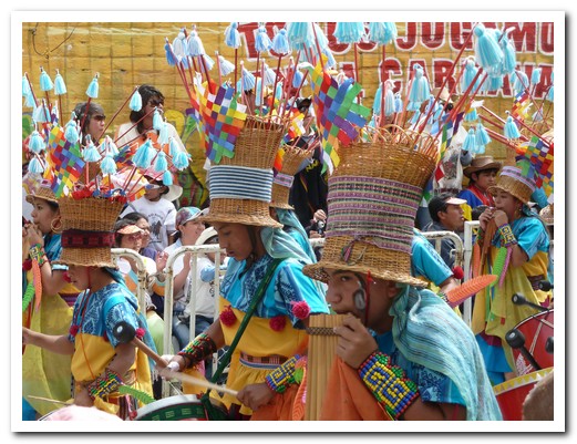
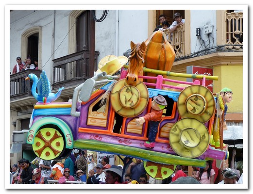
Carnaval of Blacks & Whites – Pasto
06th January 2011

.
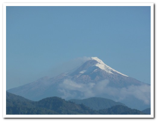
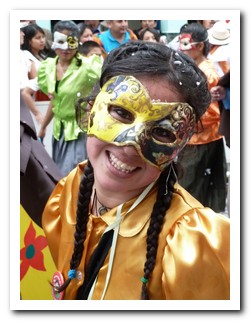
San Juan de Pasto [13] lies at the base of the active volcán Galeras in a valley surrounded by a patchwork of green hills in the south of Colombia. We came for the annual Carnival of Blacks and Whites, which originally was an ancient Indian ritual to ask their gods for protection for their crops. Later the Spanish declared January 5 a day off for black slaves who celebrated enthusiastically. It has evolved into a weeklong party.
.
The celebrations had already begun when we arrived on New Year´s Eve. The streets were filled with people, many carrying effigies (called Años Viejos) of all shapes and sizes. They are made from old clothes and filled with rags, paper or sawdust (it used to be gunpowder!) to represent the old year. People carry them, strap them to their cars or prop them up outside their shops and houses. At midnight they are all burnt to wipe out the past year to be able to begin again afresh. The beer was flowing freely.
.
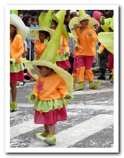
The children´s parade got the Carnaval off to a fine start. Everyone was spraying each other with foam. Things were starting to get messy! That afternoon the rain didn´t dampen the spirits of the performers or spectators of the groups paying homage to Pacha Mama (Mother Earth), each with about 100 dancers and musicians.
.
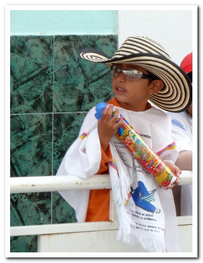
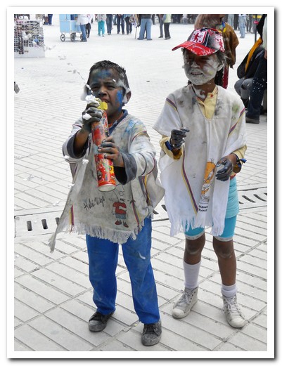
On the 5th things hot up – wear your lest favourite outfit. This is the day of the Blacks. If you haven´t painted your face black, someone will do it for you. The black paint “acts to homogenise the different races and social classes”. The city and everyone in it is now covered in white dust, thrown by the handful. There are bands playing. It´s great fun – for the first hour or so. The 6th is the day of the Whites and the main parade with floats, music and dancing, and people in costumes. Get there early if you want a good position.
.
South of Pasto the road winds around emerald green hills, following a spectacular canyon to reach Ipiales [14], a few kilometres from the Colombia/Ecuador border. We joined hundreds of the faithful at the nearby Santuario de Nuestra Señora de las Lajas, a neo-Gothic basilica built on a bridge spanning a deep ravine.
.
Tiled mural depicting the patchwork hillsides around Pasto
Steeples of the Pasto Cathedral
Centre of Pasto

The man on stilts with his effigy

These effigies are burnt on New Year´s Eve ...
... to erase the bad things of the past year
Celebration for the Virgin de las Mercedes
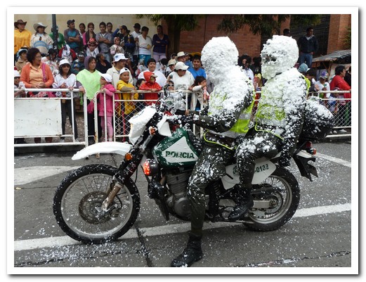
No one is exempt from being sprayed with foam at the Carnaval
The children´s parade
Parade paying homage to Pacha Mama (Mother Earth)

Little boy armed with his can of spray foam is ready for action

The over 60s group marching
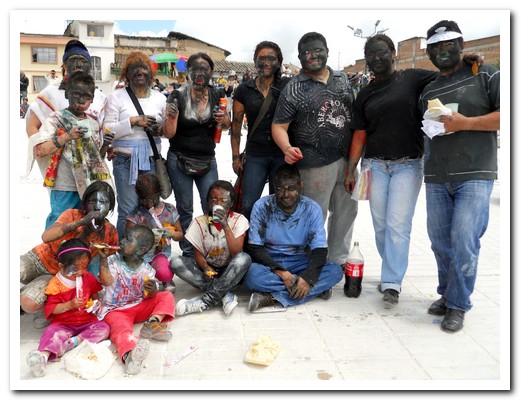
Everyone paints their face black on January 5
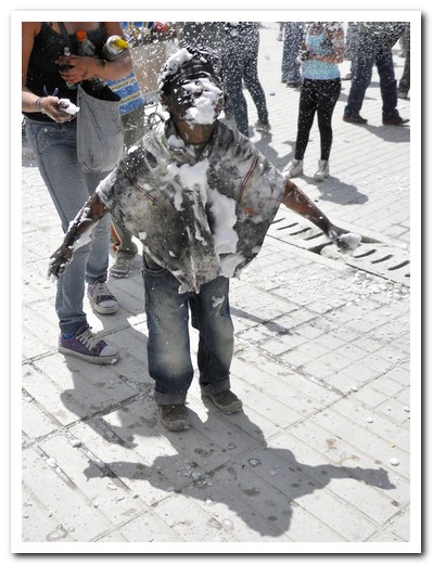
Little boy covered with foam
Beware of kids with spray cans!

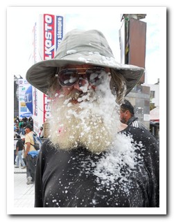
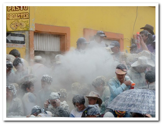
On the 6th white powder throwing gets serious
Final parade has some strange creatures

In Pasto we stayed at the Koala Inn Hostal. The breakfast pancakes were great.
Smoky roadside kitchen at a bus stop on the way to Ipiales
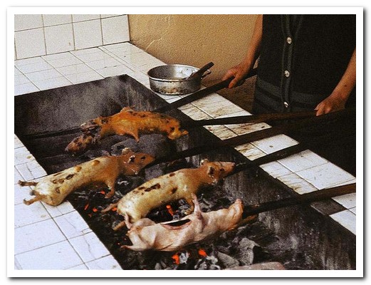
Guinea pigs (local delicacy) roasting
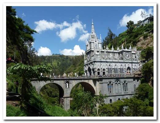
Santuario de Nuestra Señora de Las Lajas
Salento
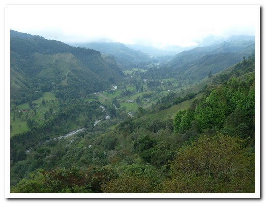
17th February 2011
We returned to Colombia by re positioning to the lovely little mountain village of Salento [15] in the middle of coffee country. Trout is on the menu at every restaurant in town. It is served on a plate sized, wafer thin crisp of mashed plantain called patacón (recipe).
.
In the Valle de Cocora, on the steep green slopes, hundreds of wax palms rise majestically out of the mist to some 60 metres. These palms, the tallest in the world, are the national tree of Colombia. They are slow growing and live over 100 years. Once facing extinction, they are now protected.
.
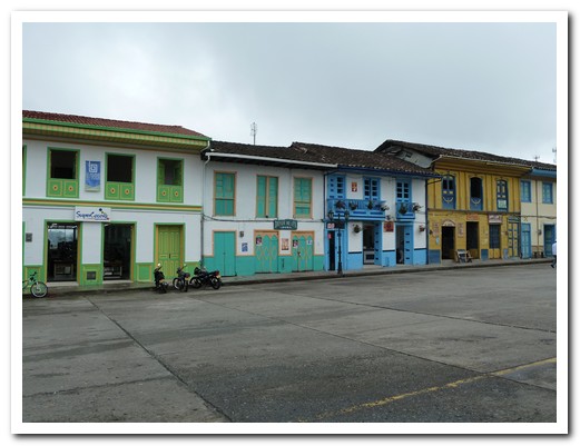
Salento
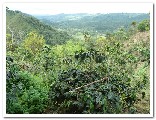
Organic coffee farm
Valle de Cocora
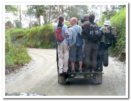
Always room for one more on the jeep ride to Cocora
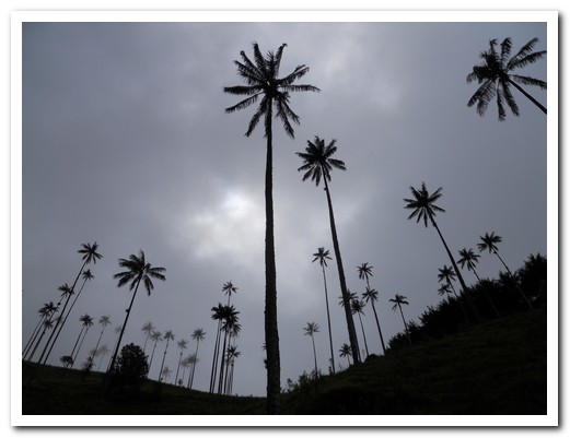
Wax palms
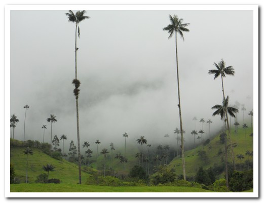
Wax palms
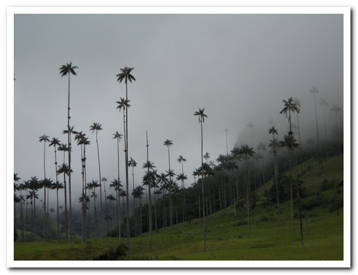
Wax palms
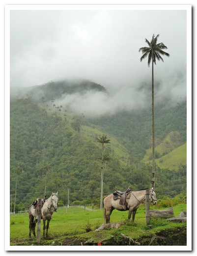
Horses in the rain - Cocora
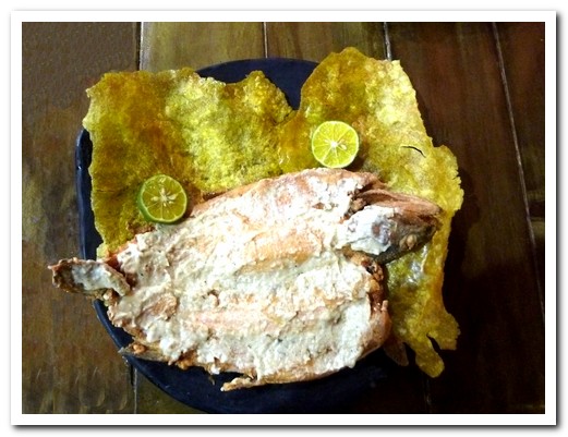
Trout with garlic sauce served on a patacón
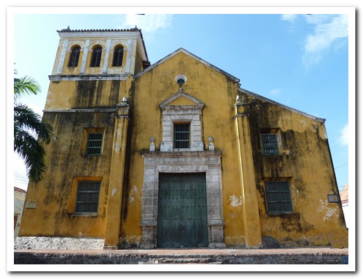
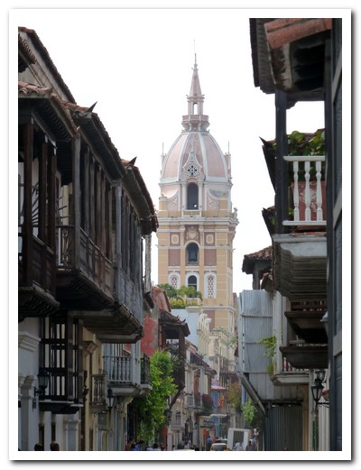
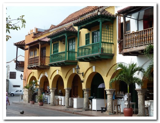
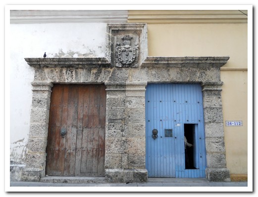
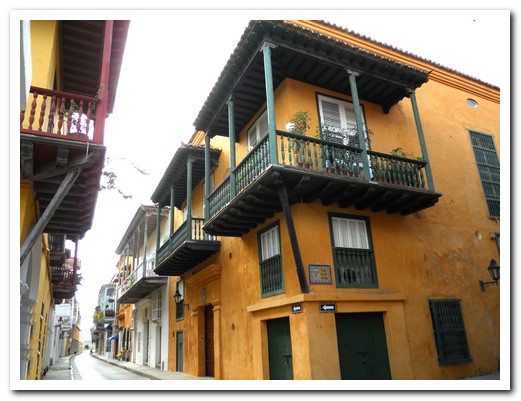
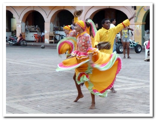
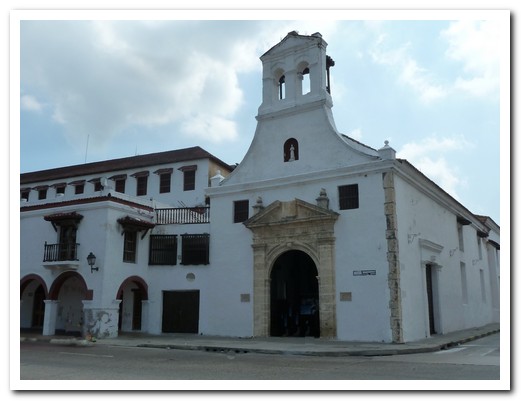
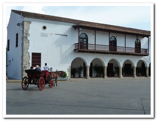
Cartagena de Indias
25th February 2011
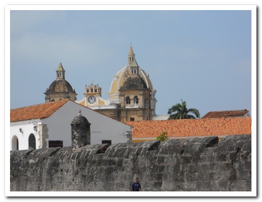
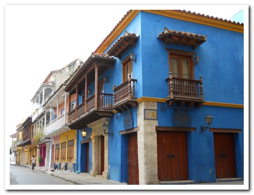
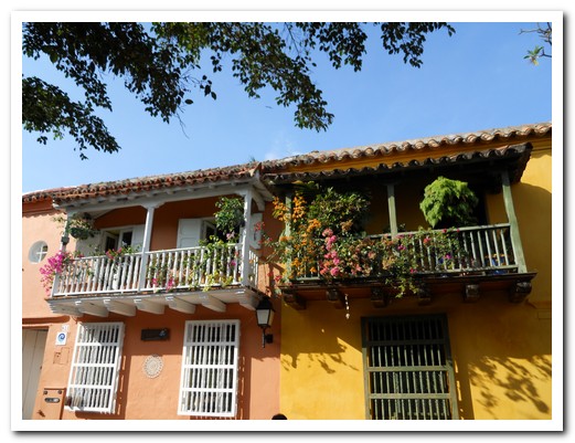
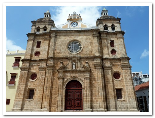
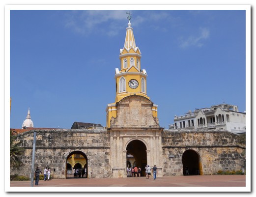
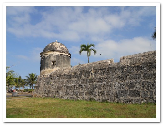
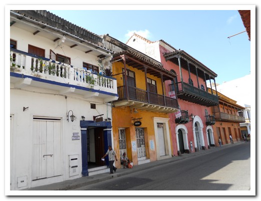
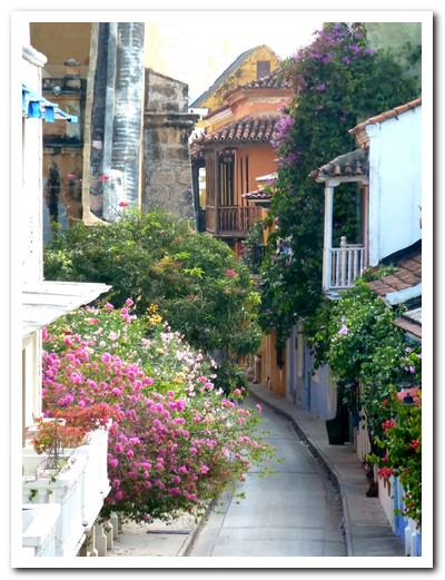
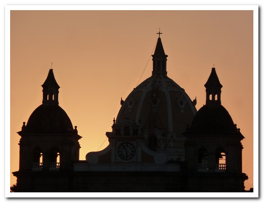
The walled old town of Cartagena de Indias [16] on Colombia´s north coast evokes images of its past grandeur as a major Spanish port. Founded in 1533, shipments of gold and emeralds left from the port and settlers and slaves arrived. To protect the city from constant pirate attacks, the fortifications included 11 kilometres of walls up to 12 meters thick and a dozen forts. Castillo de San Felipe de Barajas was the greatest and strongest fortress built by the Spaniards in any of their colonies. Inside the walls, balconies covered in bougainvillea hang over narrow twisting streets filled with brightly painted houses. Cartagena is a beautiful city with a strong African flavour. We spent a week there staying in Casa Villa Colonial in the historic area of Getsemaní.
.
An hour out of Cartagena, Volcán de Lodo El Totumo (mud volcano) rises 20 meters above the ground making a miniature volcano with a thick muddy crater at the top. We went up the ladder on the side of the hill and into the mud, thick as chocolate on a hot day. It was the strangest experience floating (wallowing) in the mud – you cannot stand, but you cannot sink. Afterwards we were washed off in the nearby lake by old women who had no hesitation in ordering “take off the pants”.
.
The plan is to sail off into the sunset on the 26 February with Captain John on the 60 foot yacht The Wild Card so after 17 months it is bye bye South America and hello Central America.
.
Old Cartagena behind the city walls

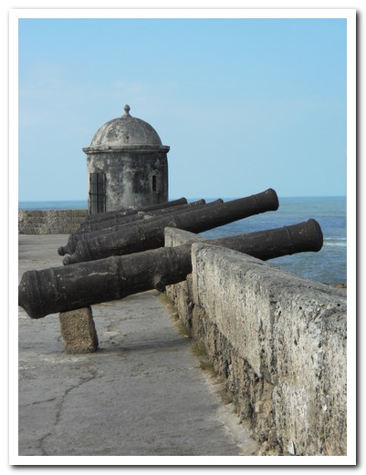
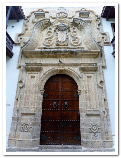
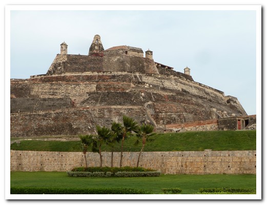
Castillo de San Felipe de Barajas took amost 200 years to build
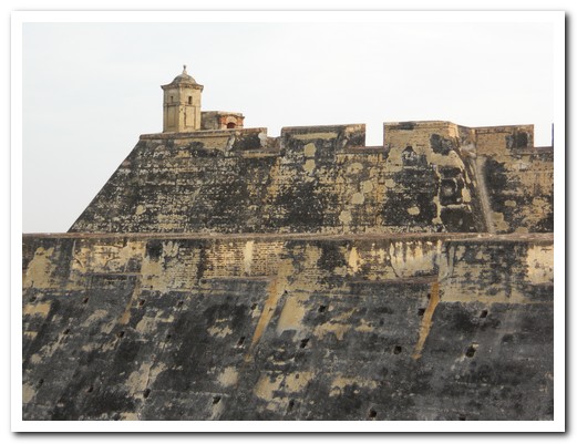
The Castle´s defenses were never breached

Tunnels under the fort
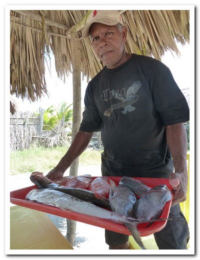
Which fish for lunch?
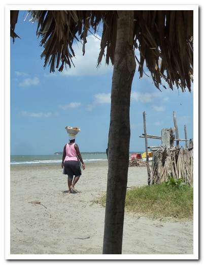
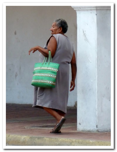
Lady selling stuff on the beach
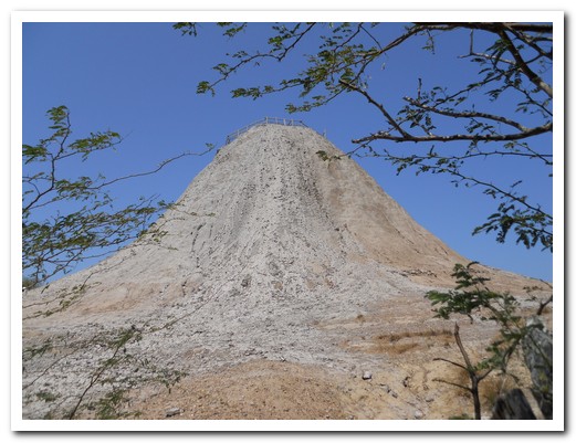
El Totumo mud volcano
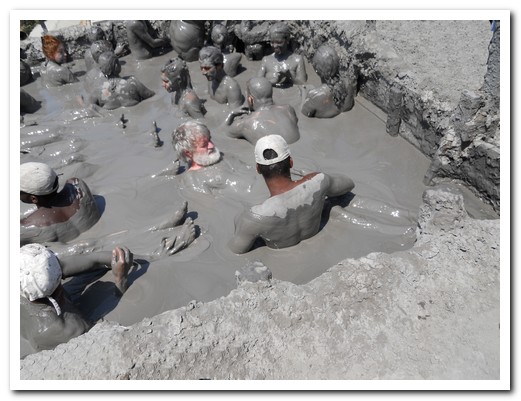
Jeff wallowing in the mud
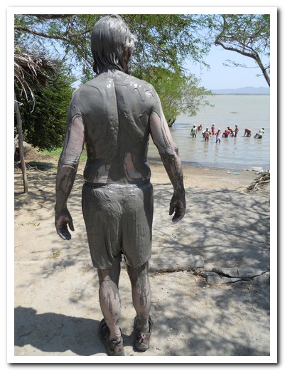
Heading down to the lake to wash off the mud
Sailing off into the sunset from Cartagena to Panama ¡Ojalá!