Categories
- Argentina
- Chile
- Antarctica
- Easter Island
- Falklands (Malvinas)
- Bolivia
- Peru
- Uruguay
- Paraguay
- Brazil
- Venezuela
- Colombia
- Ecuador
- Galapagos
- Panama
- Costa Rica
- Cuba
- Nicaragua
- Honduras
- El Salvador
- Guatemala
- Belize
- Mexico
- Latin American Xmas
Pages
- Street Art of Buenos Aires
- A week in Buenos Aires
- The Jesuit Missions in South America
- Contact Us
- Map of Central America
- First week in Latin America – October 2009
- Home Page
- Map of South America
Archives
- October 2011 (3)
- September 2011 (9)
- August 2011 (10)
- July 2011 (7)
- June 2011 (6)
- May 2011 (11)
- April 2011 (10)
- March 2011 (4)
- February 2011 (5)
- January 2011 (6)
- December 2010 (6)
- November 2010 (4)
- October 2010 (8)
- September 2010 (5)
- August 2010 (7)
- July 2010 (5)
- June 2010 (6)
- May 2010 (6)
- April 2010 (7)
- March 2010 (6)
- February 2010 (9)
- January 2010 (4)
- December 2009 (8)
- November 2009 (5)
- October 2009 (2)
Into the Copper Canyon and out of México
17th October 2011
The alpine style village of Creel (2400 meters) [44] is about halfway between El Fuerte and Chihuahua and a pleasant place for our day off. It was founded in 1907 as a railroad depot on the Chihuahua-Pacific line.
.
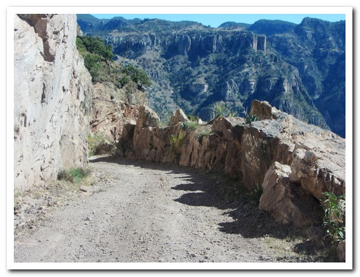
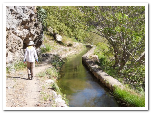
Julio from 3 Amigos picked us up early to see the strange rock formations near Creel before heading down to Batopilas [45], a Rarámuri term meaning “alongside the river”. It was a full day; crossing the Basihuare and Copper Canyons and stopping for a picnic lunch before the nail biting 2000 metre descent down a steep winding dirt road to the lovely colonial mining village straddling the river at the bottom of the Batopilas Canyon. Today the town has a population of 1700, but in its mining heyday it supported 10,000. An aqueduct brought water from the river to generate electricity, making Batopilas the second electrified town in México. Next day we walked a couple of hours along the old mule path that leads to Chihuahua 13 days away.
.
Back up the road and across the canyons and we were at Cusarare (2200 metres) [46] which means “where the eagles fly” in the Rarámuri language. We spent the night at Sierra Lodge, nestled against the side of a small pine covered valley way off the beaten track – no electricity, no telephones, no TV’s, no radios, no Internet.
.
The following day Julio transferred us to Chihuahua [47] 4 hours away at 1400 meters. Chihuahua means “dry sandy place”. Founded in 1709, it played a significant role in both the México independence movement and the Mexican revolution. We had guided tour of the city to see the sights and hear the history.
.
Next morning we were off to the airport for our flight home via Los Angeles and Fiji. After 2 years travelling, it is time to go home and we are happy to say we managed to travel safely throughout Latin America, from Antarctica to northern México, enjoying the experiences immensely. This will be our last blog!
.
Waiting for the train in Creel

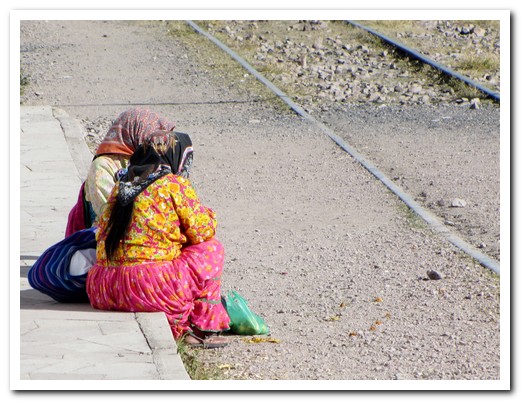
A Rarámuri couple come into Creel

The effect of erosion ...
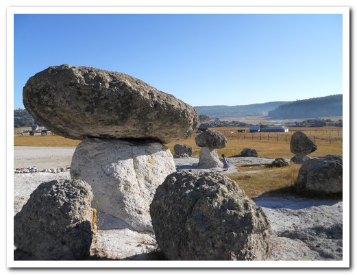
... in the Valley of the Mushrooms
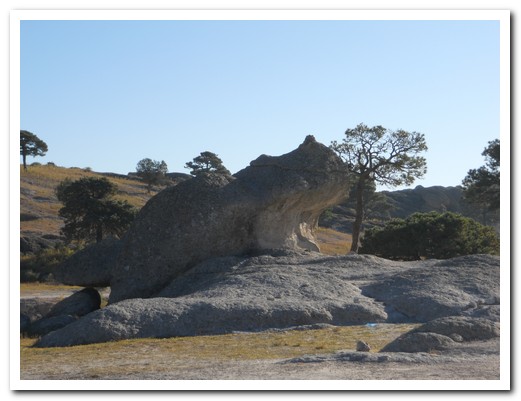
Valley of the Frogs

Rarámuri log cabin
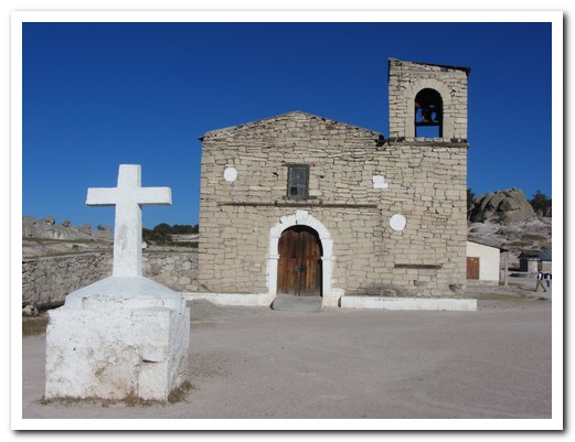
Jesuit Mission Church at San Ignacio (1754)

Overgrown Mission cemetery

Little Rarámuri girl selling handicrafts
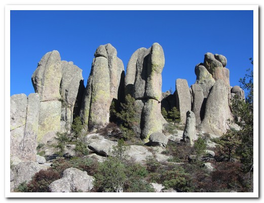
The Valley of the Monks
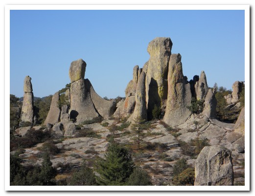
In the Valley of the Monks
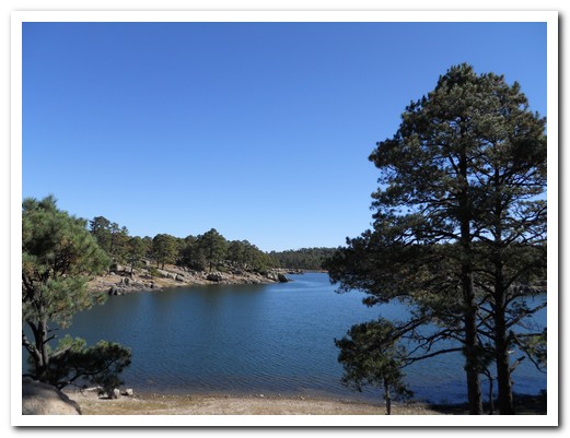
Lake Araraka
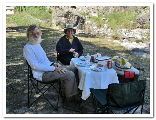
A perfect picnic
Looking down into the Batopilas Canyon ...
... before descending 2000 meters down a dirt road
Wedding Cake Mountain
The Rarámuri like to live on isolated mountain farms
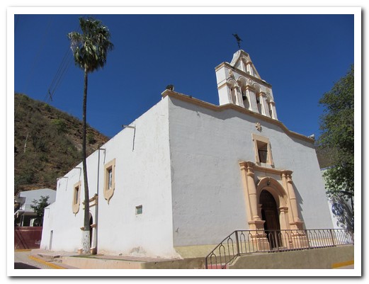
Batopilas Church
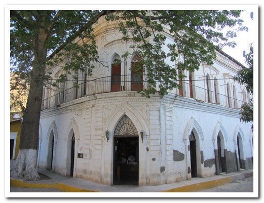
The old general store in Batopilas
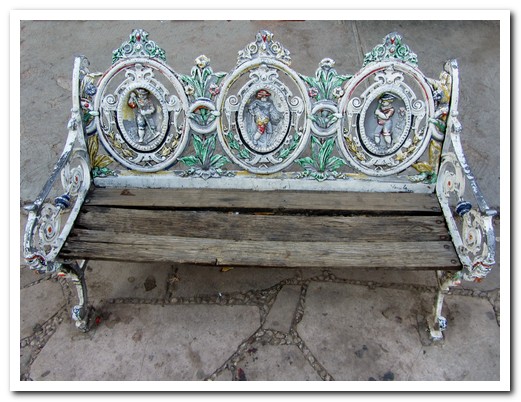
Pretty cast iron benches around the plaza
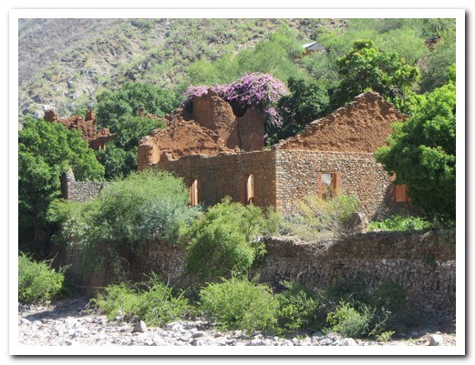
Ruins of Hacienda San Miguel (the old silver mine main office)
The aqueduct bought water to run the hydro electric plant for the mine
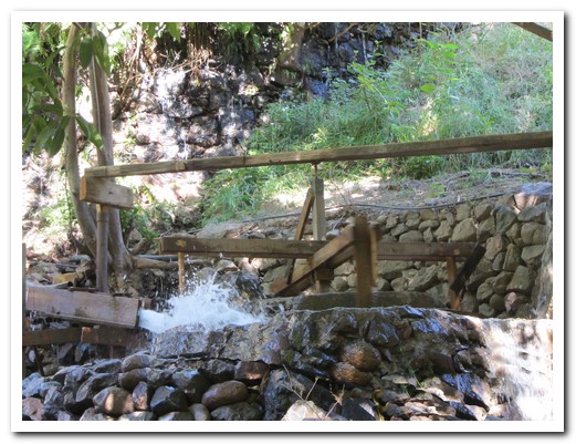
There is still a rock crushing mill powered by water from the aqueduct
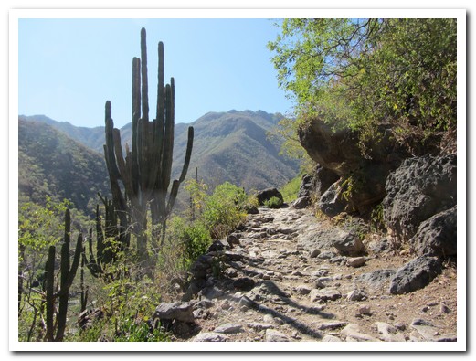
It took 13 days along this old mule path to reach Chihuahua - used up until 1977
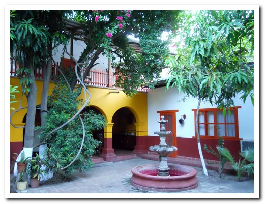
Real de Minas Hotel courtyard
The lost Cathedral of Satevo, Jesuit 18th century, built entirely of bricks - unique in this region
S bend in the Copper Canyon River
Rarámuri means he who walks well
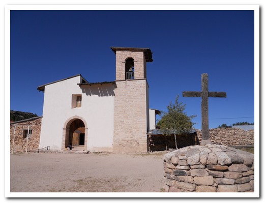
The Jesuits built the first church in Cusarare in 1741
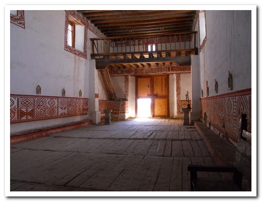
In 1973 the church was restored and the interior was decorated in Rarámuri designs
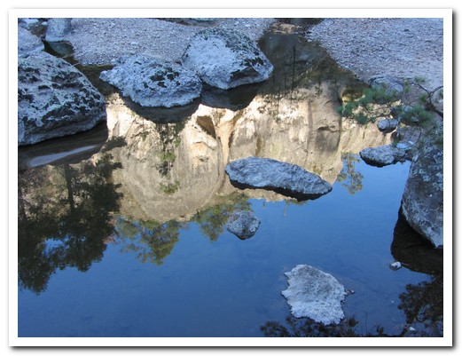
Reflections in the Cusarare River near the Sierra Lodge

Cusarare Falls, about an hour walk from the Lodge
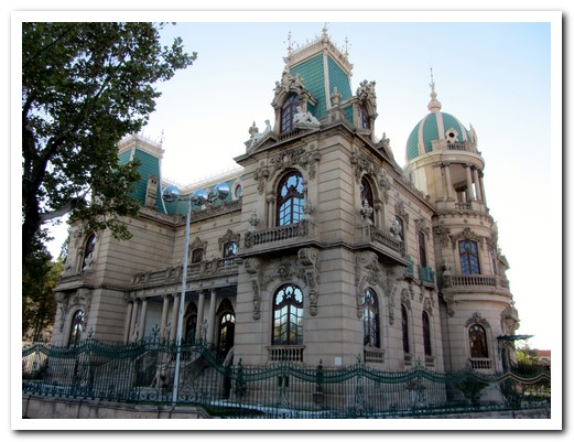
A French style mansion from the silver mining days in Chihuahua

One last Cathedral - Chihuahua
Copper Canyon – The Chepe Train
12th October 2011
To get to the start of our Copper Canyon train trip, instead of a long slow ferry from Baja California and arriving at midnight, we went for the 1 hour flight to Los Mochis in a 13 passenger, single engine Cessna Grand Caravan. One of us enjoyed it.
.
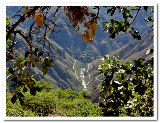
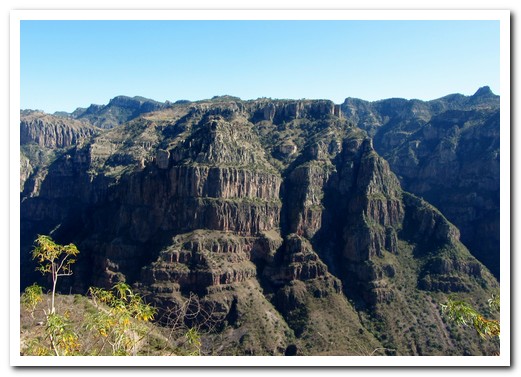
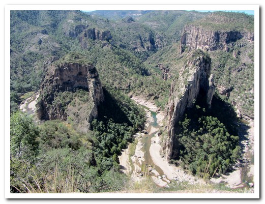
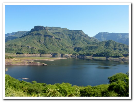
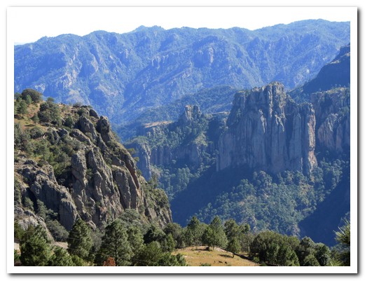
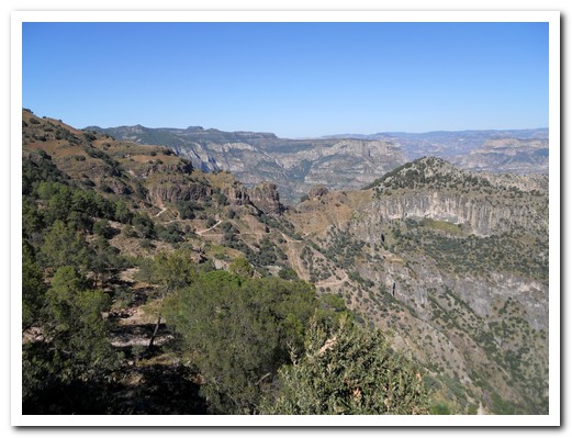
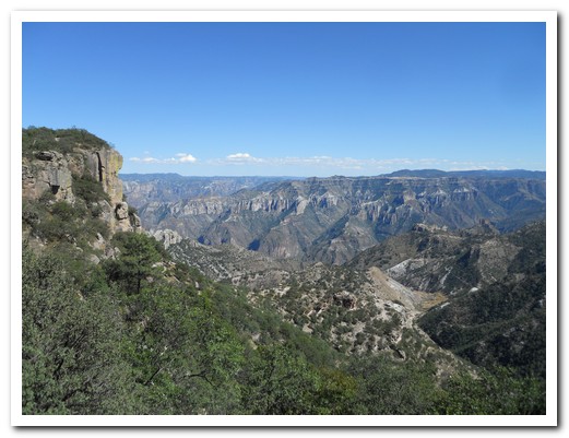
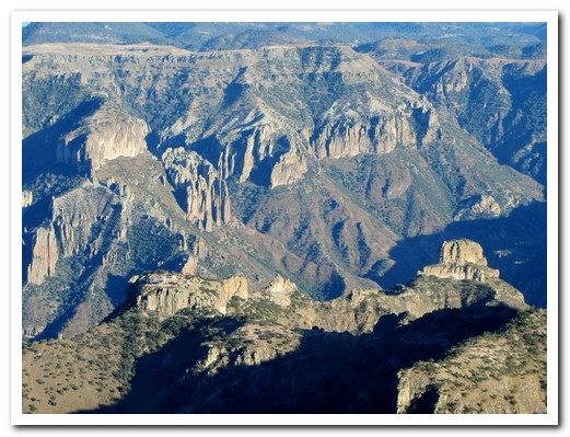
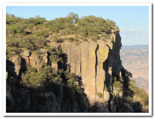
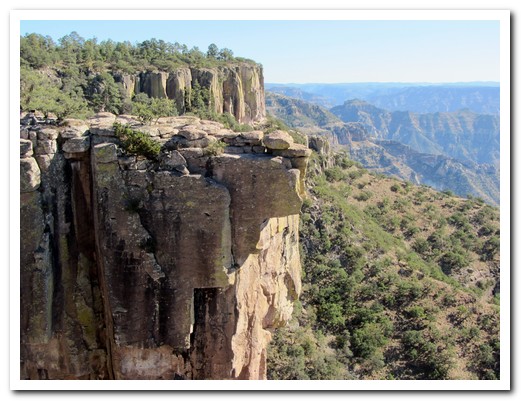
Barranca del Cobre (Copper Canyon) was named by the Spanish who mistakenly believed the greenish lichen to be copper. The “Copper Canyon” is actually a system of many canyons dating back about 60 million years when huge plateaus of land formed with cracks about 1 meter in depth. Water and wind, constant erosion over millions of years, created the kilometre deep canyons from these cracks.
.
With an extra day in El Fuerte [41] , a colonial style Mexican Pueblo Mágico founded in 1564, we were able to kayak down the sparkling River with several rapids sections and many birds, stopping for a hike up a small hill to see 2000 year old petroglyphs. We boarded the El Chepe train here in El Fuerte.
.
The Chihuahua al Pacífico (Chepe) railroad with its 37 bridges, 89 tunnels, a 180 degree turn and elevations from sea level to 2500 metres took almost 90 years to complete. Originally it ran 2000 kilometres from Wichita, Kansas to the Sea of Cortez in México, but now it carries freight, locals and tourists the 640 kilometres between Chihuahua and Los Mochis on the most dramatic train ride in the western hemisphere.
.
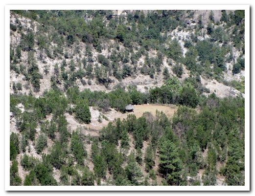
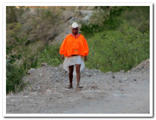
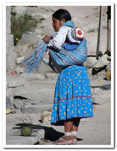
We got off the train at Bahuichiva to spend the night at the Paraiso del Oso Lodge in the forest near the village of Cerocahui [42], a high valley community of 2000. From cool mountain clifftops we had a spectacular view of the tropical village of Urique at the bottom of the canyon 1450 metres below. The former Jesuit Mission of Cerocahui was established in 1680 at the request of the local Rarámuri Indians who continue to live in isolated ranchitos in the mountains surviving by subsistence farming. There are about 60,000 living in northwestern México – the largest, most intact, traditional tribe in America. They are world famous for their endurance and long distance running; some of them are capable of running without stopping for 20 hours.
.
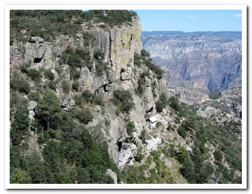
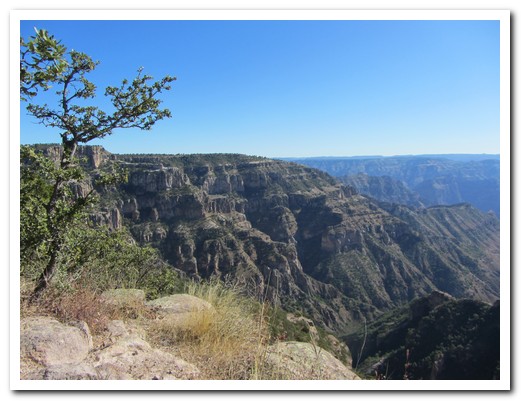
Next day we took the train on to Posada Barrancas [43] where we stayed in the Mirador Hotel perched on the edge of a cliff overlooking the junction of Urique, Tararecua and Copper Canyons. Our room had a balcony hanging over the canyons and an absolutely stunning vista. No need to do anything here, just looking was enough. The canyons under the full moon were especially beautiful.
.
The following morning we were driven to the many great canyon viewing places in the Divisadero area. Somehow the canyons looked different from every one. From there we continued on to the alpine style village of Creel [44] at 2400 metres.
.
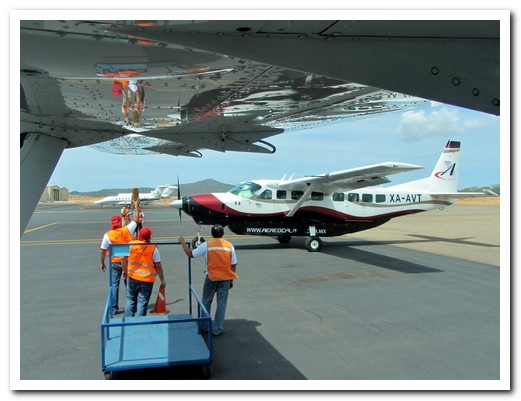
Another Aero Calafia Cessna Caravan taxies in at Cabo
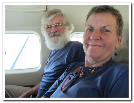
Enjoying the flight
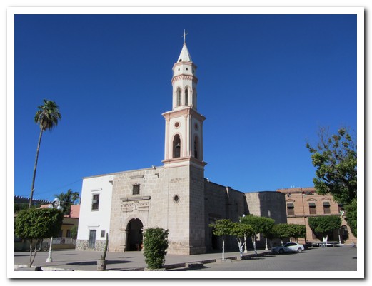
The Church at El Fuerte was built in 1854
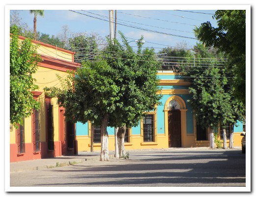
Colonial buildings of El Fuerte
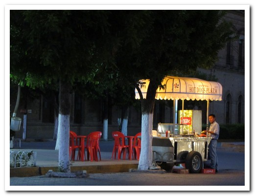
He turns up on the Plaza every evening and makes great hot dogs
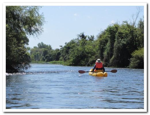
El Fuerte River
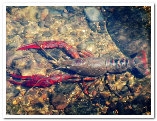
The local delicacy comes from the River

River bird
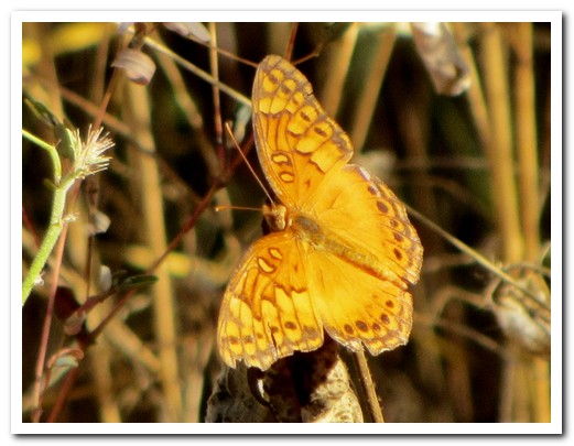
Butterfly
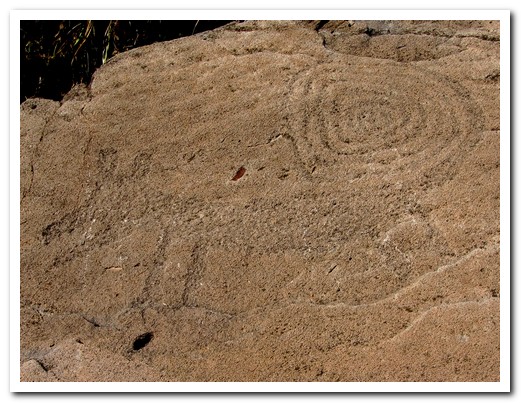
Petroglyph of a coyote with a long curled tail

Fertility symbol - a woman with the sun in her womb

Different techniques indicate different peoples and different periods

It takes 4 engines to pull the Chepe train up to 2500 metres

There are 50 flag down stops
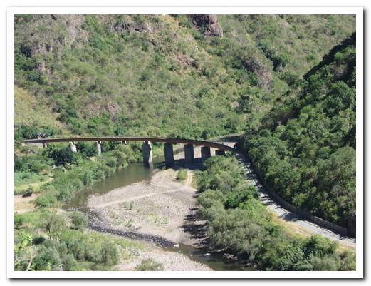
One of the 37 bridges
A dam holds water from the canyons
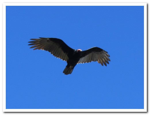
A hawk soars ...
... from the cliff tops near Cerocahui
View of the Urique Canyon with the road leading down to ...

... Urique 1450 metres below

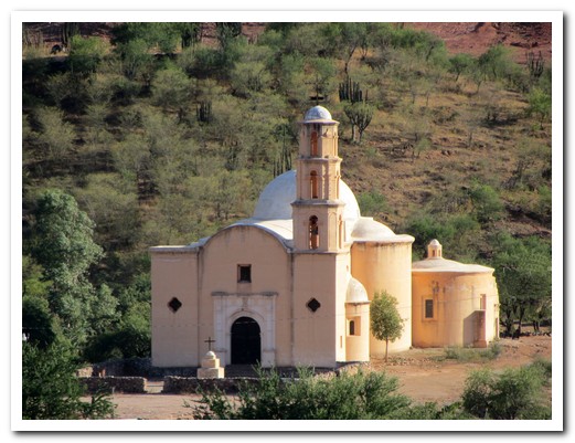
The Jesuit Mission Church in Cerocahui was completed in 1741
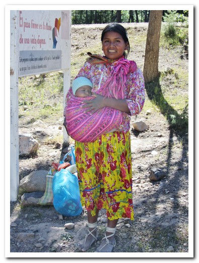
Young Rarámuri woman with her baby
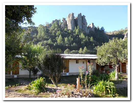
Paraiso del Oso Lodge under a rocky outcrop near Cerocahui
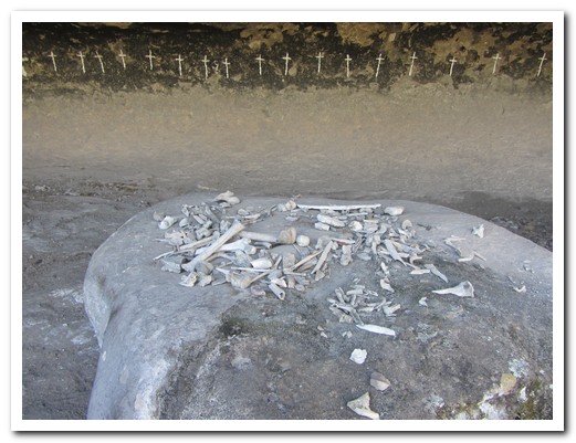
Cave of the crosses with human bones, a short hike from Paraiso del Oso
Junction of Urique, Tararecua and Copper Canyons from the Mirador Hotel
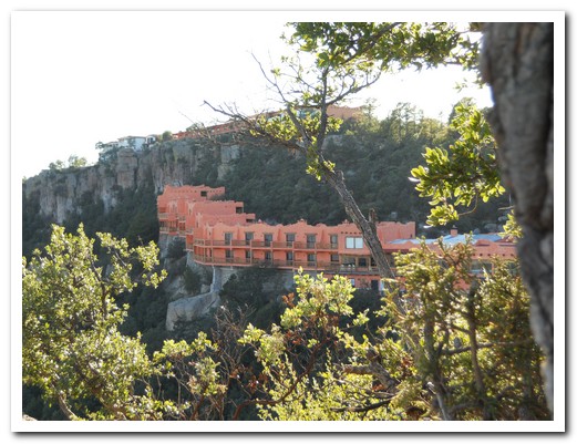
The Mirador Hotel built on the Canyon rim
Looking down into the canyon from our room balcony

Colourful birds linger around the hotel
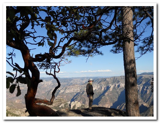
Jeff admiring the view
The Spanish though this lichen was copper
The Rarámuri live in caves and houses built into the cliff
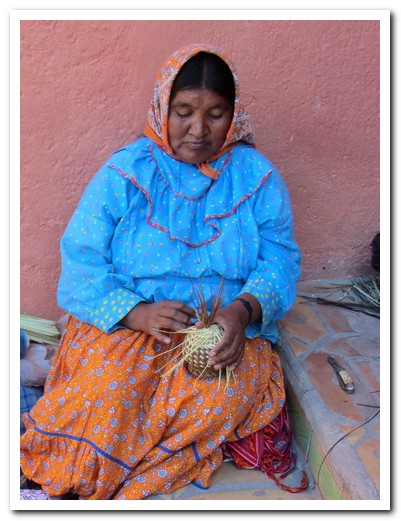
A women making a basket (which we bought)
Lady with her baby

The Rarámuri women make beautiful baskets
Balancing Rock at Divisadero
Copper Canyon - the result of million of years of erosion
Baja Missions
07th October 2011
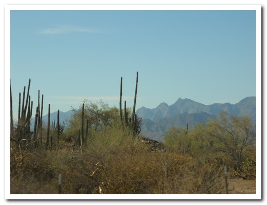
The conquest of the harsh desert of California represented one of the greatest missionary accomplishments of New Spain. The Jesuits built 17 Missions in Baja California between 1697 and 1767 when they were expelled from all of the Americas. Only a handful remain. A mission was much more than a church building; it was an organization and a centre of “civilization” giving Spain a valuable presence in California, and keeping out other European powers. Unfortunately, the Baja Indians were all but eliminated by conflict and diseases and by the early twentieth century their languages and traditional culture became extinct.
.
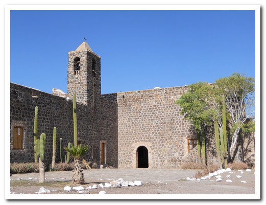
The first mission, Nuestra Señora de Loreto, was established in Loreto [37] in 1697. This normally sleepy seaside town comes alive for winter whale watching. We hired a taxi driving through gorgeous desert scenery to the second and most beautiful mission, San Francisco Javier established in 1699. Original aqueducts still water olive trees and date palms introduced by the Jesuits continuing to provide a livelihood for the pretty oasis pueblo.
.
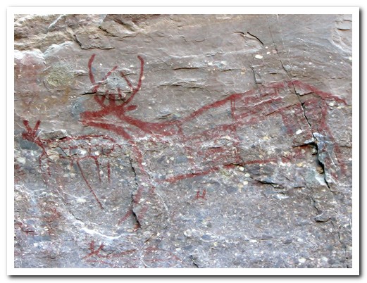
Santa Rosalia de Mulegé [38] was the 4th Mission, established in 1705. During the American-Mexican war of 1846-1848, the USA occupied long stretches of the Mexican Pacific coast. The people of Mulegé defeated the “Gringos” and it was never taken. The town´s official name is now Heroica Mulegé. To remember the battle of the 1847, every year on 02 October it becomes the capital of Mexico for a day. Salvador, a local guide, took us west of Mulegé into the La Trinidad Canyon in the Sierra de Guadalupe Mountains to see exceptional prehistoric cave paintings that have resisted the elements for thousands of years.
.
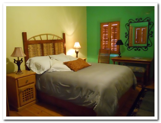
On a dark desert highway, we had to stop for the night. I heard the mission bell, and I was thinking to myself “this could be heaven or this could be hell”. Welcome to the Hotel California, such a lovely place. (Apologies to The Eagles) Todos Santos [39] has a “grown up from the 1970s hippy era” feel about it with lots of galleries and artists, but minus the drugs. Of course we just had to stay in the Hotel California which really is lovely.
.
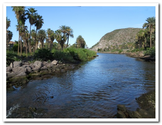
San Jose del Cabo Añuiti [40], the Jesuit´s 12th Mission – established in 1730, was vital for the Spanish Galleons to re-supply fresh water for the long transoceanic voyage between New Spain and Manila. Today with its endless sunshine, it is a popular vacation spot for North Americans. The Estero (Wetlands) between the town and the beach provides food and shelter for more than 100 species of birds and makes for a nice morning walk to the surf beach.
.
Desert landscape between La Paz and Loreto

Loreto Mission, the Jesuits first (1697)

Fish tacos - a Baja speciality, delicious

Black sand beach near Loreto
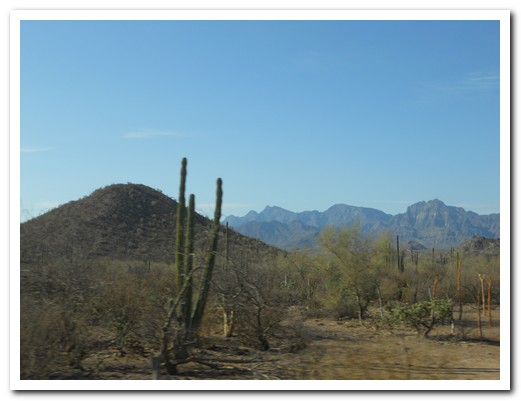
Desert scenery ...

... on the way to San Javier Mission
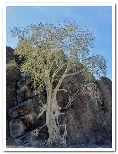
Tree sending roots down to find water
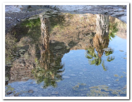
Palms reflected in a desert pond

San Francisco Javier (1699), the second Jesuit Mission ...

... is in the mountains south of Loreto

This olive tree was planted by the Jesuits over 300 years ago
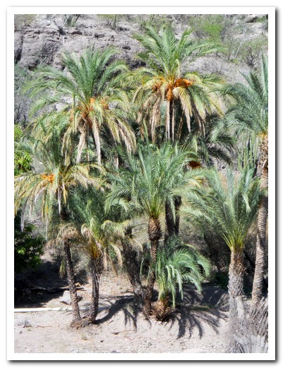
The Jesuits also introduced date palms
Mission Santa Rosalia de Mulegé (1705)
With a good water supply Mulegé was the most prosperous Mission
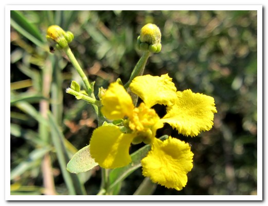
Desert flowers

These cactus are about 300 years old
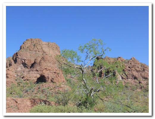
Desert scenery
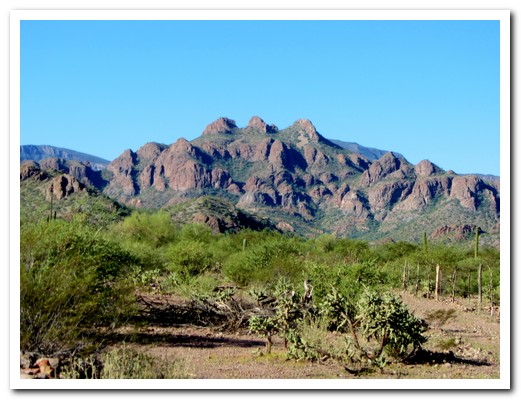
Sierra de Guadalupe

Indians marked rocks to be able to find hunting areas when they returned after several years
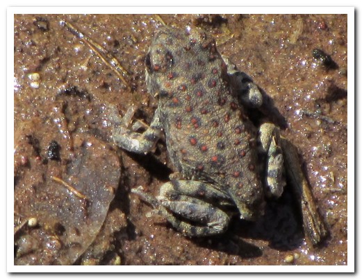
Frog blends in

We needed to swim to La Trinidad Canyon to see ...
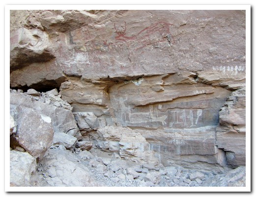
... cave paintings dating back thousands of years - the longer we looked, the more we saw

A Shaman with a dead antelope, red coyote above
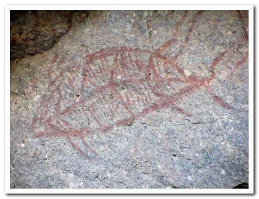
A fish in red
Adult and baby deer

An animal, two fish and a BBQ tool (?)

We heard the Mission bell at Todos Santos (1733) - at 5 am
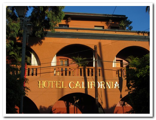
Welcome to the Hotel California
Such a lovely place
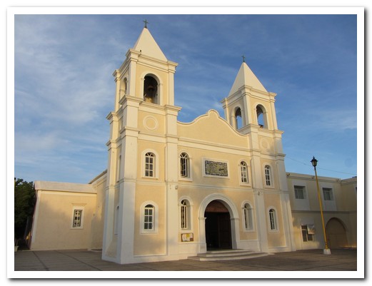
The 1730 Mission church San José del Cabo

Shrimp fajitas - spoon it onto soft tortillas
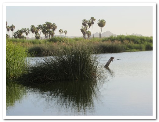
Wetlands at San José del Cabo
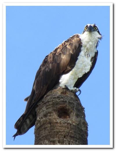
Hawk looking for prey
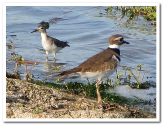
Two little birds in the water
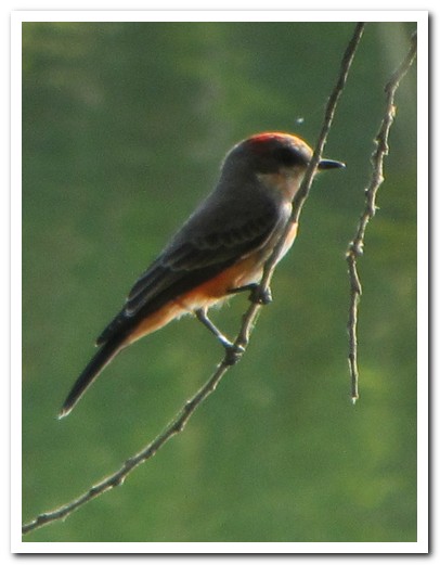
Beautiful small red bird

Water bird
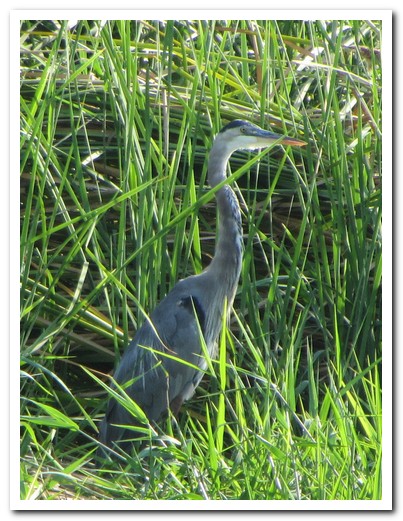
Grey heron
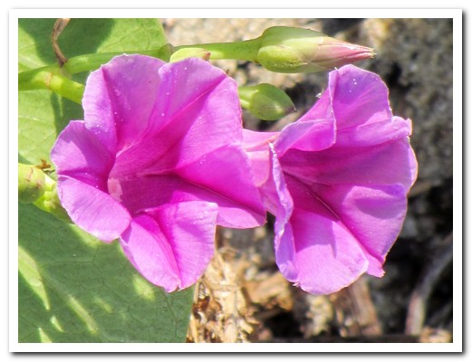
Beach flowers

Dragonfly
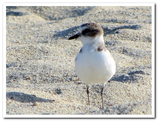
Small bird in the sand
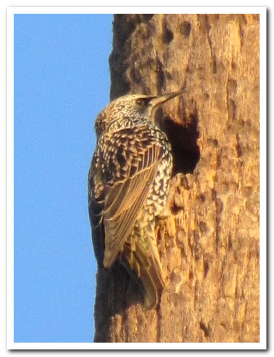
Woodpecker entering its nest

Red beaked bird glides across the water

Good surf at San José del Cabo