Categories
- Argentina
- Chile
- Antarctica
- Easter Island
- Falklands (Malvinas)
- Bolivia
- Peru
- Uruguay
- Paraguay
- Brazil
- Venezuela
- Colombia
- Ecuador
- Galapagos
- Panama
- Costa Rica
- Cuba
- Nicaragua
- Honduras
- El Salvador
- Guatemala
- Belize
- Mexico
- Latin American Xmas
Pages
- Street Art of Buenos Aires
- A week in Buenos Aires
- The Jesuit Missions in South America
- Contact Us
- Map of Central America
- First week in Latin America – October 2009
- Home Page
- Map of South America
Archives
- October 2011 (3)
- September 2011 (9)
- August 2011 (10)
- July 2011 (7)
- June 2011 (6)
- May 2011 (11)
- April 2011 (10)
- March 2011 (4)
- February 2011 (5)
- January 2011 (6)
- December 2010 (6)
- November 2010 (4)
- October 2010 (8)
- September 2010 (5)
- August 2010 (7)
- July 2010 (5)
- June 2010 (6)
- May 2010 (6)
- April 2010 (7)
- March 2010 (6)
- February 2010 (9)
- January 2010 (4)
- December 2009 (8)
- November 2009 (5)
- October 2009 (2)
Quetzaltenango
29th May 2011
Further west, Quetzaltenango (Xela) [5] sits higher up at 2300 meters. Outside the city in fertile valleys backed by mist covered mountains, a patchwork of farms grow a variety of crops without the use of machinery. Bananas shade coffee grown up the slopes. In the village of Zunil the women´s skirts are particularly attractive.
.
With Eddie as our guide we headed off to the jungle surrounded archaeological site of Takalik Abaj, about 2 hours southwest of Xela, where evidence of both Olmec (the earliest Mesoamerican civilization) and early Maya has been unearthed. Work is still going on at the site and a large pyramid structure is being reconstructed but much of the site remains buried.
.
In the afternoon we went to see some nearby villages with quaint and unusual churches. The magnificent 1524 church at Salcajá, Hermita la Concepción, is the oldest in Central America. We also visited a house next to the church where we sampled a very smooth homemade rum and fruit liqueur (called caldo de frutas) made only in Salcajá and watched a man weaving skirt material on a Spanish loom (the women weave narrower pieces on a pre-Spanish back strap loom).
.
The large white church, some 250 to 300 years old, in San Cristobál Totonicapan is dedicated to Santiago the Apostle. Moving on to San Andrés Xecul with its bright yellow church bearing vividly coloured figures, Eddie took us to the house just up the hill where San Simón resides – a mix of Mayan and Christian influences. People arrived with offerings of cigarettes and alcohol, then lit candles (different colours for each day to overcome various ailments and punish enemies) while praying to this bizarrely dressed, hard drinking, chain smoking, and fornicating figure – not the sort of Saint you´d want to upset!
.
Due to recent violent activity and Travel Advise against going to the north of the country, as well as a scew up with our visas way back in Honduras, we limited our time to southern highlands, unfortunately missing the World Heritage Mayan ruins of Tikal and will fly out of Guatemala City [6] for Belize.
.
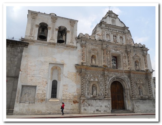
Facade and bell tower of the old Cathedral in Xela

Cathedral domes at night
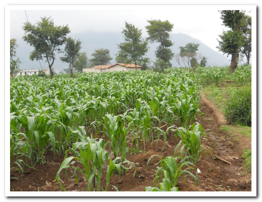
Corn is the staple crop in the highlands
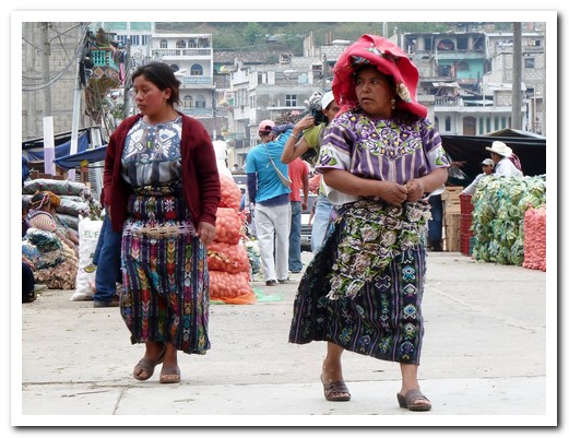
Ladies skirts ....
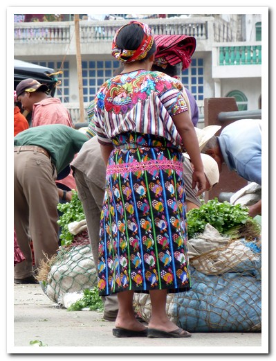
... are very colourful in Zunil
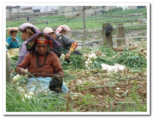
Picking onions near Zunil
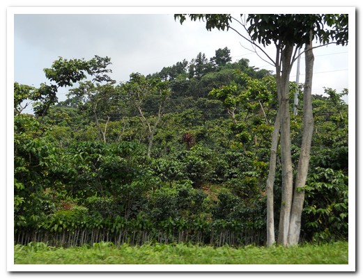
Coffee grows on the slopes
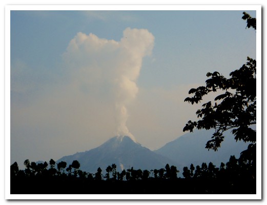
Smoking Volcán Santiaguito
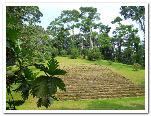
Early Mayan pyramid at Takalik Abaj
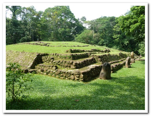
Another pyramid
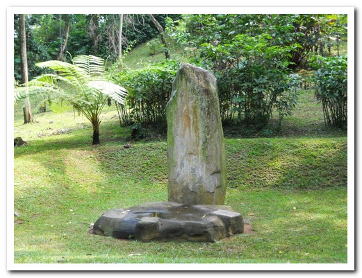
Stela with altar in front
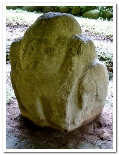
Large Olmec head, about 1 metre high

Statues in front of steps
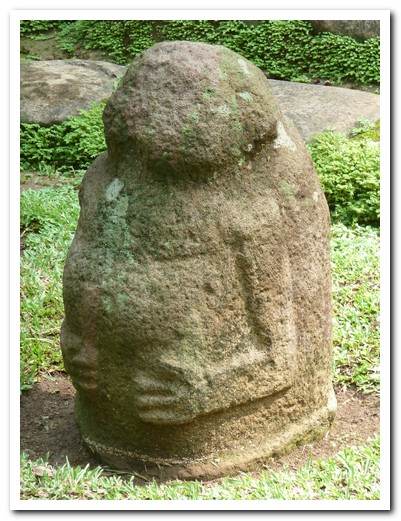
Potbellied Olmec statue
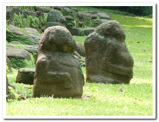
Two more Olmec statues

Large toad
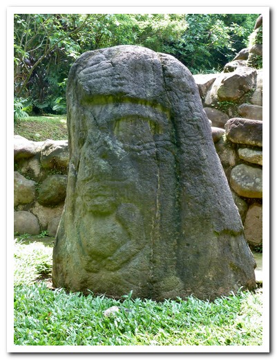
Olmec head - with a cross legged person coming out of the mouth
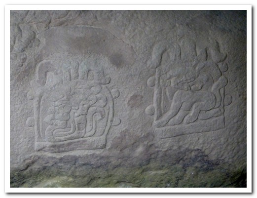
Hieroglyphics
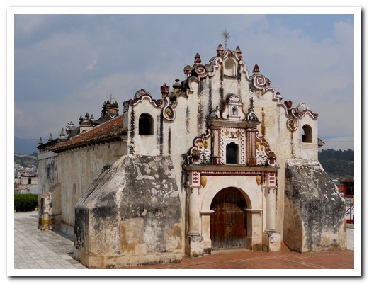
Oldest church in Central America (1524)

Homemade liqueur (caldo de frutas), the fruit is delicious too
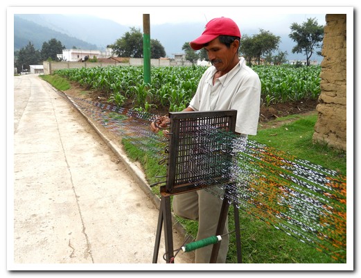
Preparing the cotton thread for a 150 metre long cloth
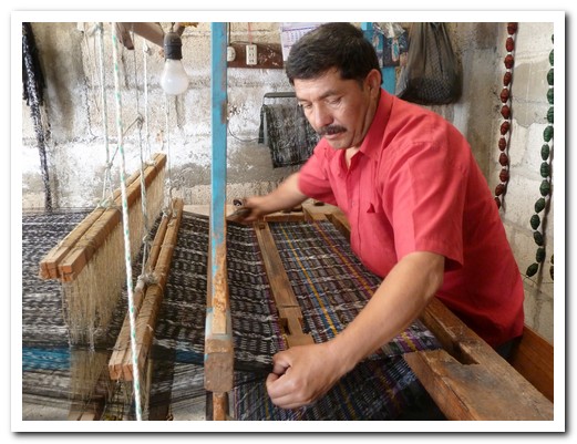
Men weave on the Spanish foot loom

The finished cloth sells for about $4 a metre, not much return for the work
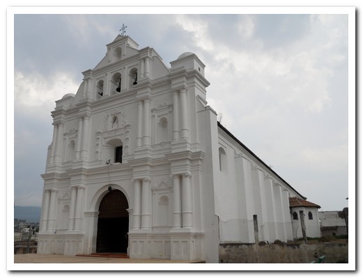
Church at San Cristobal Totonicapán is about 300 years old
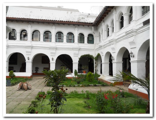
Convent behind the church
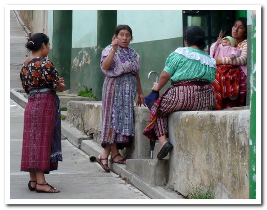
Ladies chatting
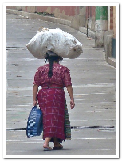
Coming home from shopping
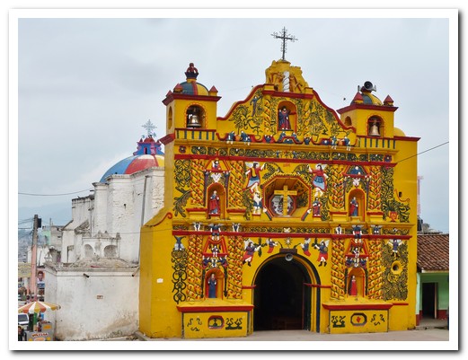
Bright yellow 17 the century church at San Andrés Xecul
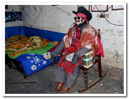
San Simón, the hard drinking, smoking Mayan saint
Chichicastenango
26th May 2011
After transferring to Chichicastenango (Chichi) [4] in the Guatemalan highlands, we headed down to the main square to match the people setting up their stalls for the market the following day. Amidst the hectic scene people were cooking tortillas, corn and fried chicken. Next to the Market is the church of Santo Tomás (1540), built on top of a Mayan temple. 18 steps, one for each month in the Mayan calendar, lead up to the church. The evening before market, incense and candles are burnt on the church steps to pray for good sales.
.
People from the surrounding villages have been bringing their goods here to sell since before the Spanish. Arriving early on market day, we sat high on the church steps among the flower sellers to watch the vibrant movement of people. A stall could be as simple as a basket of berries on the street, a bucket of chillies or corn from the sack to expensive jewellery. As well as the quality handicrafts there is pottery, household goods, fruit and vegetables, wooden masks, chickens, fragrant wood and much more. Offerings were burnt in front of the church in an age old Mayan ritual, more incense was spread about which filled the church before the arrival of 2 Cofradias (Mayan priests). There is an acceptance of Mayan beliefs, and a strange mix of Catholicism and Mayan rites.
.
The ladies´ blouses here remind us of an old fashioned tapestry wall hanging. The hand embroidered patterns on top of an already heavy woven material cover almost the entire blouse. At 2000 meters up, it can get cold in Chichi. Yet the skirts go only just below the knees, in contrast to the women of Lake Atitlán who wear theirs down to their ankles.
.
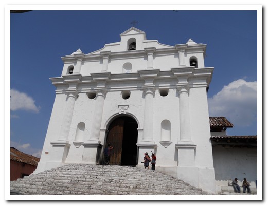
1540 Santo Tomás Church in the centre of Chichi
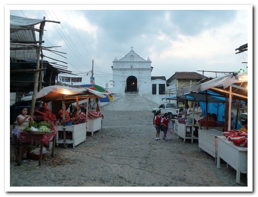
Market stalls being set up the night before
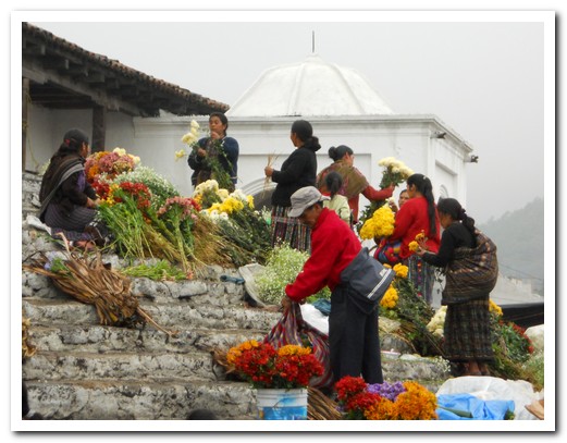
Flower sellers on the Church steps
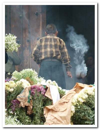
Incense being spread around outside the Church
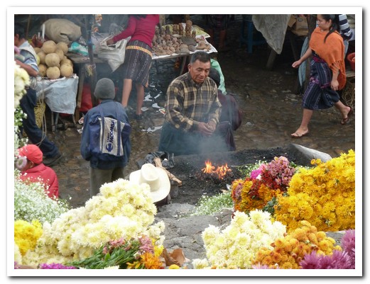
Offerings burnt at the bottom of the steps to the Church
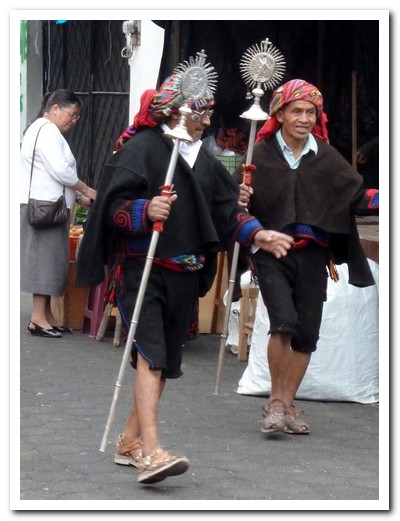
Mayan priests on their way to the Church
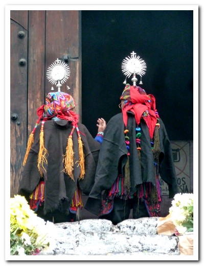
Kneeling in front of the Church
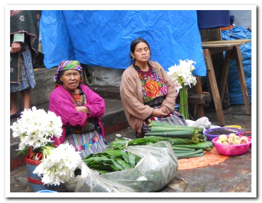
A simple stall
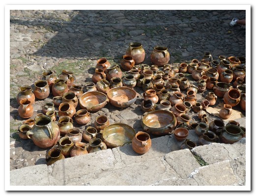
Pottery
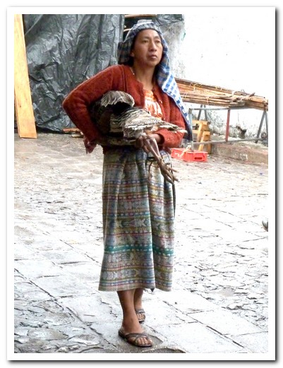
Turkey anyone?
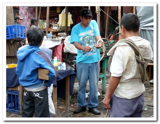
Every market needs a snake oil man
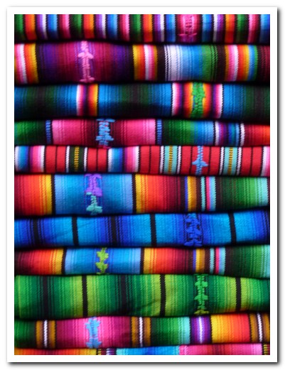
Stacks of colourful hand woven cloth
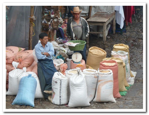
Corn is sold from the sack
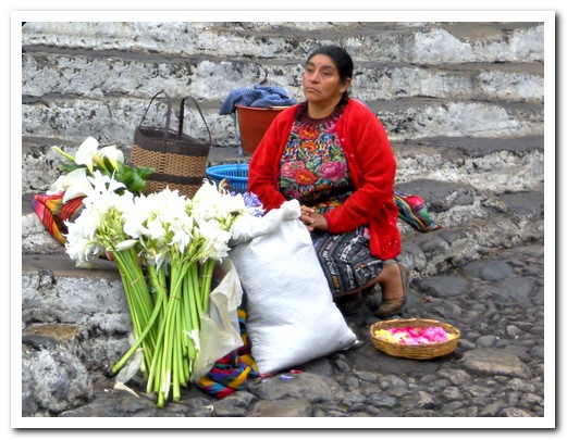
Flower seller
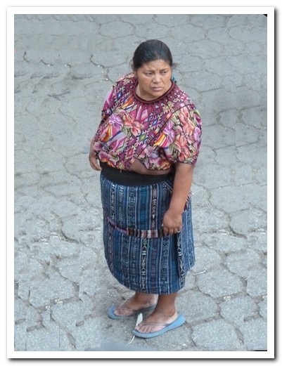
Typical dress
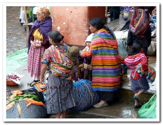
People standing around the market
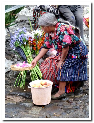
Little old lady with her flowers
 |
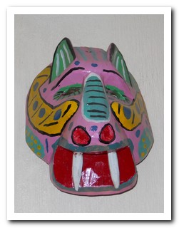 |
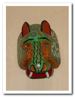
| Chichi is a famous for ceremonial mask carving |
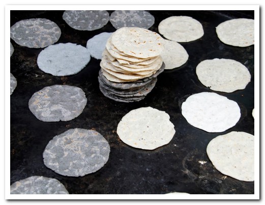
Blue tortillas, made from blue corn, cooking at the market
Lago de Atitlán
25th May 2011
Panajachel [3] (or Pana as the locals call it) on Lake Atitlán at 1500 metres made a good base to explore the villages scattered around the lake. We enjoyed our stay at the Posada de los Volcanes hotel. For Mayans “Atitlan” means “the place where the rainbow gets its colours” and it is a beautiful place. On a clear day 3 magnificent volcanos, San Pedro, Tolimán and Atitlán can be seen towering over the lake. The village is all about tourism, shops and stalls full of all sorts of colourful souvenirs line the streets – the main street is 10 “no gracias” long.
.
Sunday is market day at Santiago Atitlán on the other side of the lake. By the time we arrived on the chicken boat the village was bustling with men, women and children, most dressed in traditional attire unique to the village. The men wear knee length woven cotton pants, some with stripes, others with an intricately embroidered pattern around the bottom, an embroidered sash, long sleeve shirt and finished off with a cowboy hat. The women´s blouses have an exquisite embroidered pattern such as birds or flowers around the neck. They wear these with a bright woven, wrap around skirt, tied up with an embroidered sash with a colourful shawl over the shoulder. We sat and listened to the melodious sounds of hymns coming from the overflowing 1547 church just off the main square.
.
On Monday we went by boat, which only goes when it is full, to the villages of San Pedro La Laguna and San Marcos La Laguna. San Pedro sits below the volcano of the same name. Both villages have significant populations of feral gringos and instead of beauty and tranquillity had a creepy feel. The women of San Pedro wear lovely coordinated blouses, skirts and aprons, quite different to Santiago just a few kilometres away.
.
Carlos, we called him Caro (expensive) because he charged gringo prices, took us in his tuk tuk to the lakeside villages of Santa Catarina Palopó and San Antonio Palopó. The women of both villages weave and wear brilliant blue – the colour of the lake.
.
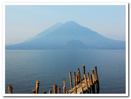
Volcán Tolimán with Volcán Atitlán behind
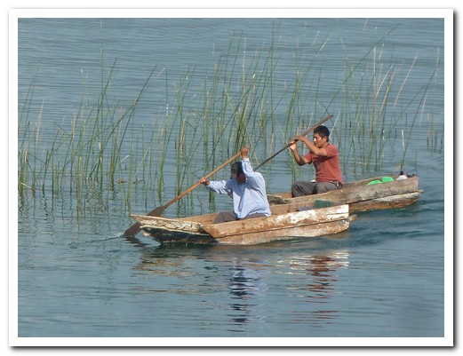
Fishing on the lake
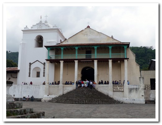
1547 Church at Santiago de Atitlán overflowing with worshipers
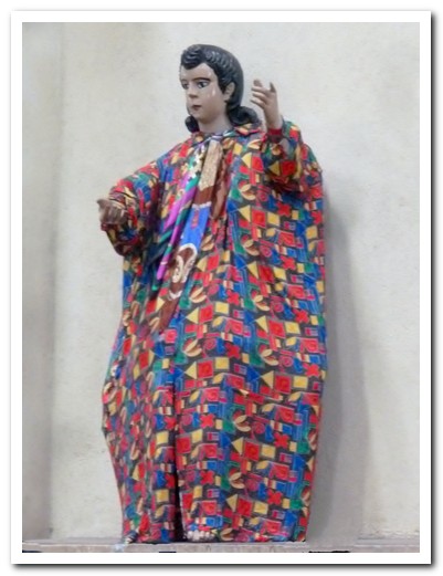
Carved saint re-dressed by local women each year
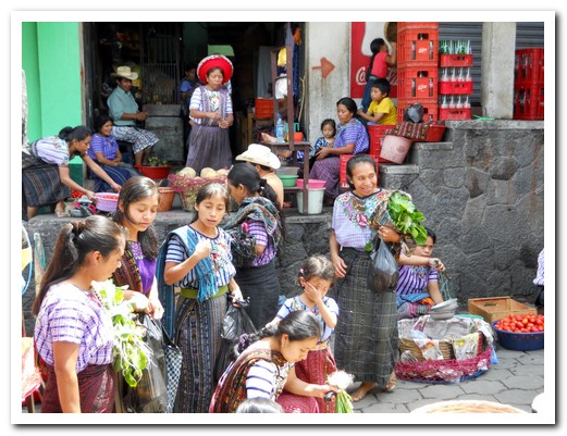
Women at Santiago market
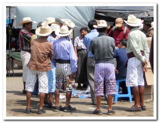
Men discussing knives for sale at the Santiago market
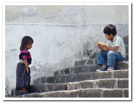
Children on the Santiago church steps
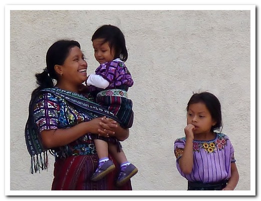
Family in their Sunday best
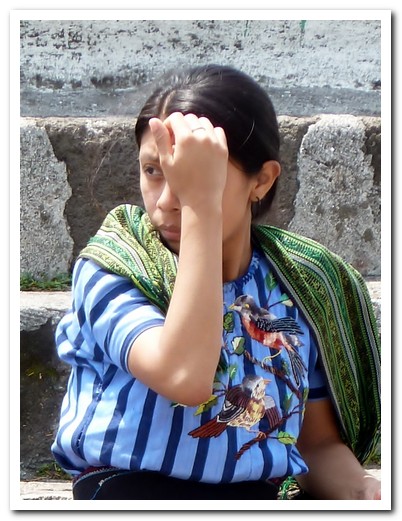
Beautiful embroidery on the blouse favoured by the women of Santiago
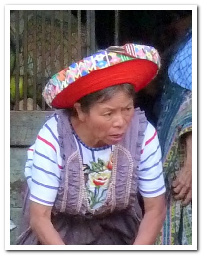
Hat made from 30 meters of embroidered ribbon wound round and round
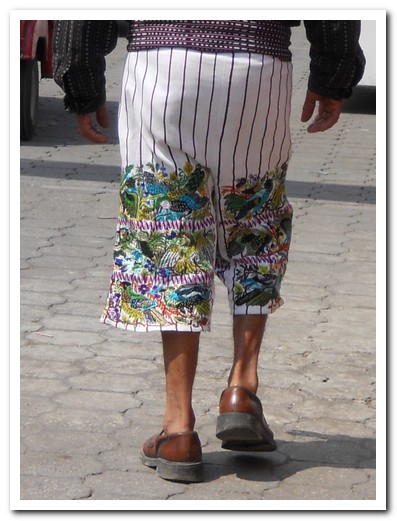
Santiago man´s embroidered trousers
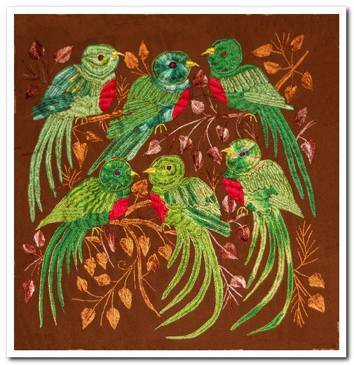
We liked these colourful parrots, so we bought this piece
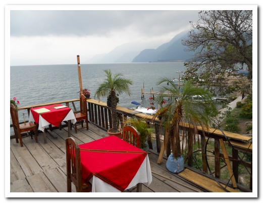
Panajachel lakeside restaurant
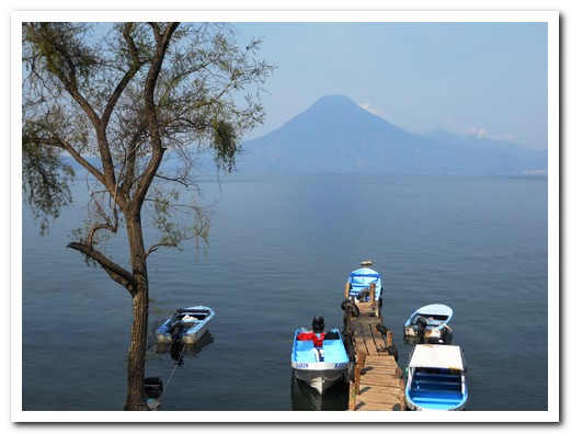
Volcán San Pedro
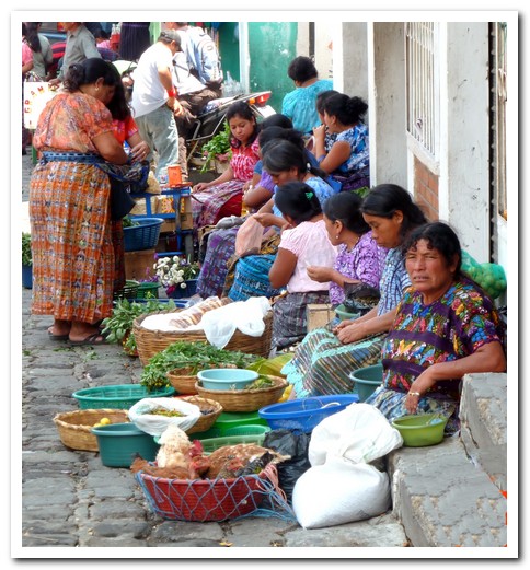
Market at San Pedro la Laguna
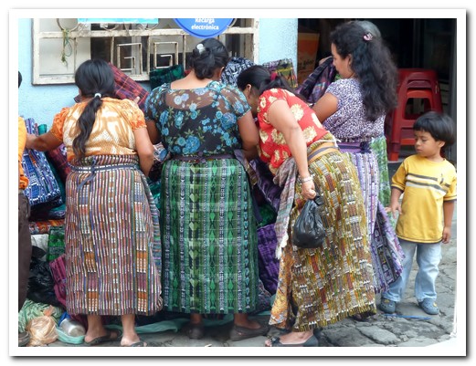
Ladies bargaining at San Pedro market - they all wear aprons here
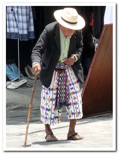
Old man climbing up from the lake
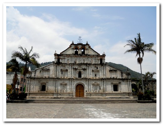
1541 Cathedral at Panajachel has the original facade
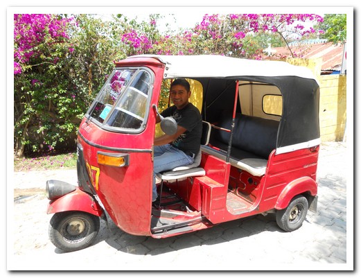
Carlos took us in his tuk tuk
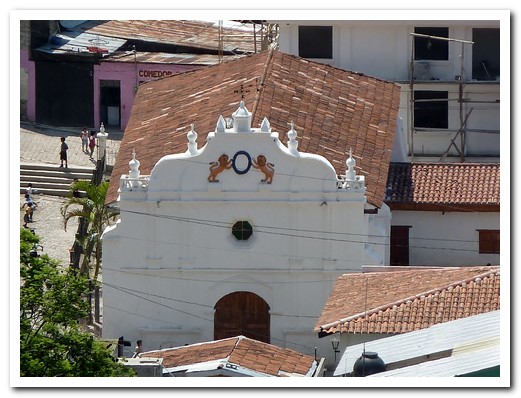
Church at Santa Catarina Palopó
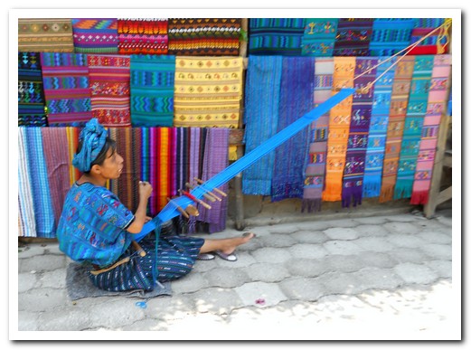
Lady weaving - Santa Catarina
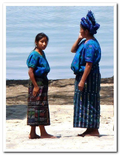
Typical blue, the colour of the lake, worn by ladies in Santa Catarina
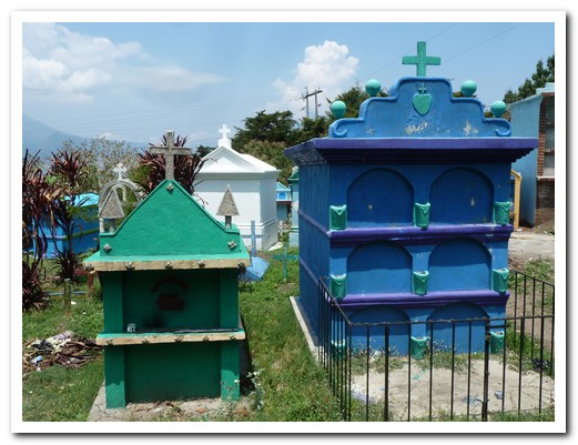
Santa Catarina cemetery matches the colours of the dresses
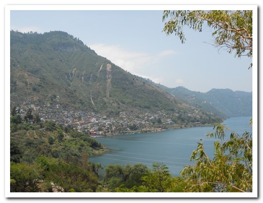
The village of San Antonio Palopó on the lake shores
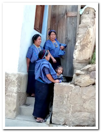
Women in San Antonio Palopó wear a thin headband
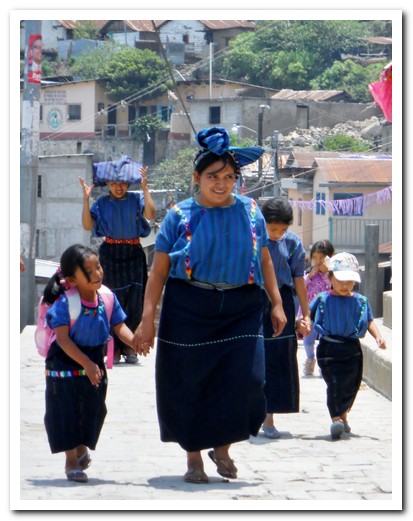
Typical dress from San Antonio Palopó
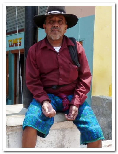
Shorts worn by the men of San Antonio Palopó
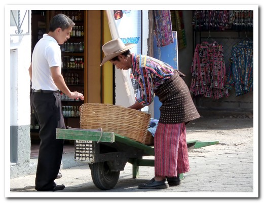
Sololá man (from 500 meters higher up) makes a sale in Pana
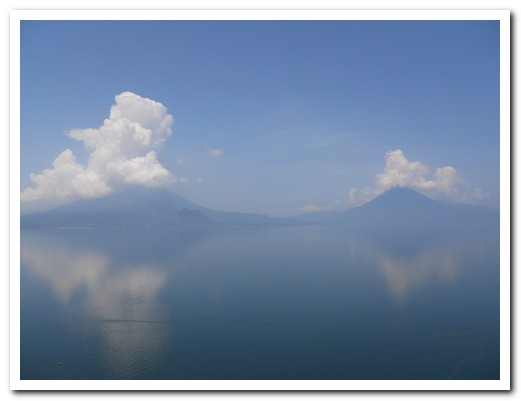
Looking across the lake at the volcanoes
Antigua
21st May 2011
Antigua [2], surrounded by 3 volcanos, Agua, Acatenango and Fuego, was our first stop in Guatemala. Another impressive World Heritage city, Antigua was the Spanish colonial capital of Central America for 231 years. The remains of a dozen or so ornate churches, monasteries and convents destroyed by earthquakes give Antigua an unequalled charm. From our hotel window we had a perfect view of Volcán Agua.
.
Walking around the town we noticed local women in brightly woven cloth skirts and tops. Guatemala has the largest Mayan population of any country. There are at least 15 distinct Mayan groups in the country, speaking Spanish as a second language. The textile museum (Museo Casa del Tejido) provided a fascinating insight into the traditional Maya dress from the highlands. Each village has its own different patterns; married women wear different belts to single women. They wear a beautifully woven folded cloth on their heads for sun protection (hiding the beautiful design). The men also have their distinctive trousers and shirts, with collars to match their wives’ shawls.
.
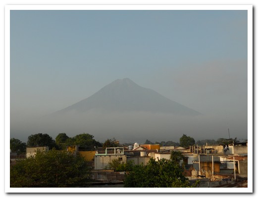
Volcán Agua from our bedroom window
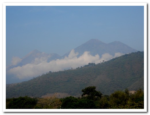
Twin Volcanoes Acatenango and Fuego
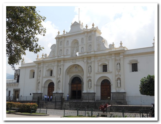
Cathedral in Antigua
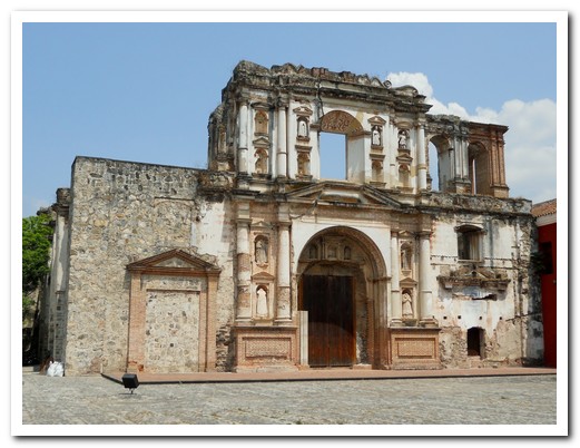
Ruins of the Jesuit church
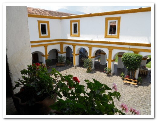
Inner courtyard of the Jesuit church has been restored
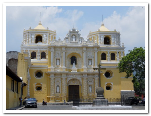
Iglesia La Merced
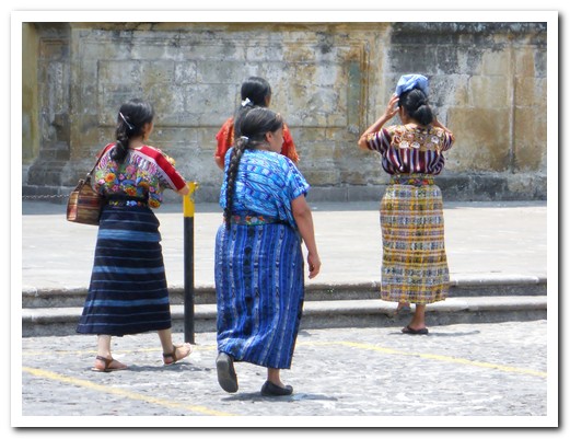
Ladies in traditional dress
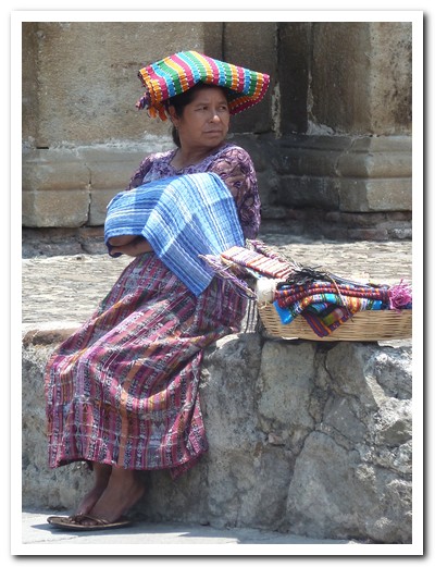
Lady selling woven cloth on the street
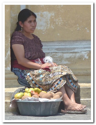
Lady selling mangoes outside a church
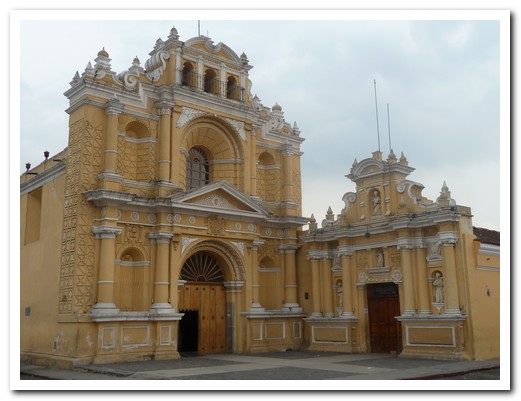
Iglesia Santo Hermano Pedro has been caring for the disabled for 350 years
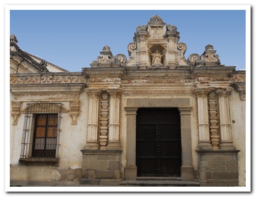
Entrance to the University San Carlos (1675)
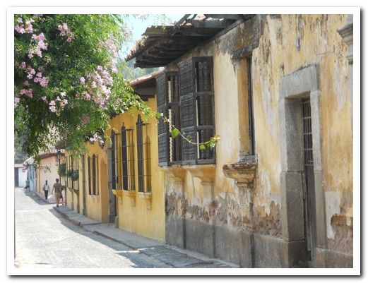
Cobbled street
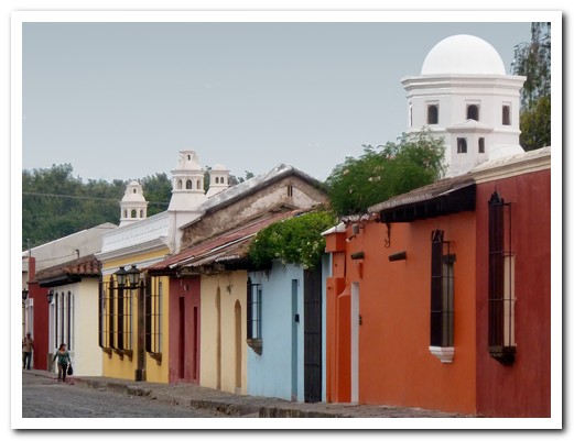
All the houses have chimneys
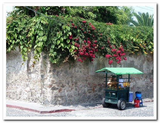
Street vendors cart
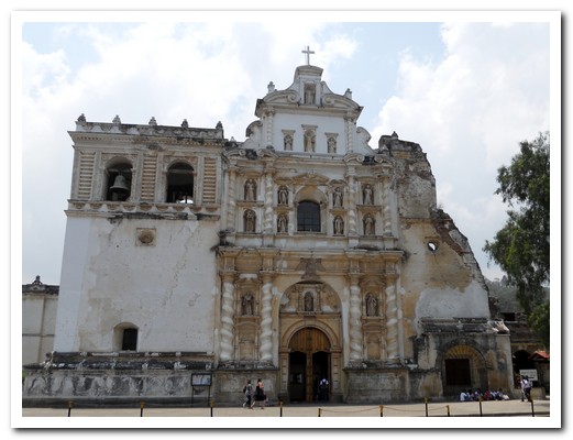
Iglesia San Francisco
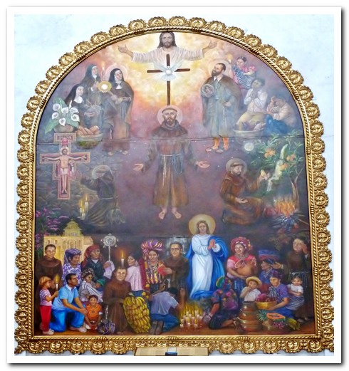
Inside is a painting depicting the Maya
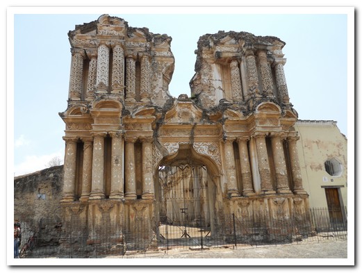
Other church ruins
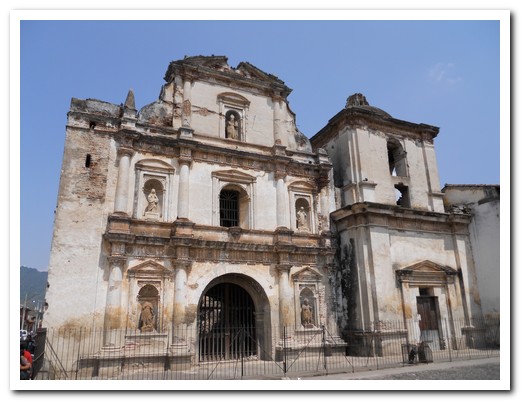
Other church ruins
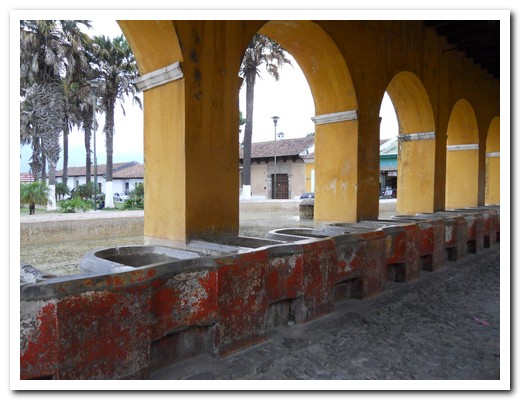
The old laundry
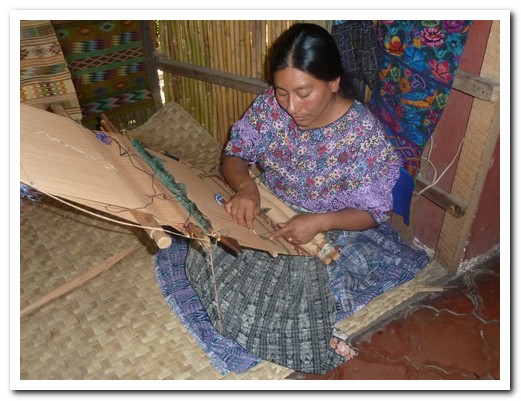
A lady weaving the traditional way
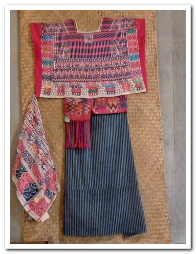
Example of traditional clothing
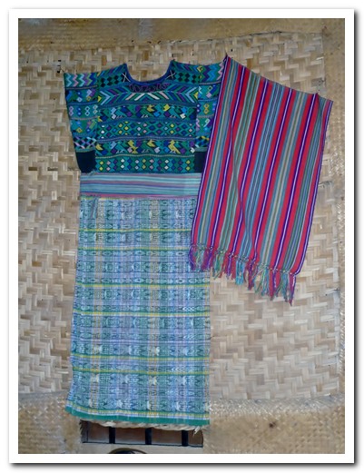
Another example of traditional clothing
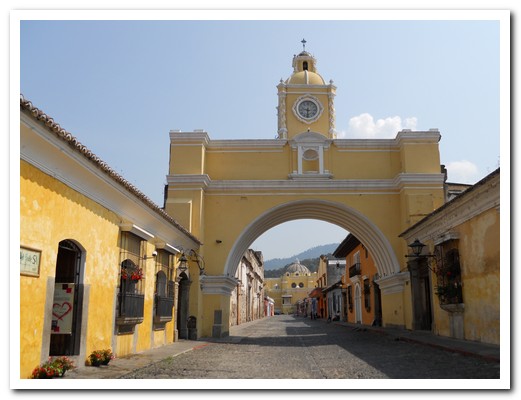
Convento de Santa Catalina (1613)
Mayas, Volcanoes and Surf
20th May 2011
El Salvador has some modest but impressive Mayan sites. The Mayan village at Joya de Cerén [4], often called the “Pompeii of Central America”, was buried under ash from a volcanic eruption some 1400 years ago and remains well preserved. It is the only Mayan site where the everyday life of ordinary people can be seen. A plate found there shows finger marks and traces of food from an unfinished meal. Nearby San Andrés [5] was an ancient ceremonial centre and Tazumal [6], built around 500BC remained occupied until the Spanish arrived. At both sites, partially restored pyramids stand.
.
In Parque Nacionál Cerro Verde [7] we took a pleasant walk around the crater rim at 2000 metres. Volcán Izalco and Volcán Santa Anna were occasionally visible through the swirling mist. Local families were enjoying their Sunday off. Below lies the picturesque crater lake, Lago Coatepeque.
.
Finishing off with a couple of days at Playa El Tunco [8], a pleasant little surfers community on the Pacific coast we watched both local and gringos ride some big waves. Five kilometres east at Puerto La Libertad fisherman wait for a break in the surf, then race their boats in to be quickly winched up onto the end of wharf before the next wave crashes in.
.
We enjoyed our time in El Salvador and the Salvadoreños were some of the most friendly people we have met. Crossing the border into Guatemala at La Hachadura [9] we headed onto Antigua.
.
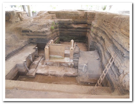
Mayan village house dug out of layers of volcanic ash at Joya de Cerén
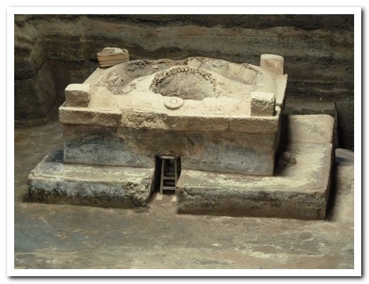
The village sauna at Joya de Cerén
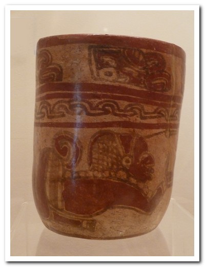
Decorated vessel
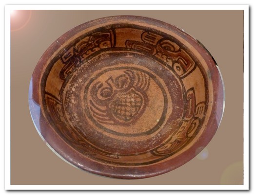
Bowl with crab motif
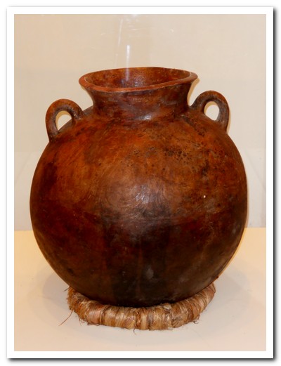
Large urn
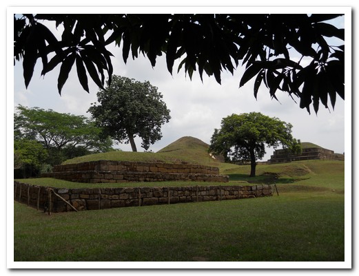
Pyramids at San Andres
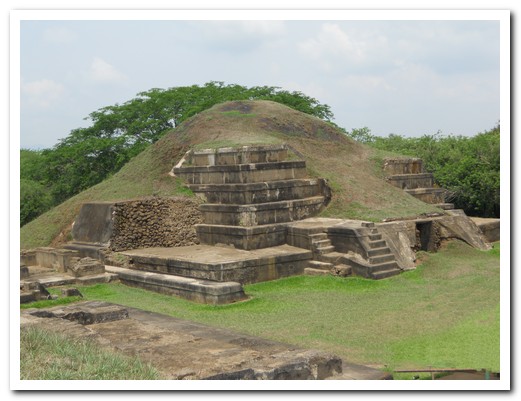
Temple San Andres
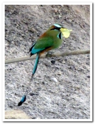
Torogoz, the national bird, with butterfly in its mouth
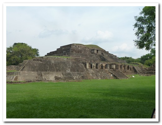
Temple at Tazumal
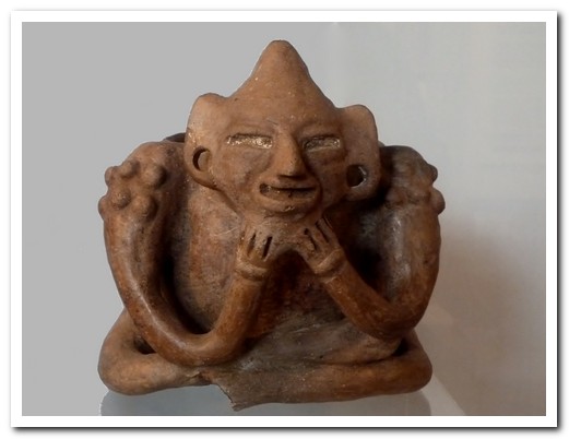
Pottery figure on a bowl
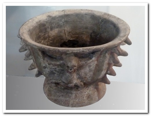
Bowl with spikes, representing the Ceiba tree
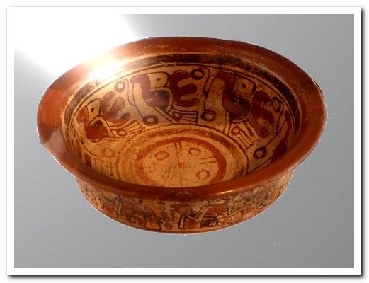
Decorated bowl
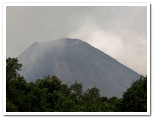
Volcán Izalco emerging from the mist
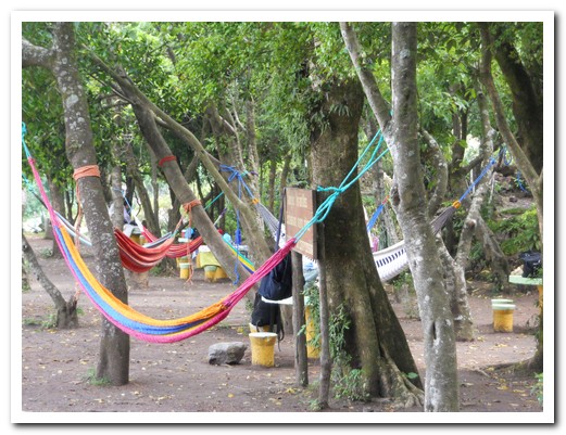
Salvadoreños don´t go on a picnic without the hammock
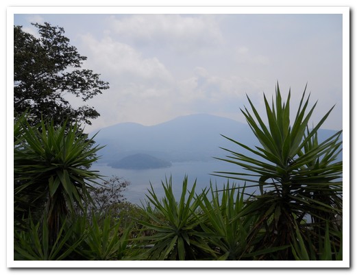
Volcanic Lake Coatepeque
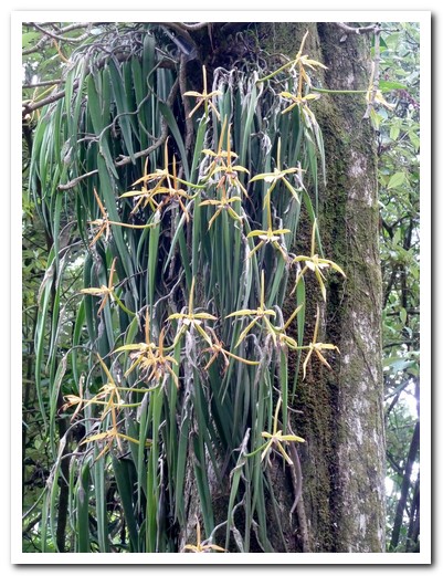
Orchids on Cerro Verde
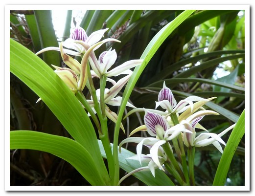
Orchids on Cerro Verde
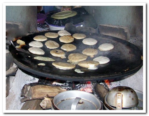
Pupusas cooked the traditional way on a comal over a wood fire
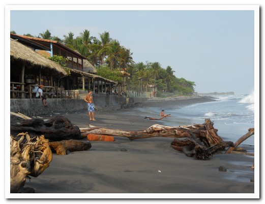
Playa El Tunco
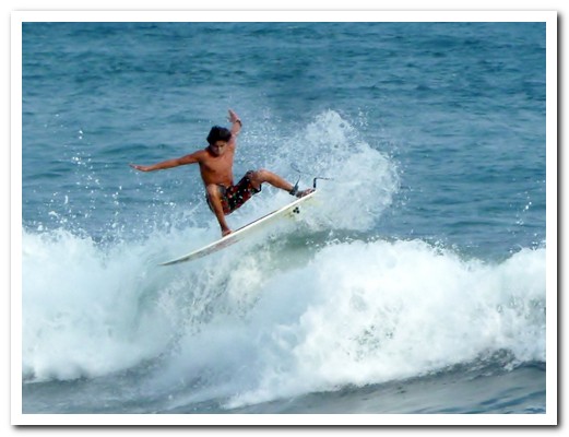
Surfing at El Tunco is world class
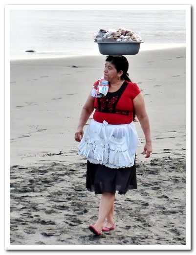
Lady selling fresh cashews and almonds on the beach
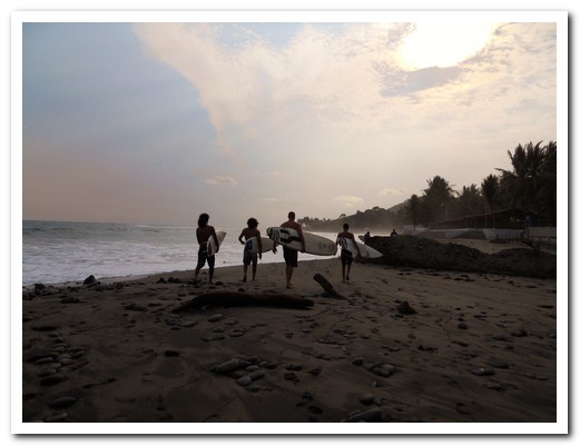
Surfers are still heading out at dusk
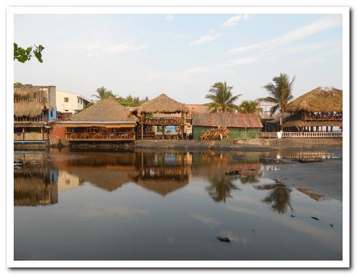
Reflections in the stream
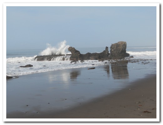
El Tunco - the rock is supposed to look like a pig
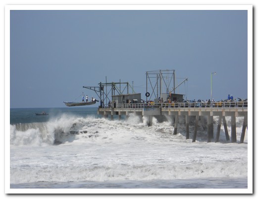
Hauling up the fishing boat onto the wharf between waves
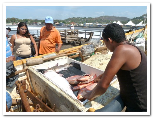
Fish for sale straight from the boat
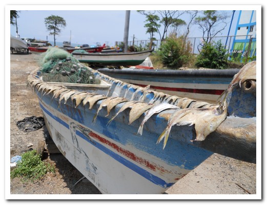
Fish drying in the sun
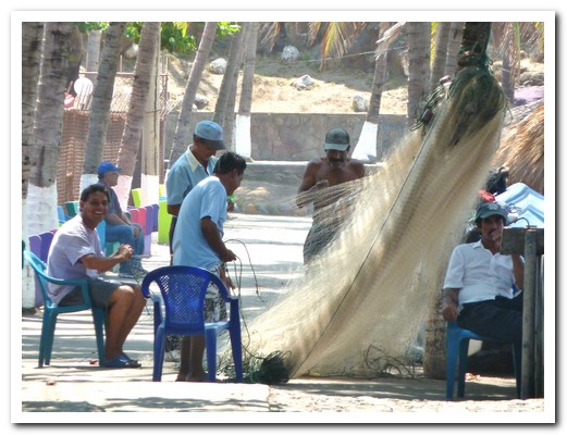
Repairing the nets under the shade of coconut trees
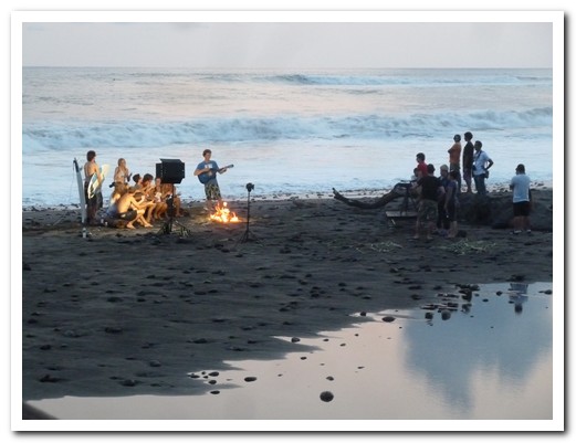
The Ministry of Tourism gathered up all the gringos to film an advertisement on the beach
San Salvador
17th May 2011
El Salvador is the smallest country in Central America. We began in La Palma [1] just over the border from Honduras. This friendly colourful village has brightly painted murals on almost every wall, inspired by painter Fernando Llort.
.
Moving on to the capital San Salvador [2], dominated by Volcán San Salvador, we spent a pleasant evening, sharing a traditional meal with the Massi family, relatives of our friends Gloria and Alfredo. Pupusas, cooked rounds of cornmeal dough stuffed with a variety of fillings and eaten with cabbage salad are the national dish. The family history began in Italy. Two brothers came to El Salvador in 1923. One, Enriquo, created the country´s military flying school but later tragically died in an aeroplane accident. The other, Alfredo, was a pioneer film maker and produced most of the Salvadorian films of the 1930´s, mainly documentaries.
.
Staying in Hotel Posada del Rey Primero in San Salvador was more like staying with relatives. The staff are super friendly and the hotel, an old house, has little secluded areas to sit – all tastefully and brightly decorated.
.
Suchitoto [3], a colonial town on Lake Suchitlán north of San Salvador is known as “The Cultural Capital of El Salvador”. Founded by the Spanish in 1528 it was briefly the capital in the 16th century. For lunch, we enjoyed the best ever freshly made papusas from a stall in the market.
.
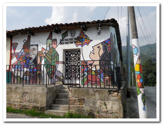
Colourful houses of La Palma
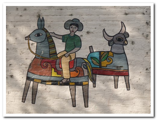
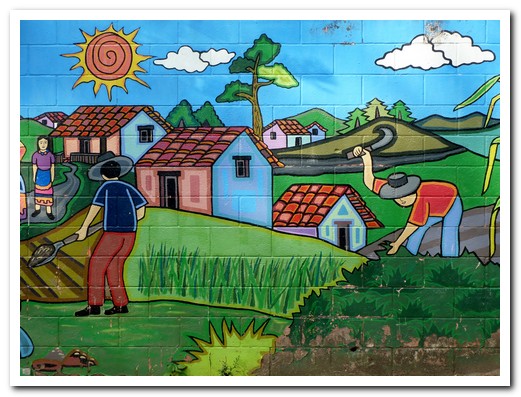
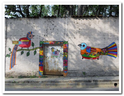
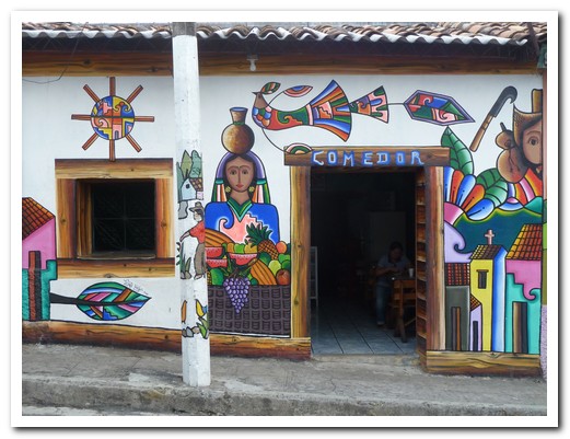
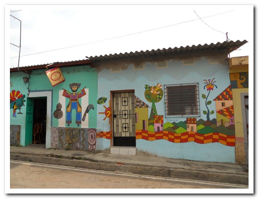
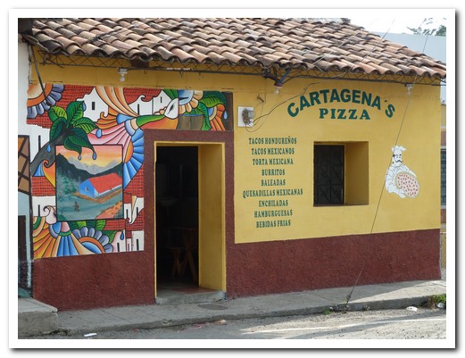
Our favourite restaurant in La Palma
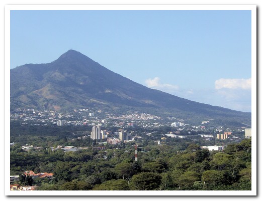
Volcán San Salvador dominates the Capital
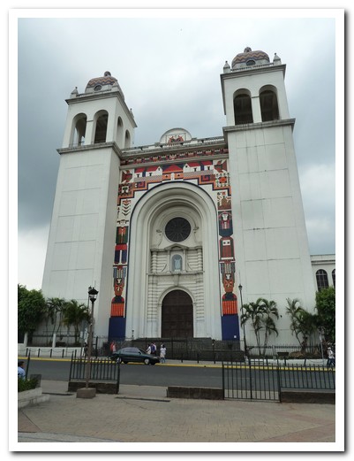
The original Cathedral was wooden but burnt down
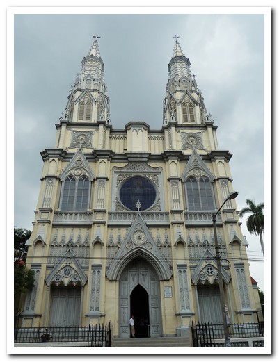
Historical church with walls of pressed metal
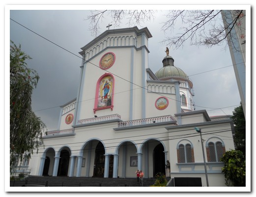
Basilica with ....
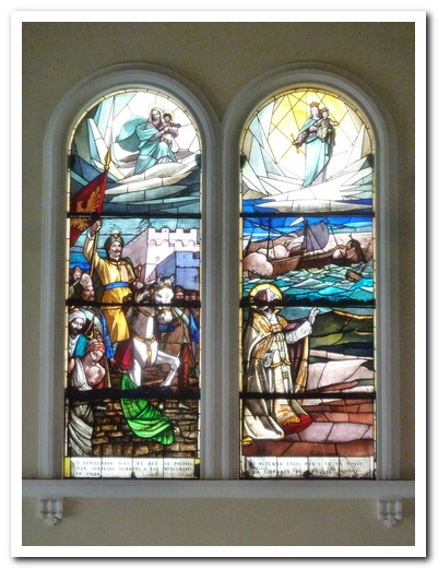
... beautiful stained glass windows
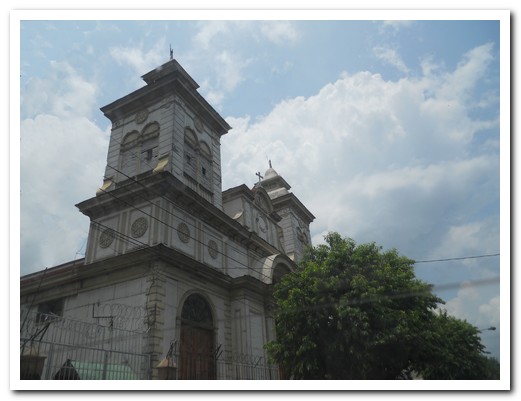
Old wooden church
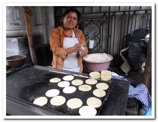
We stopped for a snack of tortillas fresh off the hot plate
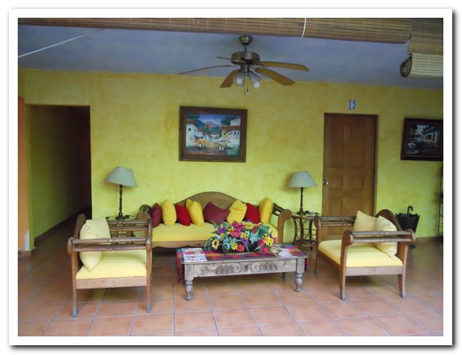
Our hotel Posada de Rey Primero
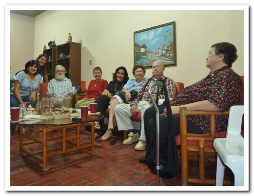
A visit with the Massi family and friends ...
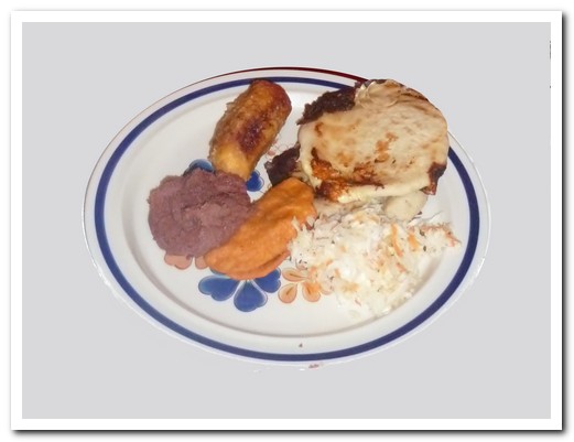
... for a great typical meal
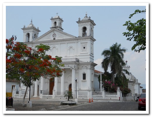
Cathedral at Suchitoto from 1823
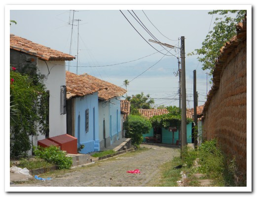
Colonial street of Suchitoto
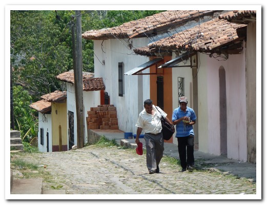
Colonial street of Suchitoto
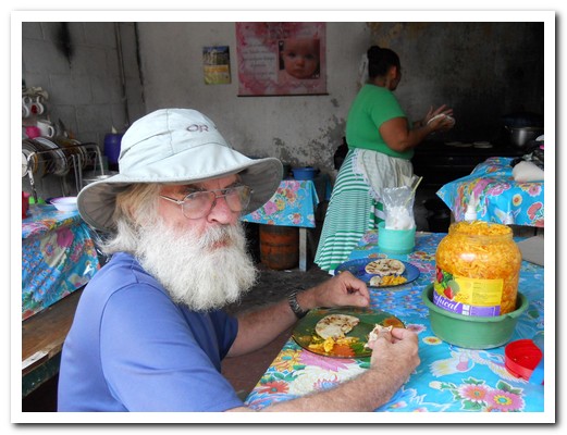
Pupasas straight off the fire
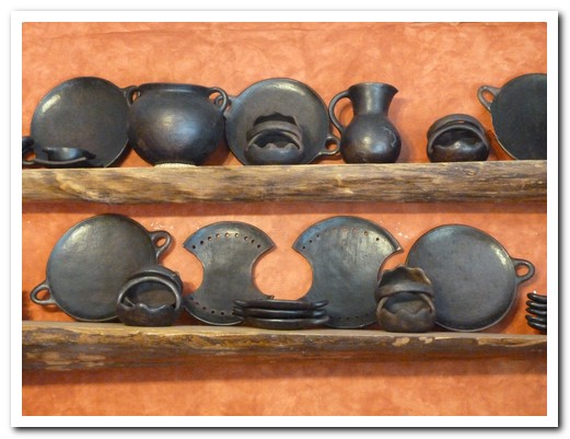
Black pottery from eastern El Salvador
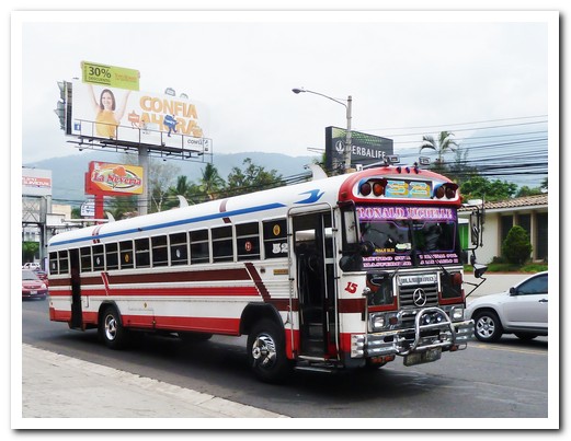
Buses in San Salvador are raised in the front. No one knows why. This one has 3 fins on top too!
Santa Rosa de Copán and Gracias
11th May 2011
Before leaving Honduras we visited the colonial hill towns of Santa Rosa de Copán [6] and Gracias [7]. A scenic road twisting through green countryside links the two. Men dressed in checked shirts, boots and cowboy hats are everywhere.
.
It is always entertaining travelling on rural buses, they never fill up – there is always room for one more. People get on to sell stuff, like worm medicine (complete with pictures and guaranteed to kill every known intestinal parasite). They make their sales pitch at full volume and at high speed. It goes on and on. People listen, and some actually buy. Ladies will hold someone else´s baby on their lap so they don´t have to give up their seat. Three bums fit in a two bum seat.
.
We have been enjoying eggs ranchero for breakfast, fried eggs with a spicy tomato sauce served with refried beans, cheese and a corn tortilla, yum. Another favourite is a baleada, a flour tortilla spread with refried beans and a variety of other fillings then folded over, cheap and satisfying. The best meals are from vendors cooking on the plaza and eating with the locals.
.
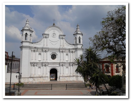
Cathedral at Santa Rosa de Copán
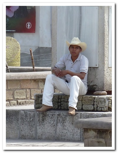
Cowboy
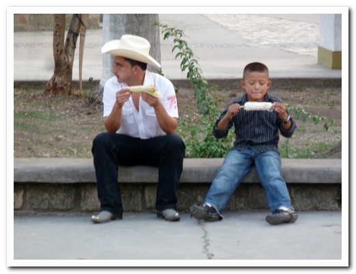
Like father, like son
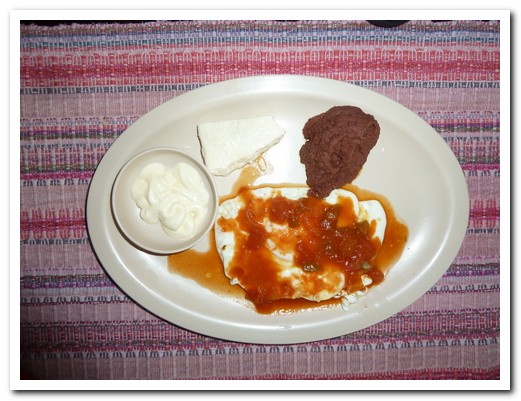
Eggs ranchero
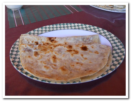
Baleadas
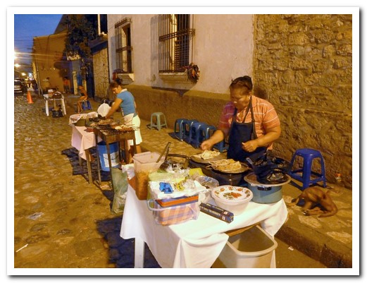
The best food is cooked outside
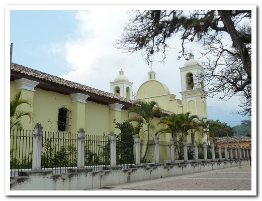
Iglesia San Marcos at Gracias
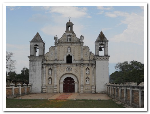
Iglesia Las Mercedes at Gracias - remains of colored sawdust from Semana Santa on the path
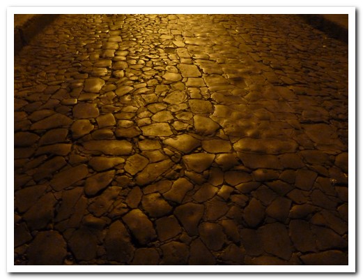
Cobbled street at night
Copán Ruinas
09th May 2011
A short walk on a shady footpath from the little cobbled village of Copán Ruinas [5] (a surprisingly un-touristy tranquil pueblo) is the ruins of Copán, one of the most important Mayan cities from 250AD to 900AD. Known as the “Paris of the Mayas” since it is the most enchanting and artistic of all the Mayan sites, it is a World Heritage site for its sculptures and hieroglyphics. Once 30,000 people lived in the valley but due to soil depletion, wars and revolt, the city was abandoned well before the arrival of the Spanish.
.
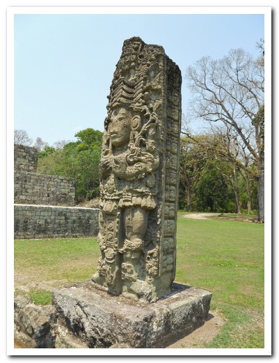
The principal site contains temples built around a great plaza, one on top of another. One of the temples, still buried under the present visible one, has been reconstructed in the museum. Large (3 to 5 meters high) stone stelae stand in front of the temples. These are intricately carved statues with the image of the ruler on one or two sides with hieroglyphics on the others, once covered in red. Carved altars used for sacrifice sit in front of the stelae. An acropolis, ball court, and necropolis complete the archaeological site. Large ceiba trees covered in bromeliads tower over temple ruins while their roots twist among the stone blocks of the walls giving the whole site a mysterious air.
.
Las Sepulturas nearby show residences around courtyards believed to be homes of the rich and powerful. It was connected to the main ceremonial site by a causeway.
.
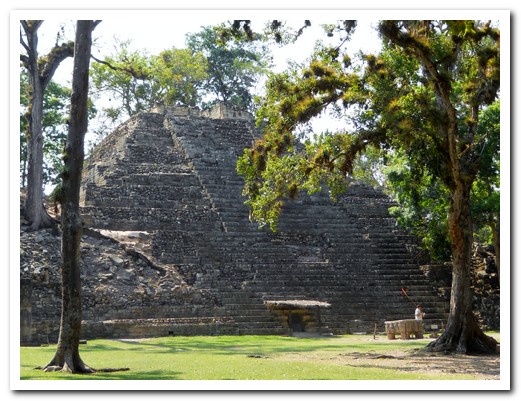
Temple 16 has seen many phases
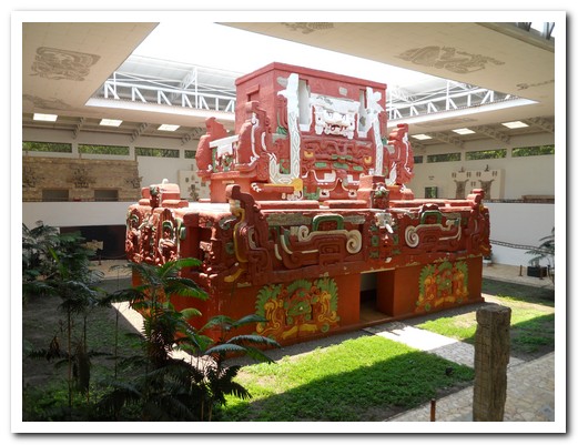
An exact replica of a temple inside the Temple 16 has been constructed in the museum
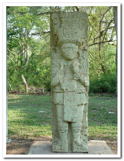
A stela - a carved statue of the ruler
Another stela
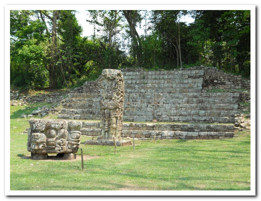
Tomb with stela and sacrificial altar in front
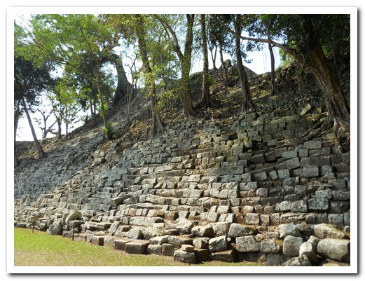
Tree roots help preserve the ruins
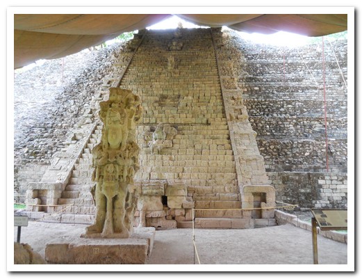
Hieroglyphic stairway, protected by a canvas awning
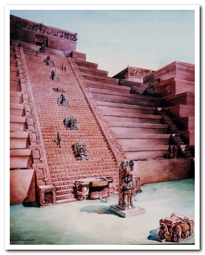
What it would have looked like
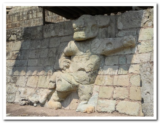
Carving of a jaguar
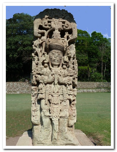
Intricately carved stela
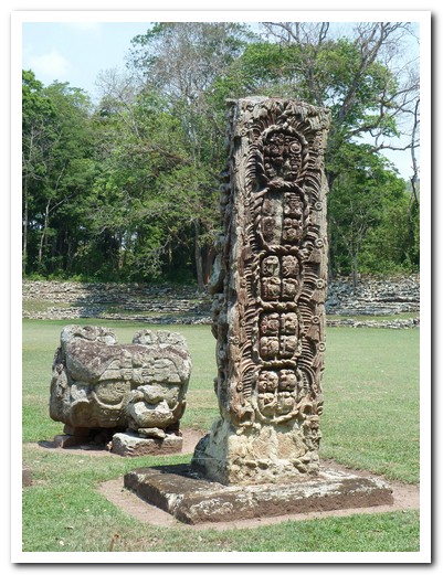
Back of a stela
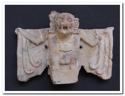
Bat carving
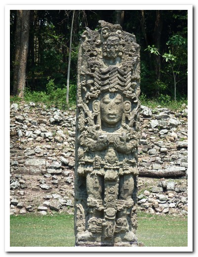
Stela
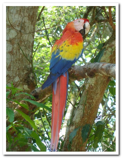
Colourful macaws, sacred to the Mayans, live at the site
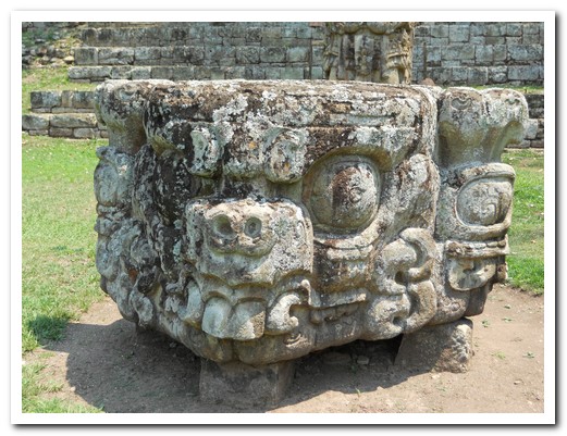
Sacrificial altar
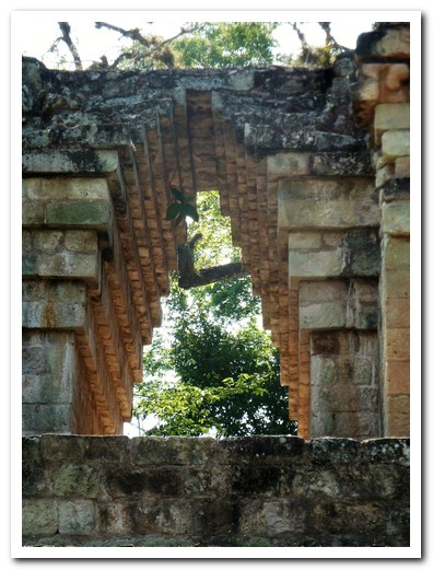
Mayan stepped arch
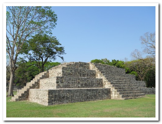
A smaller temple
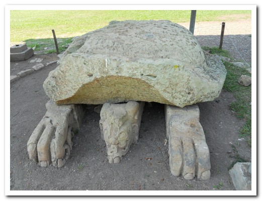
Altar in the shape of a turtle
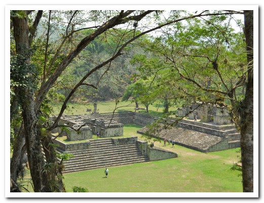
Ball court
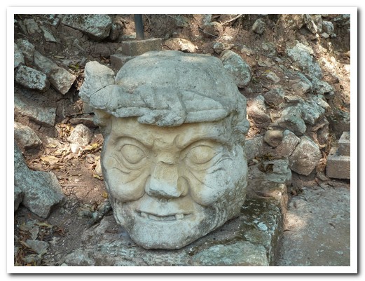
The old man of Copán
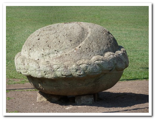
Altar with grooves to carry away the sacrificed blood
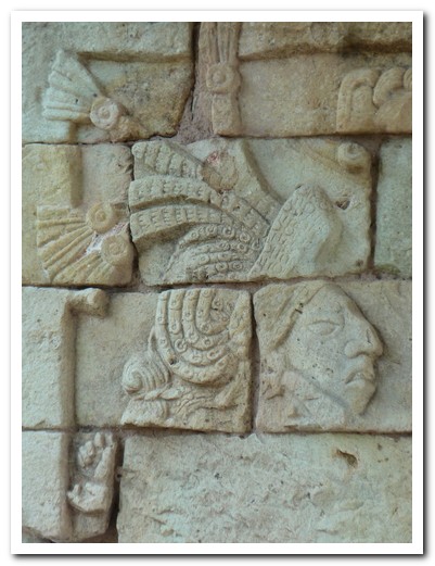
All the stones were carved using stone tool
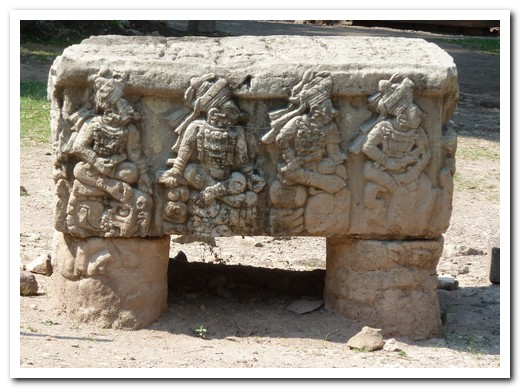
Altar with the 16 dynastic kings
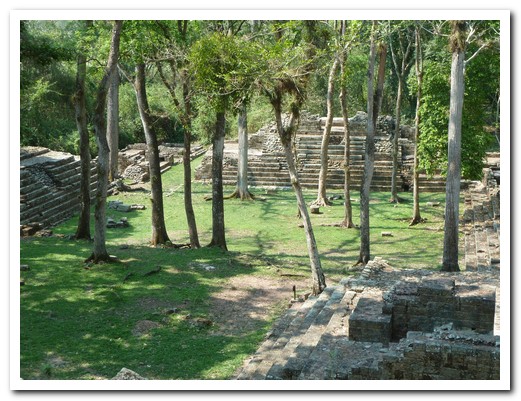
Necropolis
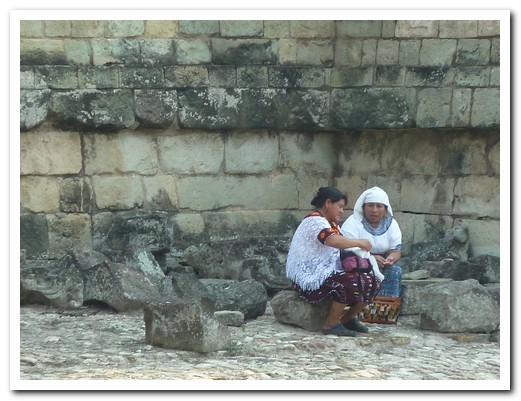
Two local Mayan descendants rest in the ruins
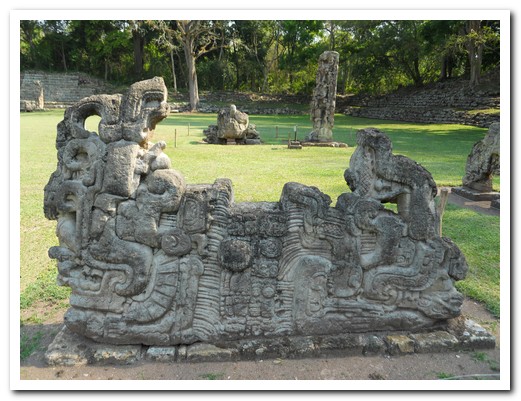
Elaborate altar
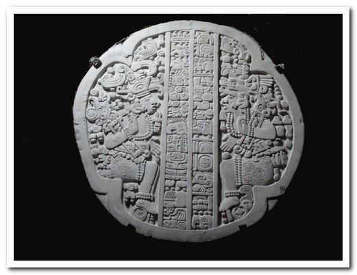
Mayan calendar
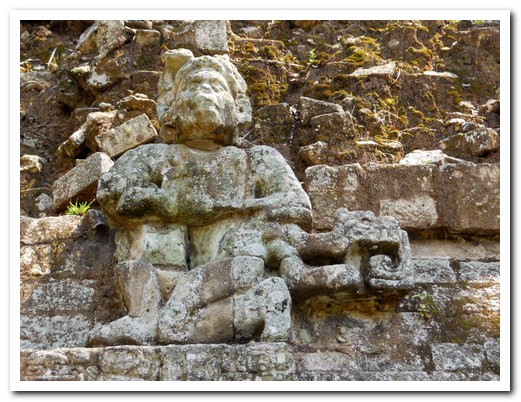
Carved monkey
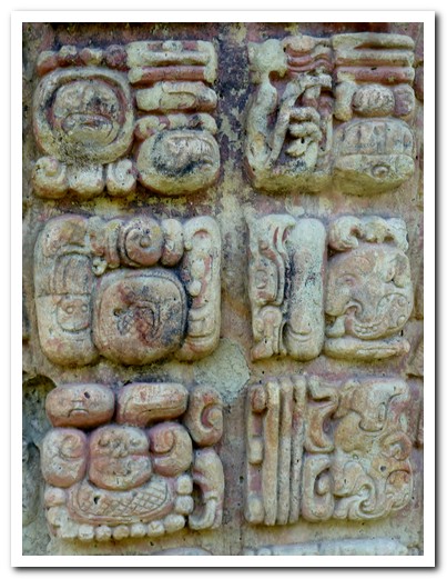
Hieroglyphics
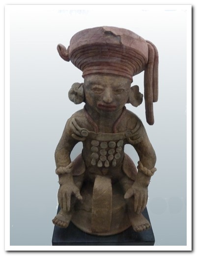
Ceramic figures found in a rulers tomb
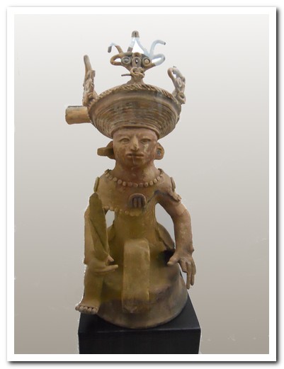
Ceramic figures found in a rulers tomb
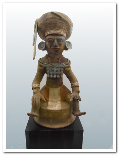
Ceramic figures found in a rulers tomb
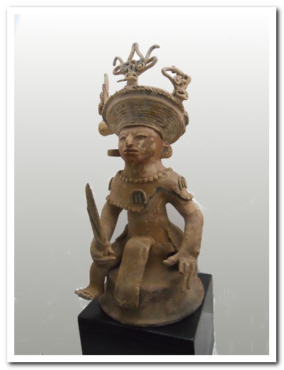
Ceramic figures found in a rulers tomb
Across Honduras
08th May 2011
The scenic road linking Nicaragua with Honduras snakes around pine covered hills. The border crossing at Las Manos [1] took us no time at all. We noticed immediately an increased prosperity with better buses, US style shopping malls and gated housing estates. Honduras is the most weaponized country we have seen. Shotgun wielding security guards are everywhere, even outside the ice-cream shops.
.
We stayed in the Honduras capital, Tegucigalpa [2] just long enough to change buses then headed for the colonial town of Comayagua [3], the former capital from 1537 to 1880. The 800 year old clock on the cathedral is the oldest in the Americas, was built by the Moors for the Palace of Alhambra and donated by the king of Spain in 1620. The colonial center of Comayagua is being gradually restored; so far the churches have been completed.
.
The countryside quickly changed from dry pine forest to tropical green where coconuts, bananas, pineapples, coffee are grown. Fresh produce is sold from roadside stalls. Whenever the bus stops, vendors race to the windows, their wares on long poles. In a few hours we were on the Caribbean Coast at Puerto Cortés [4]. We went out to a 40 room beach resort and got an eerie feeling when we were the only guests, like being in a ghost hotel.
.
Garifuna people live in villages along the coast. They are descendants of West African slaves and Caribbean Indians, brought to Honduras in 1797, known for their dance and music.
.
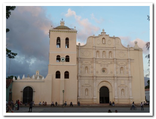
Comayagua Cathedral with the oldest clock in the Americas
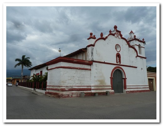
Iglesia La Merced the first church in Comayagua from 1550
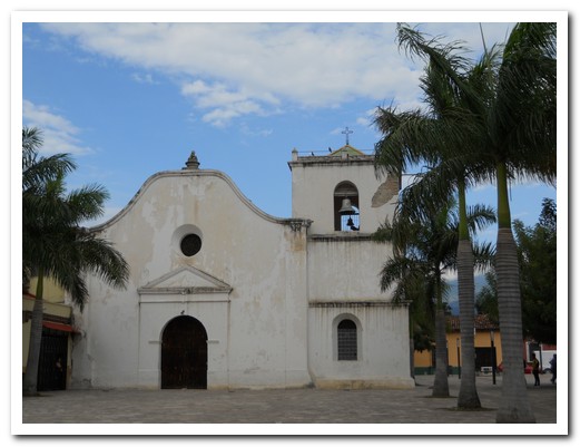
Iglesia San Francisco, 1560
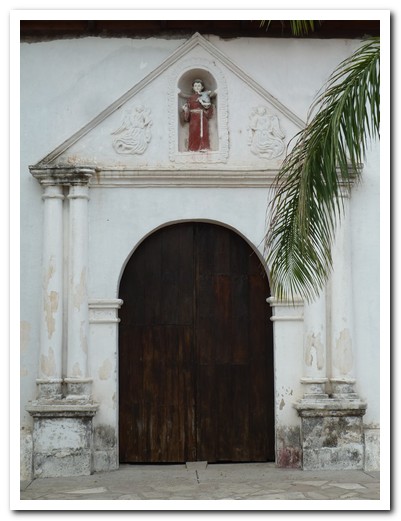
Side door of San Francisco
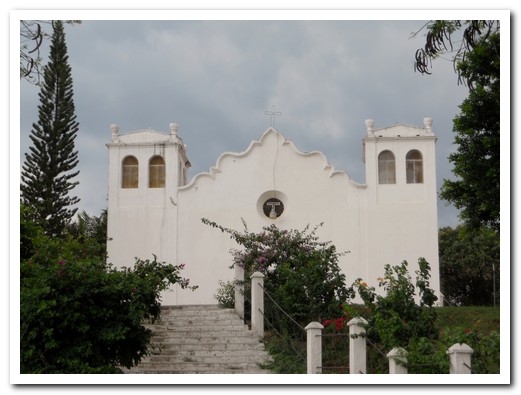
Iglesia San Sebastian, 1580
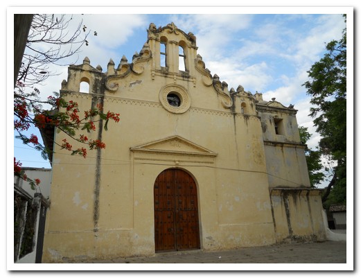
Nuestra Señora de la Caridad, the indigenous church
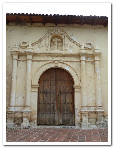
Side door of the church
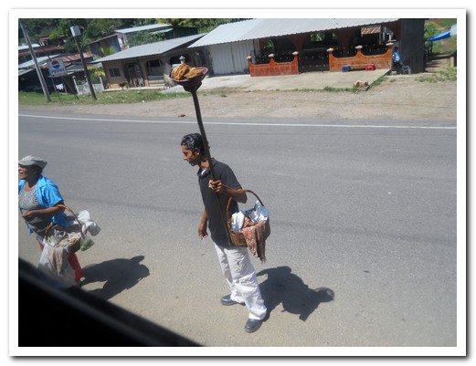
Fried lake fish on a pole for sale to bus passengers
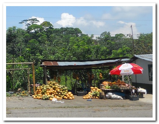
Fruits stall beside the highway
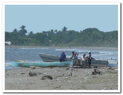
Fishermen from the Garifuna village of Travesía
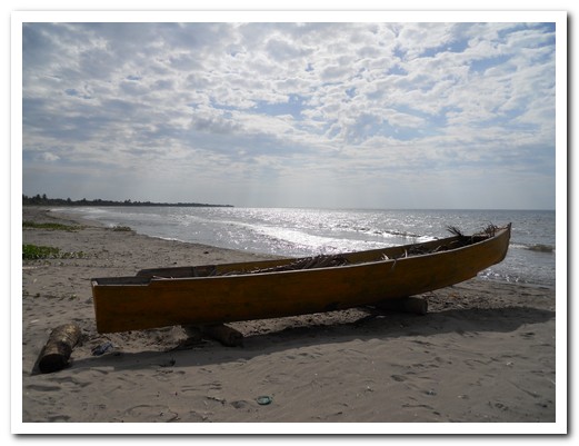
Fishing canoe on the Travesía beach
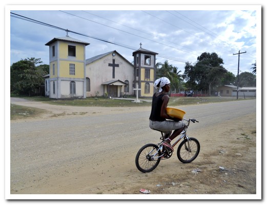
Village church
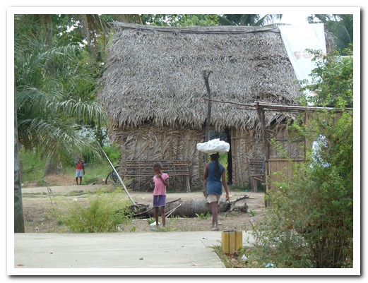
Village hut
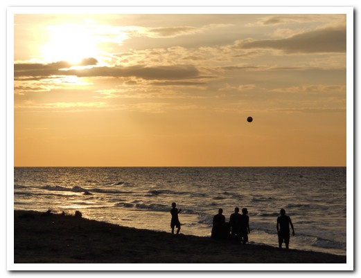
Football at dusk
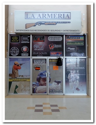
Get a new gun here at the bus station at San Pedro Sula