Categories
- Argentina
- Chile
- Antarctica
- Easter Island
- Falklands (Malvinas)
- Bolivia
- Peru
- Uruguay
- Paraguay
- Brazil
- Venezuela
- Colombia
- Ecuador
- Galapagos
- Panama
- Costa Rica
- Cuba
- Nicaragua
- Honduras
- El Salvador
- Guatemala
- Belize
- Mexico
- Latin American Xmas
Pages
- Street Art of Buenos Aires
- A week in Buenos Aires
- The Jesuit Missions in South America
- Contact Us
- Map of Central America
- First week in Latin America – October 2009
- Home Page
- Map of South America
Archives
- October 2011 (3)
- September 2011 (9)
- August 2011 (10)
- July 2011 (7)
- June 2011 (6)
- May 2011 (11)
- April 2011 (10)
- March 2011 (4)
- February 2011 (5)
- January 2011 (6)
- December 2010 (6)
- November 2010 (4)
- October 2010 (8)
- September 2010 (5)
- August 2010 (7)
- July 2010 (5)
- June 2010 (6)
- May 2010 (6)
- April 2010 (7)
- March 2010 (6)
- February 2010 (9)
- January 2010 (4)
- December 2009 (8)
- November 2009 (5)
- October 2009 (2)
Copper Canyon – The Chepe Train
12th October 2011
To get to the start of our Copper Canyon train trip, instead of a long slow ferry from Baja California and arriving at midnight, we went for the 1 hour flight to Los Mochis in a 13 passenger, single engine Cessna Grand Caravan. One of us enjoyed it.
.
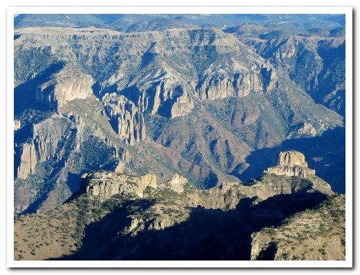
Barranca del Cobre (Copper Canyon) was named by the Spanish who mistakenly believed the greenish lichen to be copper. The “Copper Canyon” is actually a system of many canyons dating back about 60 million years when huge plateaus of land formed with cracks about 1 meter in depth. Water and wind, constant erosion over millions of years, created the kilometre deep canyons from these cracks.
.
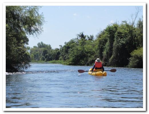
With an extra day in El Fuerte [41] , a colonial style Mexican Pueblo Mágico founded in 1564, we were able to kayak down the sparkling River with several rapids sections and many birds, stopping for a hike up a small hill to see 2000 year old petroglyphs. We boarded the El Chepe train here in El Fuerte.
.
The Chihuahua al Pacífico (Chepe) railroad with its 37 bridges, 89 tunnels, a 180 degree turn and elevations from sea level to 2500 metres took almost 90 years to complete. Originally it ran 2000 kilometres from Wichita, Kansas to the Sea of Cortez in México, but now it carries freight, locals and tourists the 640 kilometres between Chihuahua and Los Mochis on the most dramatic train ride in the western hemisphere.
.
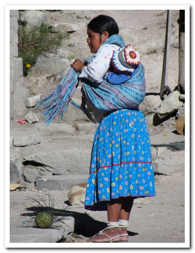
We got off the train at Bahuichiva to spend the night at the Paraiso del Oso Lodge in the forest near the village of Cerocahui [42], a high valley community of 2000. From cool mountain clifftops we had a spectacular view of the tropical village of Urique at the bottom of the canyon 1450 metres below. The former Jesuit Mission of Cerocahui was established in 1680 at the request of the local Rarámuri Indians who continue to live in isolated ranchitos in the mountains surviving by subsistence farming. There are about 60,000 living in northwestern México – the largest, most intact, traditional tribe in America. They are world famous for their endurance and long distance running; some of them are capable of running without stopping for 20 hours.
.
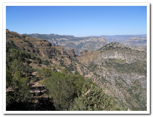
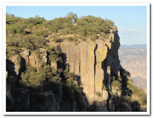
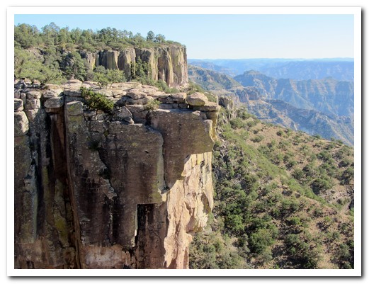
Next day we took the train on to Posada Barrancas [43] where we stayed in the Mirador Hotel perched on the edge of a cliff overlooking the junction of Urique, Tararecua and Copper Canyons. Our room had a balcony hanging over the canyons and an absolutely stunning vista. No need to do anything here, just looking was enough. The canyons under the full moon were especially beautiful.
.
The following morning we were driven to the many great canyon viewing places in the Divisadero area. Somehow the canyons looked different from every one. From there we continued on to the alpine style village of Creel [44] at 2400 metres.
.
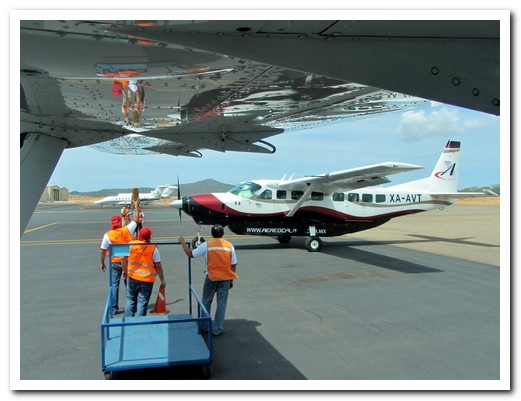
Another Aero Calafia Cessna Caravan taxies in at Cabo
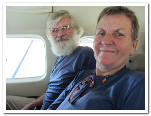
Enjoying the flight
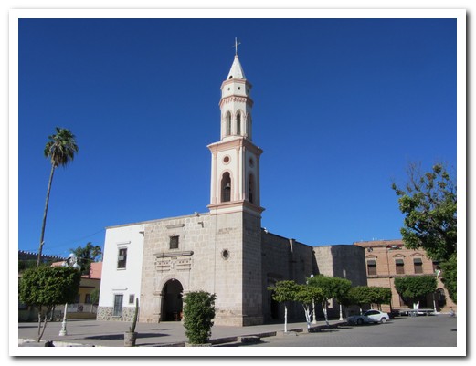
The Church at El Fuerte was built in 1854
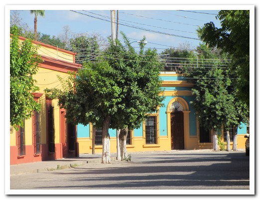
Colonial buildings of El Fuerte
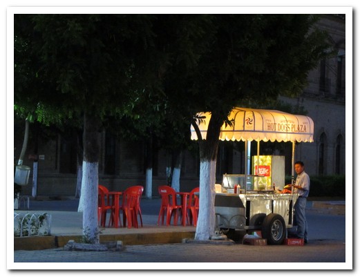
He turns up on the Plaza every evening and makes great hot dogs
El Fuerte River
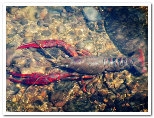
The local delicacy comes from the River

River bird
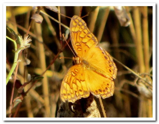
Butterfly
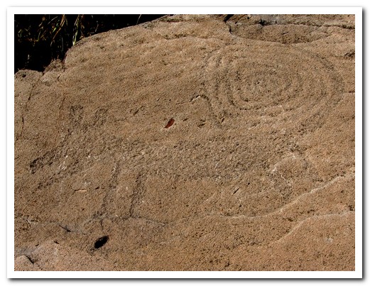
Petroglyph of a coyote with a long curled tail

Fertility symbol - a woman with the sun in her womb

Different techniques indicate different peoples and different periods

It takes 4 engines to pull the Chepe train up to 2500 metres

There are 50 flag down stops
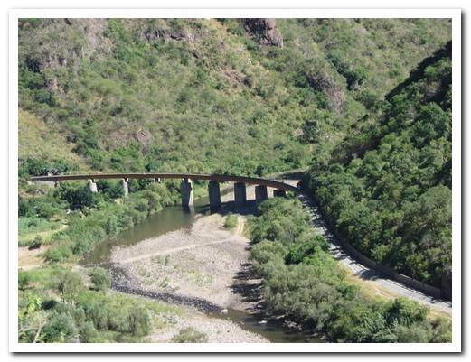
One of the 37 bridges
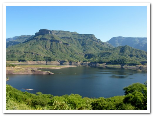
A dam holds water from the canyons
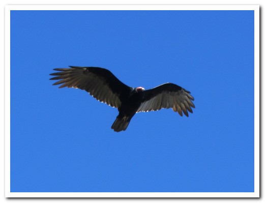
A hawk soars ...
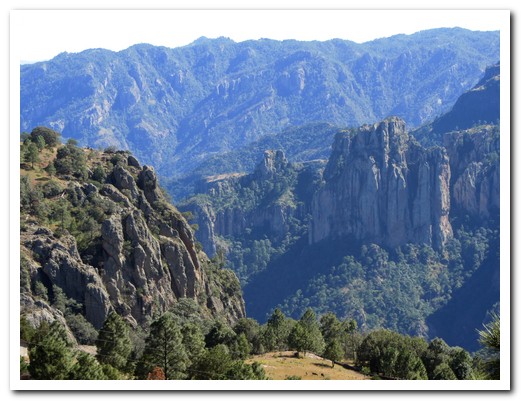
... from the cliff tops near Cerocahui
View of the Urique Canyon with the road leading down to ...

... Urique 1450 metres below

The Jesuit Mission Church in Cerocahui was completed in 1741
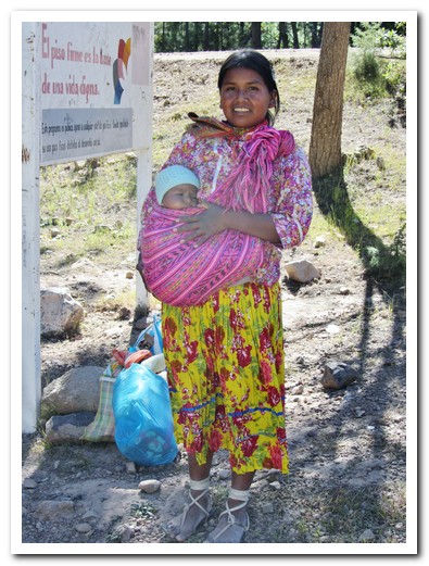
Young Rarámuri woman with her baby
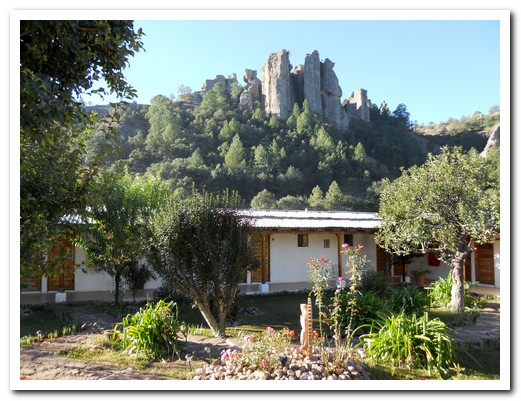
Paraiso del Oso Lodge under a rocky outcrop near Cerocahui
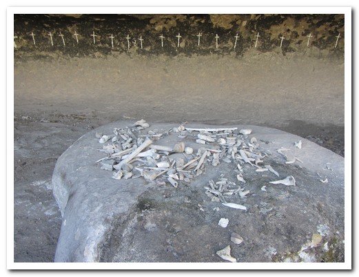
Cave of the crosses with human bones, a short hike from Paraiso del Oso
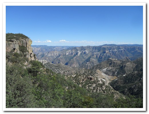
Junction of Urique, Tararecua and Copper Canyons from the Mirador Hotel
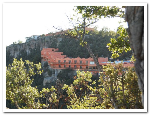
The Mirador Hotel built on the Canyon rim
Looking down into the canyon from our room balcony

Colourful birds linger around the hotel
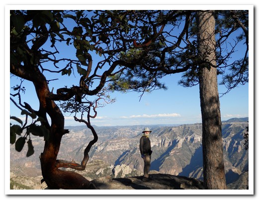
Jeff admiring the view
The Spanish though this lichen was copper
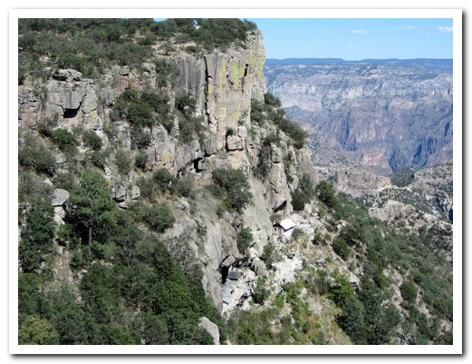
The Rarámuri live in caves and houses built into the cliff
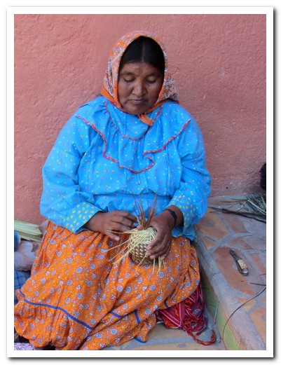
A women making a basket (which we bought)
Lady with her baby

The Rarámuri women make beautiful baskets
Balancing Rock at Divisadero
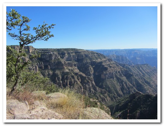
Copper Canyon - the result of million of years of erosion